 |
|
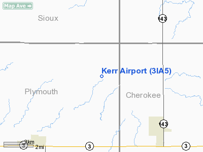
Location &
QuickFacts
|
FAA
Information Effective: |
2007-07-05 |
|
Airport
Identifier: |
3IA5 |
|
Airport
Status: |
Operational |
|
Longitude/Latitude: |
095-52-57.0540W/42-52-37.9510N
-95.882515/42.877209 (Estimated) |
|
Elevation: |
1450 ft / 441.96 m (Estimated) |
|
Land: |
4 acres |
|
From
nearest city: |
4 nautical miles NW of Marcus, IA |
|
Location: |
Plymouth County, IA |
|
Magnetic Variation: |
06E (1985) |
Owner & Manager
|
Ownership: |
Privately owned |
|
Owner: |
Donald L Kerr |
|
Address: |
12291 L 22
Remsen, IA 51050 |
|
Phone number: |
712-376-2365 |
|
Manager: |
Donald L Kerr |
|
Address: |
12291 L22
Remsen, IA 51050 |
|
Phone number: |
712-376-2365 |
Airport
Operations and Facilities
|
Airport
Use: |
Private |
|
Wind
indicator: |
Yes |
|
Segmented Circle: |
No |
|
Control
Tower: |
No |
|
Landing
fee charge: |
No |
|
Sectional chart: |
Omaha |
|
Region: |
ACE - Central |
|
Boundary
ARTCC: |
ZMP - Minneapolis |
|
Tie-in
FSS: |
FOD - Fort Dodge |
|
FSS on
Airport: |
No |
|
FSS
Phone: |
515-955-8114 |
|
FSS Toll
Free: |
1-800-WX-BRIEF |
|
Runway Information
Runway 18/36
|
Dimension: |
2500 x 60 ft / 762.0 x 18.3 m |
|
Surface: |
TURF, |
|
|
Runway 18
|
Runway 36
|
|
Traffic
Pattern: |
Left |
Left |
|
Obstruction: |
4 ft road |
4 ft fence, 0.0 ft from runway |
|
Radio Navigation Aids
|
ID |
Type |
Name |
Ch |
Freq |
Var |
Dist |
|
ORC |
NDB |
Orange City |
|
521.00 |
05E |
10.4 nm |
|
CKP |
NDB |
Pilot Rock |
|
423.00 |
05E |
16.9 nm |
|
SHL |
NDB |
Sheldon |
|
338.00 |
05E |
20.4 nm |
|
SOY |
NDB |
Sioux Center |
|
368.00 |
06E |
20.5 nm |
|
ISB |
NDB |
Sibley |
|
269.00 |
05E |
30.0 nm |
|
SLB |
NDB |
Storm Lake |
|
434.00 |
04E |
32.7 nm |
|
OI |
NDB |
Tommi |
|
305.00 |
07E |
35.8 nm |
|
GAK |
NDB |
Sioux Gateway |
|
233.00 |
06E |
35.9 nm |
|
LTU |
NDB |
Little Sioux |
|
326.00 |
05E |
36.2 nm |
|
SU |
NDB |
Salix |
|
414.00 |
07E |
37.6 nm |
|
MEY |
NDB |
Mapleton |
|
335.00 |
05E |
42.1 nm |
|
VMR |
NDB |
Vermillion |
|
375.00 |
06E |
46.9 nm |
|
SKI |
NDB |
Sac City |
|
356.00 |
04E |
49.8 nm |
|
DDL |
VOR/DME |
Sheldon |
023X |
108.60 |
05E |
20.2 nm |
|
SPW |
VOR/DME |
Spencer |
037X |
110.00 |
05E |
34.5 nm |
|
OTG |
VOR/DME |
Worthington |
043X |
110.60 |
08E |
48.1 nm |
|
SUX |
VORTAC |
Sioux City |
112X |
116.50 |
09E |
37.5 nm |
Remarks
-
ARPT CLSD WINTER MONTHS.
-
PROVIDED
APPROACHES ARE MAINTAINED FOR A 20:1 GLIDE SLOPE AND TRANSITIONAL SFCS FOR A
7:1 SLOPE.
Based
Aircraft
|
Aircraft based
on field: |
2 |
|
Single Engine
Airplanes: |
2 |
Kerr Airport
Address:
Plymouth County, IA
Tel:
712-376-2365
Images
and information placed above are from
http://www.airport-data.com/airport/3IA5/
We
thank them for the data!
|
General Info |
| Country |
United
States |
| State |
IOWA
|
| FAA ID |
3IA5
|
| Latitude |
42-52-37.951N |
|
Longitude |
095-52-57.054W |
|
Elevation |
1450
feet |
| Near
City |
MARCUS
|
We don't guarantee the information is fresh and accurate. The data may
be wrong or outdated.
For more up-to-date information please refer to other sources.
|
|


