 |
|
| Keokuk Municipal Airport |
| IATA: EOK â ICAO: KEOK â FAA LID: EOK |
| Summary |
| Airport type |
Public |
| Operator |
City of Keokuk |
| Location |
Keokuk, Iowa |
| Elevation AMSL |
671 ft / 205 m |
| Coordinates |
40°27â²36â³N 091°25â²43â³W / 40.46°N 91.42861°W / 40.46; -91.42861 |
| Runways |
| Direction |
Length |
Surface |
| ft |
m |
| 8/26 |
5,500 |
1,676 |
Concrete |
| 14/32 |
3,576 |
1,090 |
Concrete |
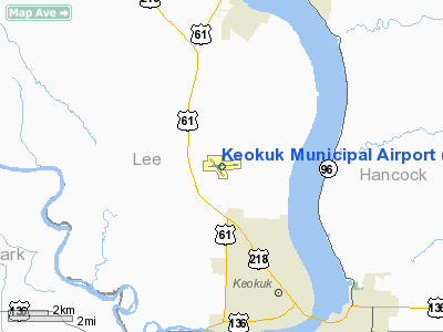
Keokuk Municipal Airport (IATA: EOK, ICAO: KEOK, FAA LID: EOK) is a public general aviation airport located 4 miles northwest of Keokuk, Iowa, United States.
The above content comes from Wikipedia and is published under free licenses – click here to read more.
Location &
QuickFacts
|
FAA
Information Effective: |
2007-07-05 |
|
Airport
Identifier: |
EOK |
|
Airport
Status: |
Operational |
|
Longitude/Latitude: |
091-25-42.6040W/40-27-35.6680N
-91.428501/40.459908 (Estimated) |
|
Elevation: |
671 ft / 204.52 m (Surveyed) |
|
Land: |
372 acres |
|
From
nearest city: |
4 nautical miles NW of Keokuk, IA |
|
Location: |
Lee County, IA |
|
Magnetic Variation: |
02E (1985) |
Owner & Manager
|
Ownership: |
Publicly owned |
|
Owner: |
City Of Keokuk |
|
Address: |
415 Blondeau
Keokuk, IA 52632 |
|
Phone number: |
319-524-2050 |
|
Manager: |
Greg Gobble |
|
Address: |
2504 340th Street
Keokuk, IA 52632 |
|
Phone number: |
319-524-6203 |
Airport
Operations and Facilities
|
Airport
Use: |
Open to public |
|
Wind
indicator: |
Yes |
|
Segmented Circle: |
No |
|
Control
Tower: |
No |
|
Lighting
Schedule: |
DUSK-DAWN
ACTVT MIRL RYS 14/32; 08/26; VASI RY 14; PAPI RYS 08; 26; 32; REIL RYS
08; 14 & 32; MALSR RY 26 - CTAF. |
|
Beacon
Color: |
Clear-Green (lighted land airport) |
|
Landing
fee charge: |
No |
|
Sectional chart: |
Chicago |
|
Region: |
ACE - Central |
|
Boundary
ARTCC: |
ZKC - Kansas City |
|
Tie-in
FSS: |
FOD - Fort Dodge |
|
FSS on
Airport: |
No |
|
FSS
Phone: |
515-955-8114 |
|
FSS Toll
Free: |
1-800-WX-BRIEF |
|
NOTAMs
Facility: |
EOK (NOTAM-d service avaliable) |
|
Federal Agreements: |
NGY |
Airport Communications
|
CTAF: |
122.800 |
|
Unicom: |
122.800 |
Airport Services
|
Fuel
available: |
100LLA |
|
Airframe
Repair: |
MAJOR |
|
Power
Plant Repair: |
MAJOR |
|
Bottled
Oxygen: |
HIGH/LOW |
|
Bulk
Oxygen: |
NONE |
|
Runway Information
Runway 08/26
|
Dimension: |
5500 x 100 ft / 1676.4 x 30.5 m |
|
Surface: |
CONC, Good Condition |
|
Surface
Treatment: |
Wire Comb or Wire Tine |
|
Edge Lights: |
Medium |
|
|
Runway 08
|
Runway 26
|
|
Longitude: |
091-26-09.8610W |
091-24-58.9060W |
|
Latitude: |
40-27-34.6300N |
40-27-38.6860N |
|
Elevation: |
669.00 ft |
670.00 ft |
|
Alignment: |
86 |
127 |
|
ILS Type: |
|
ILS/DME |
|
Traffic
Pattern: |
Left |
Left |
|
Markings: |
Non-precision instrument, Fair Condition |
Non-precision instrument, Fair Condition |
|
Crossing
Height: |
40.00 ft |
40.00 ft |
|
VASI: |
4-light PAPI on left side |
4-light PAPI on left side |
|
Visual
Glide Angle: |
3.00° |
3.00° |
|
Approach
lights: |
|
MALSR |
|
Runway End
Identifier: |
Yes |
No |
|
Runway 14/32
|
Dimension: |
3576 x 100 ft / 1090.0 x 30.5 m |
|
Surface: |
CONC, Good Condition |
|
Weight Limit: |
Single wheel: 30000 lbs.
Dual wheel: 30000 lbs. |
|
Edge Lights: |
Medium |
|
|
Runway 14
|
Runway 32
|
|
Longitude: |
091-26-09.4960W |
091-25-41.0380W |
|
Latitude: |
40-27-48.0360N |
40-27-20.2490N |
|
Elevation: |
668.00 ft |
666.00 ft |
|
Alignment: |
127 |
127 |
|
Traffic
Pattern: |
Left |
Left |
|
Markings: |
Non-precision instrument, Good Condition |
Non-precision instrument, Good Condition |
|
Crossing
Height: |
36.00 ft |
40.00 ft |
|
VASI: |
4-box on left side |
4-light PAPI on left side |
|
Visual
Glide Angle: |
3.00° |
3.00° |
|
Runway End
Identifier: |
Yes |
Yes |
|
Obstruction: |
27 ft trees, 895.0 ft from runway, 100 ft right of
centerline, 25:1 slope to clear |
41 ft tree, 656.0 ft from runway, 182 ft left of
centerline, 11:1 slope to clear |
|
Radio Navigation Aids
|
ID |
Type |
Name |
Ch |
Freq |
Var |
Dist |
|
EOK |
NDB |
Keokuk |
|
366.00 |
02E |
0.4 nm |
|
MPZ |
NDB |
Mount Pleasant |
|
212.00 |
02E |
29.3 nm |
|
UI |
NDB |
Quincy |
|
293.00 |
02E |
35.4 nm |
|
JZY |
NDB |
Macomb |
|
251.00 |
01E |
39.8 nm |
|
FFL |
NDB |
Fairfield |
|
332.00 |
03E |
41.8 nm |
|
HAE |
NDB |
Hannibal |
|
411.00 |
03E |
44.0 nm |
|
BEX |
NDB |
Bloomfield |
|
269.00 |
02E |
48.8 nm |
|
BRL |
VORTAC |
Burlington |
051X |
111.40 |
05E |
27.9 nm |
|
UIN |
VORTAC |
Quincy |
083X |
113.60 |
05E |
37.4 nm |
Remarks
-
FOR SVC AFT HRS
CALL 319-470-0807.
-
UNLIGHTED TOWER
APRXLY 1000 FT MSL 4 MILES SE.
-
DEER ON & INVOF ARPT.
-
RY 26 IS CALM
WIND RY.
Based
Aircraft
|
Aircraft based
on field: |
26 |
|
Single Engine
Airplanes: |
20 |
|
Multi Engine
Airplanes: |
5 |
|
Jet Engine
Airplanes: |
1 |
Operational Statistics
Time Period:
2004-11-17 -
2005-11-16
|
Aircraft
Operations: |
255/Week |
|
Air Taxi: |
5.7% |
|
General
Aviation Local: |
49.1% |
|
General
Aviation Itinerant: |
45.3% |
Keokuk Municipal Airport
Address:
Lee County, IA
Tel:
319-524-2050, 319-524-6203
Images
and information placed above are from
http://www.airport-data.com/airport/EOK/
We
thank them for the data!
|
General Info |
| Country |
United
States |
| State |
IOWA
|
| FAA ID |
EOK
|
| Latitude |
40-27-35.668N |
|
Longitude |
091-25-42.604W |
|
Elevation |
671 feet
|
| Near
City |
KEOKUK
|
We don't guarantee the information is fresh and accurate. The data may
be wrong or outdated.
For more up-to-date information please refer to other sources.
|
|


