 |
|
|
|
|
|
Location &
QuickFacts
|
FAA
Information Effective: |
2007-07-05 |
|
Airport
Identifier: |
3IA8 |
|
Airport
Status: |
Operational |
|
Longitude/Latitude: |
091-23-13.5460W/40-24-25.1580N
-91.387096/40.406988 (Estimated) |
|
Elevation: |
617 ft / 188.06 m (Estimated) |
|
Land: |
0 acres |
|
From
nearest city: |
0 nautical miles N of Keokuk, IA |
|
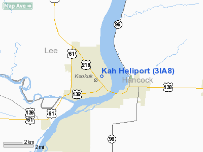
Location: |
Lee County, IA |
|
Magnetic Variation: |
02E (1985) |
Owner & Manager
|
Ownership: |
Privately owned |
|
Owner: |
Keokuk Area Hospital |
|
Address: |
1600 Morgan St
Keokuk, IA 52632 |
|
Phone number: |
319-524-7150 |
|
Manager: |
Allan W. Zastrow, Admin. |
|
Address: |
1600 Morgan St
Keokuk, IA 52632 |
|
Phone number: |
319-524-7150 |
Airport
Operations and Facilities
|
Airport
Use: |
Private
MEDICAL. |
|
Wind
indicator: |
Yes |
|
Segmented Circle: |
No |
|
Control
Tower: |
No |
|
Lighting
Schedule: |
PHONE REQ
FOR ROTG BCN AND PERIMETER LGTS CALL 319-524-7150. |
|
Beacon
Color: |
Clear-Green-Yellow (heliport) |
|
Sectional chart: |
Kansas City |
|
Region: |
ACE - Central |
|
Boundary
ARTCC: |
ZKC - Kansas City |
|
Tie-in
FSS: |
FOD - Fort Dodge |
|
FSS
Phone: |
515-955-8114 |
|
FSS Toll
Free: |
1-800-WX-BRIEF |
|
Runway Information
Helipad H1
|
Dimension: |
40 x 40 ft / 12.2 x 12.2 m |
|
Surface: |
CONC, |
|
|
Runway H1
|
Runway
|
|
Traffic
Pattern: |
Left |
Left |
|
Radio Navigation Aids
|
ID |
Type |
Name |
Ch |
Freq |
Var |
Dist |
|
EOK |
NDB |
Keokuk |
|
366.00 |
02E |
4.1 nm |
|
UI |
NDB |
Quincy |
|
293.00 |
02E |
31.9 nm |
|
MPZ |
NDB |
Mount Pleasant |
|
212.00 |
02E |
32.7 nm |
|
JZY |
NDB |
Macomb |
|
251.00 |
01E |
38.4 nm |
|
HAE |
NDB |
Hannibal |
|
411.00 |
03E |
41.0 nm |
|
FFL |
NDB |
Fairfield |
|
332.00 |
03E |
45.5 nm |
|
BRL |
VORTAC |
Burlington |
051X |
111.40 |
05E |
28.4 nm |
|
UIN |
VORTAC |
Quincy |
083X |
113.60 |
05E |
34.0 nm |
Remarks
-
OWNER DESIRES
ARPT NOT BE CHARTED.
-
PRVDD APCH/DEP
PATHS ARE MAINT FOR AN 8:1 GLIDE SLOPE & TRSNL SFC FOR A 2:1 SLOPE.
Kah Heliport
Address:
Lee County, IA
Tel:
319-524-7150
Images
and information placed above are from
http://www.airport-data.com/airport/3IA8/
We
thank them for the data!
|
General Info |
| Country |
United
States |
| State |
IOWA
|
| FAA ID |
3IA8
|
| Latitude |
40-24-25.158N |
|
Longitude |
091-23-13.546W |
|
Elevation |
617 feet
|
| Near
City |
KEOKUK
|
We don't guarantee the information is fresh and accurate. The data may
be wrong or outdated.
For more up-to-date information please refer to other sources.
|
|


