 |
|
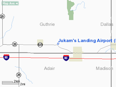
Location &
QuickFacts
|
FAA
Information Effective: |
2007-07-05 |
|
Airport
Identifier: |
IA00 |
|
Airport
Status: |
Operational |
|
Longitude/Latitude: |
094-21-45.8720W/41-31-11.9555N
-94.362742/41.519988 (Estimated) |
|
Elevation: |
1230 ft / 374.90 m (Estimated) |
|
Land: |
3 acres |
|
From
nearest city: |
2 nautical miles E of Menlo, IA |
|
Location: |
Guthrie County, IA |
|
Magnetic Variation: |
04E (1995) |
Owner & Manager
|
Ownership: |
Privately owned |
|
Owner: |
Odean Jukam |
|
Address: |
13131 Cedarcrest Lane
Clive, IA 50325-8751 |
|
Phone number: |
515-457-9440 |
|
Manager: |
Odean Jukam |
|
Address: |
13131 Cedarcrest Lane
Clive, IA 50325-8751 |
|
Phone number: |
515-457-9440 |
Airport
Operations and Facilities
|
Airport
Use: |
Private |
|
Wind
indicator: |
Yes |
|
Segmented Circle: |
No |
|
Control
Tower: |
No |
|
Sectional chart: |
Omaha |
|
Region: |
ACE - Central |
|
Boundary
ARTCC: |
ZMP - Minneapolis |
|
Tie-in
FSS: |
FOD - Fort Dodge |
|
FSS
Phone: |
515-955-8114 |
|
FSS Toll
Free: |
1-800-WX-BRIEF |
|
Runway Information
Runway 05/23
|
Dimension: |
1900 x 75 ft / 579.1 x 22.9 m |
|
Surface: |
TURF, |
|
|
Runway 05
|
Runway 23
|
|
Traffic
Pattern: |
Left |
Left |
|
Displaced
threshold: |
150.00 ft |
0.00 ft |
|
Obstruction: |
15 ft road, 300.0 ft from runway |
|
|
Radio Navigation Aids
|
ID |
Type |
Name |
Ch |
Freq |
Var |
Dist |
|
GCT |
NDB |
Guthrie Center |
|
518.00 |
05E |
10.2 nm |
|
GFZ |
NDB |
Greenfield |
|
338.00 |
04E |
12.3 nm |
|
PRO |
NDB |
Perry |
|
251.00 |
06E |
20.8 nm |
|
ADU |
NDB |
Audubon |
|
266.00 |
04E |
26.6 nm |
|
EFW |
NDB |
Jefferson |
|
391.00 |
03E |
29.7 nm |
|
AIO |
NDB |
Atlantic |
|
365.00 |
04E |
31.6 nm |
|
UNE |
NDB |
Union County |
|
379.00 |
04E |
33.8 nm |
|
CRZ |
NDB |
Corning |
|
278.00 |
04E |
36.2 nm |
|
CIN |
NDB |
Carroll |
|
397.00 |
04E |
36.8 nm |
|
IKV |
NDB |
Ankeny |
|
275.00 |
03E |
37.5 nm |
|
BNW |
NDB |
Boone |
|
407.00 |
03E |
39.4 nm |
|
HNR |
NDB |
Harlan |
|
272.00 |
05E |
44.1 nm |
|
DSM |
VORTAC |
Des Moines |
122X |
117.50 |
07E |
32.5 nm |
|
DSM |
VOT |
Des Moines |
|
109.20 |
|
31.0 nm |
Remarks
-
PRVDD A CLEAR
APCH TO EA RY FOR A 20:1 GLIDE SLOPE & A CLEAR TRANSITIONAL SFC FOR A 7:1
SLOPE.
Based
Aircraft
|
Aircraft based
on field: |
1 |
|
Single Engine
Airplanes: |
1 |
Jukam's Landing Airport
Address:
Guthrie County, IA
Tel:
515-457-9440
Images
and information placed above are from
http://www.airport-data.com/airport/IA00/
We
thank them for the data!
|
General Info |
| Country |
United
States |
| State |
IOWA
|
| FAA ID |
IA00
|
| Latitude |
41-31-11.956N |
|
Longitude |
094-21-45.872W |
|
Elevation |
1230
feet |
| Near
City |
MENLO
|
We don't guarantee the information is fresh and accurate. The data may
be wrong or outdated.
For more up-to-date information please refer to other sources.
|
|


