 |
|
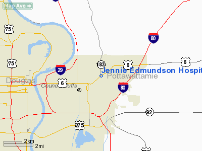
Jennie Edmundson Hospital Heliport |
|
|
Location &
QuickFacts
|
FAA
Information Effective: |
2007-07-05 |
|
Airport
Identifier: |
6IA2 |
|
Airport
Status: |
Operational |
|
Longitude/Latitude: |
095-50-07.0410W/41-16-08.9930N
-95.835289/41.269165 (Estimated) |
|
Elevation: |
1000 ft / 304.80 m (Estimated) |
|
Land: |
0 acres |
|
From
nearest city: |
0 nautical miles NE of Council Bluffs, IA |
|
Location: |
Pottawattamie County, IA |
|
Magnetic Variation: |
05E (1995) |
Owner & Manager
|
Ownership: |
Privately owned |
|
Owner: |
Jennie Edmundson Hospital |
|
Address: |
933 East Pierce Street
Council Bluffs, IA 51503 |
|
Phone
number: |
712-328-6000 |
|
Manager: |
Wes Fett |
|
Address: |
933 East Pierce Street
Council Bluffs, IA 51503 |
|
Phone number: |
712-328-6000 |
Airport Operations and Facilities
|
Airport
Use: |
Private
MEDICAL USE. |
|
Segmented Circle: |
No |
|
Control
Tower: |
No |
|
Lighting
Schedule: |
PHONE REQ
FOR PERIMETER LGTS CALL 712-328-6000. |
|
Sectional chart: |
Omaha |
|
Region: |
ACE - Central |
|
Boundary
ARTCC: |
ZMP - Minneapolis |
|
Tie-in
FSS: |
FOD - Fort Dodge |
|
FSS on
Airport: |
No |
|
FSS
Phone: |
515-955-8114 |
|
FSS Toll
Free: |
1-800-WX-BRIEF |
|
Runway Information
Helipad H1
|
Dimension: |
70 x 65 ft / 21.3 x 19.8 m |
|
Surface: |
ASPH, |
|
|
Runway H1
|
Runway
|
|
Traffic
Pattern: |
Left |
Left |
|
Radio Navigation Aids
|
ID |
Type |
Name |
Ch |
Freq |
Var |
Dist |
|
OM |
NDB |
Gerfi |
|
320.00 |
05E |
8.0 nm |
|
MLE |
NDB |
Millard |
|
371.00 |
06E |
13.4 nm |
|
PMV |
NDB |
Plattsmouth |
|
329.00 |
06E |
19.9 nm |
|
HNR |
NDB |
Harlan |
|
272.00 |
05E |
29.1 nm |
|
RDK |
NDB |
Red Oak |
|
230.00 |
04E |
30.4 nm |
|
FET |
NDB |
Fremont |
|
311.00 |
06E |
32.7 nm |
|
AHQ |
NDB |
Wahoo |
|
400.00 |
07E |
34.5 nm |
|
AIO |
NDB |
Atlantic |
|
365.00 |
04E |
36.5 nm |
|
SDA |
NDB |
Shenandoah |
|
411.00 |
05E |
36.7 nm |
|
AFK |
NDB |
Nebraska City |
|
347.00 |
05E |
39.9 nm |
|
DNS |
NDB |
Denison |
|
350.00 |
04E |
47.6 nm |
|
ADU |
NDB |
Audubon |
|
266.00 |
04E |
48.8 nm |
|
ICL |
NDB |
Clarinda |
|
353.00 |
04E |
49.1 nm |
|
OFF |
TACAN |
Offutt |
054X |
|
05E |
9.6 nm |
|
TQE |
VOR |
Tekamah |
|
108.40 |
07E |
33.3 nm |
|
SCB |
VOR/DME |
Scribner |
47X |
111.00 |
06E |
41.1 nm |
|
OVR |
VORTAC |
Omaha |
110X |
116.30 |
08E |
7.6 nm |
|
LNK |
VORTAC |
Lincoln |
108X |
116.10 |
09E |
46.0 nm |
|
OMA |
VOT |
Omaha |
|
109.00 |
|
2.8 nm |
Remarks
-
OWNER DESIRES
HELIPORT NOT BE CHARTED.
-
ROOFTOP.
-
PRVDD
INGRESS/EGRESS 270-030; MAINTAIN CLEAR APCH/DEP TO LNDG AREA FOR A MINIMUM 8:1
GLIDE SLOPE; MAINTAIN CLEAR TRANS SFC FOR A MINIMUM 2:1 SLOPE; LOWER FLAG POLE
TO 19 FT TO MEET 8:1 SLOPE OR LIGHT PERIMETER.
Based
Aircraft
|
Aircraft based
on field: |
1 |
|
Ultralights: |
1 |
Jennie Edmundson Hospital Heliport
Address:
Pottawattamie County, IA
Tel:
712-328-6000
Images
and information placed above are from
http://www.airport-data.com/airport/6IA2/
We
thank them for the data!
|
General Info |
| Country |
United
States |
| State |
IOWA
|
| FAA ID |
6IA2
|
| Latitude |
41-16-08.993N |
|
Longitude |
095-50-07.041W |
|
Elevation |
1000
feet |
| Near
City |
COUNCIL
BLUFFS |
We don't guarantee the information is fresh and accurate. The data may
be wrong or outdated.
For more up-to-date information please refer to other sources.
|
|


