 |
|
Jefferson County Hospital Heliport |
|
|
Location &
QuickFacts
|
FAA
Information Effective: |
2007-07-05 |
|
Airport
Identifier: |
7IA6 |
|
Airport
Status: |
Operational |
|
Longitude/Latitude: |
091-57-07.6200W/41-00-11.0730N
-91.952117/41.003076 (Estimated) |
|
Elevation: |
768 ft / 234.09 m (Estimated) |
|
Land: |
0 acres |
|
From
nearest city: |
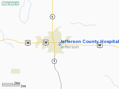
1 nautical miles N of Fairfield, IA |
|
Location: |
Jefferson County, IA |
|
Magnetic Variation: |
02E (1990) |
Owner & Manager
|
Ownership: |
Publicly owned |
|
Owner: |
Jefferson County Hospital |
|
Address: |
Box 588 Or 400 Highland
Fairfield, IA 52556 |
|
Phone
number: |
515-472-4111 |
|
Manager: |
Walter W Brownlee Ceo |
|
Address: |
Box 588 Or 400 Highland
Fairfield, IA 52556 |
|
Phone number: |
515-472-4111 |
Airport Operations and Facilities
|
Airport
Use: |
Private
MEDICAL USE. |
|
Wind
indicator: |
Yes |
|
Segmented Circle: |
No |
|
Control
Tower: |
No |
|
Lighting
Schedule: |
PHONE REQ
FOR ROTG BCN AND PERIMETER LGTS CALL 515-472-4111. |
|
Beacon
Color: |
Clear-Green-Yellow (heliport) |
|
Sectional chart: |
Chicago |
|
Region: |
ACE - Central |
|
Boundary
ARTCC: |
ZAU - Chicago |
|
Tie-in
FSS: |
FOD - Fort Dodge |
|
FSS on
Airport: |
No |
|
FSS
Phone: |
515-955-8114 |
|
FSS Toll
Free: |
1-800-WX-BRIEF |
|
Runway Information
Helipad H1
|
Dimension: |
60 x 60 ft / 18.3 x 18.3 m |
|
Surface: |
CONC, |
|
|
Runway H1
|
Runway
|
|
Traffic
Pattern: |
Left |
Left |
|
Radio Navigation Aids
|
ID |
Type |
Name |
Ch |
Freq |
Var |
Dist |
|
FFL |
NDB |
Fairfield |
|
332.00 |
03E |
1.7 nm |
|
MPZ |
NDB |
Mount Pleasant |
|
212.00 |
02E |
20.4 nm |
|
AWG |
NDB |
Washington |
|
219.00 |
02E |
20.9 nm |
|
BEX |
NDB |
Bloomfield |
|
269.00 |
02E |
26.7 nm |
|
OOA |
NDB |
Oskaloosa |
|
414.00 |
03E |
27.7 nm |
|
EOK |
NDB |
Keokuk |
|
366.00 |
02E |
40.1 nm |
|
TVK |
NDB |
Centerville |
|
290.00 |
04E |
47.1 nm |
|
OTM |
VOR/DME |
Ottumwa |
053X |
111.60 |
06E |
17.0 nm |
|
DDD |
VOR/DME |
Port City |
112X |
116.50 |
01E |
42.4 nm |
|
IOW |
VORTAC |
Iowa City |
109X |
116.20 |
05E |
34.6 nm |
|
BRL |
VORTAC |
Burlington |
051X |
111.40 |
05E |
49.6 nm |
Remarks
-
APCH/DEP PATHS
CLEAR FOR 8:1 GLIDE SLOPE & TRANSITIONAL SFC FOR A 2:1 SLOPE.
Jefferson County Hospital
Heliport
Address:
Jefferson County, IA
Tel:
515-472-4111
Images
and information placed above are from
http://www.airport-data.com/airport/7IA6/
We
thank them for the data!
|
General Info |
| Country |
United
States |
| State |
IOWA
|
| FAA ID |
7IA6
|
| Latitude |
41-00-11.073N |
|
Longitude |
091-57-07.620W |
|
Elevation |
768 feet
|
| Near
City |
FAIRFIELD |
We don't guarantee the information is fresh and accurate. The data may
be wrong or outdated.
For more up-to-date information please refer to other sources.
|
|


