 |
|
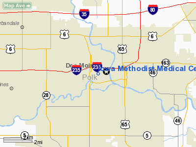
Iowa Methodist Medical Center Heliport |
|
|
Location &
QuickFacts
|
FAA
Information Effective: |
2007-07-05 |
|
Airport
Identifier: |
IA64 |
|
Airport
Status: |
Operational |
|
Longitude/Latitude: |
093-37-59.0000W/41-35-22.0000N
-93.633056/41.589444 (Estimated) |
|
Elevation: |
990 ft / 301.75 m (Estimated) |
|
Land: |
0 acres |
|
From
nearest city: |
0 nautical miles N of Des Moines, IA |
|
Location: |
Polk County, IA |
|
Magnetic Variation: |
04E (1985) |
Owner & Manager
|
Ownership: |
Privately owned |
|
Owner: |
Iowa Methodist Medical Ctr |
|
Address: |
1200 Pleasant St
Des Moines, IA 50309 |
|
Phone
number: |
515-241-6149 |
|
Manager: |
Jim Skogsbergh |
|
Address: |
1200 Pleasant St
Des Moines, IA 50309 |
|
Phone number: |
515-241-6149 |
Airport Operations and Facilities
|
Airport
Use: |
Private
MEDICAL. |
|
Wind
indicator: |
Yes |
|
Segmented Circle: |
No |
|
Control
Tower: |
No |
|
Lighting
Schedule: |
PHONE REQ
FOR PERIMETER LGTS CALL 515-283-6149. |
|
Landing fee charge: |
No |
|
Sectional chart: |
Omaha |
|
Region: |
ACE - Central |
|
Boundary ARTCC: |
ZMP - Minneapolis |
|
Tie-in FSS: |
FOD - Fort Dodge |
|
FSS on Airport: |
No |
|
FSS Phone: |
515-955-8114 |
|
FSS Toll Free: |
1-800-WX-BRIEF |
Airport
Communications
|
Runway Information
Helipad H1
|
Dimension: |
68 x 75 ft / 20.7 x 22.9 m |
|
Surface: |
CONC, |
|
|
Runway H1
|
Runway
|
|
Traffic
Pattern: |
Left |
Left |
|
Helipad H2
|
Dimension: |
66 x 75 ft / 20.1 x 22.9 m |
|
Surface: |
CONC, |
|
|
Runway H2
|
Runway
|
|
Traffic
Pattern: |
Left |
Left |
|
Helipad H3
|
Dimension: |
75 x 75 ft / 22.9 x 22.9 m |
|
Surface: |
CONC, |
|
|
Runway H3
|
Runway
|
|
Traffic
Pattern: |
Left |
Left |
|
Helipad H4
|
Dimension: |
70 x 69 ft / 21.3 x 21.0 m |
|
Surface: |
CONC, |
|
|
Runway H4
|
Runway
|
|
Traffic
Pattern: |
Left |
Left |
|
Radio Navigation Aids
|
ID |
Type |
Name |
Ch |
Freq |
Var |
Dist |
|
IKV |
NDB |
Ankeny |
|
275.00 |
03E |
7.3 nm |
|
PRO |
NDB |
Perry |
|
251.00 |
06E |
27.8 nm |
|
OXV |
NDB |
Knoxville |
|
284.00 |
03E |
29.3 nm |
|
BNW |
NDB |
Boone |
|
407.00 |
03E |
29.6 nm |
|
PEA |
NDB |
Pella |
|
257.00 |
02E |
33.0 nm |
|
GCT |
NDB |
Guthrie Center |
|
518.00 |
05E |
36.4 nm |
|
CNC |
NDB |
Chariton |
|
335.00 |
05E |
36.5 nm |
|
GFZ |
NDB |
Greenfield |
|
338.00 |
04E |
39.8 nm |
|
EFW |
NDB |
Jefferson |
|
391.00 |
03E |
40.8 nm |
|
GGI |
NDB |
Grinnell |
|
248.00 |
02E |
41.2 nm |
|
MIW |
NDB |
Marshalltown |
|
239.00 |
03E |
44.8 nm |
|
UNE |
NDB |
Union County |
|
379.00 |
04E |
49.8 nm |
|
TNU |
VOR/DME |
Newton |
072X |
112.50 |
03E |
26.3 nm |
|
JWJ |
VOR/DME |
Elmwood |
031X |
109.40 |
03E |
45.1 nm |
|
DSM |
VORTAC |
Des Moines |
122X |
117.50 |
07E |
9.2 nm |
|
DSM |
VOT |
Des Moines |
|
109.20 |
|
3.5 nm |
Remarks
-
PRVDD CLEAR APCH/DEP
PATHS FOR A MIN 8:1 GLIDE SLOPE; TRANSITIONAL SFC 2:1; ANT ON ROOF OF
ADJOINING BLDG REMOVED PRIOR TO ACTIVATION; & SIMULTANEOUS APCHS TO GND &
ROOFTOP HELIPORTS ARE DISCOURAGED.
Based
Aircraft
|
Aircraft based
on field: |
1 |
|
Helicopters: |
1 |
Iowa Methodist Medical Center Heliport
Address:
Polk County, IA
Tel:
515-241-6149
Images
and information placed above are from
http://www.airport-data.com/airport/IA64/
We
thank them for the data!
|
General Info |
| Country |
United
States |
| State |
IOWA
|
| FAA ID |
IA64
|
| Latitude |
41-35-22.000N |
|
Longitude |
093-37-59.000W |
|
Elevation |
990 feet
|
| Near
City |
DES
MOINES |
We don't guarantee the information is fresh and accurate. The data may
be wrong or outdated.
For more up-to-date information please refer to other sources.
|
|


