 |
|
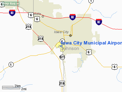
Iowa City Municipal Airport |
| Iowa City Municipal Airport |
| IATA: IOW â ICAO: KIOW |
| Summary |
| Airport type |
Public |
| Operator |
Jet Air Inc |
| Location |
Iowa City, Iowa |
| Elevation AMSL |
668 ft / 203.6 m |
| Coordinates |
41°38â²21.278â³N 91°32â²47.412â³W / 41.63924389°N 91.54650333°W / 41.63924389; -91.54650333Coordinates: 41°38â²21.278â³N 91°32â²47.412â³W / 41.63924389°N 91.54650333°W / 41.63924389; -91.54650333 |
| Runways |
| Direction |
Length |
Surface |
| ft |
m |
| 7/25 |
4355 |
1327 |
Concrete |
| 12/30 |
3900 |
1189 |
Concrete |
Iowa City Municipal Airport (IATA: IOW, ICAO: KIOW) is a general aviation airport located in the southwest portion of the city of Iowa City in Johnson County, Iowa, USA. It is located at 41°38â²21.278â³N 91°32â²47.412â³W / 41.63924389°N 91.54650333°W / 41.63924389; -91.54650333 (41.6392439, -91.5465033), along the Iowa River. The Iowa City Airport is the oldest civil airport west of the Mississippi River still in its original location, and is the second busiest general aviation airport in the state. Facilities
Iowa City Municipal Airport has two runways:
- Runway 7/25: 5,001 x 100 ft. Surface: Concrete
- Runway 12/30: 3,900 x 75 ft. Surface: Concrete
There is an airport terminal building; an aircraft maintenance shop; two corporate hangar buildings; a multi-plane hangar with attached office area; and five buildings with 60 individual hangars (T-hangars).
Airport Communications
- CTAF/UNICOM: 122.8
- WX ASOS: 128.075 (319-339-9491)
- CEDAR RAPIDS APPROACH: 119.7
- CHICAGO ARTCC APPROACH: 134.05
- CEDAR RAPIDS DEPARTURE: 119.7
- CHICAGO ARTCC DEPARTURE: 134.05
- CLEARANCE DELIVERY: 119.05
- WX ASOS at CID (16 nm NW): 124.15 (319-363-9021)
APCH/DEP SVC PRVDD BY CHICAGO ARTCC ON FREQS 132.8/328.4 (CEDAR RAPIDS RCAG) WHEN CEDAR RAPIDS APCH CTL CLSD.
Line Services
Line Services are available from the FBO;
Jet-Air Inc (319) 248-1200 7 AM - 7 PM
Line services;
- Fuel: 100LL and Jet A; mechanics; instruction; charter and aircraft rental
The above content comes from Wikipedia and is published under free licenses – click here to read more.
Location &
QuickFacts
|
FAA
Information Effective: |
2007-07-05 |
|
Airport
Identifier: |
IOW |
|
Airport
Status: |
Operational |
|
Longitude/Latitude: |
091-32-49.9010W/41-38-23.7680N
-91.547195/41.639936 (Estimated) |
|
Elevation: |
668 ft / 203.61 m (Surveyed) |
|
Land: |
450 acres |
|
From
nearest city: |
2 nautical miles SW of Iowa City, IA |
|
Location: |
Johnson County, IA |
|
Magnetic Variation: |
02E (1985) |
Owner & Manager
|
Ownership: |
Publicly owned |
|
Owner: |
City Of Iowa City |
|
Address: |
410 East Washington
Iowa City, IA 52240 |
|
Phone
number: |
319-356-5010 |
|
Manager: |
Michael Tharp
RANDALL HARTWIG (AIRPORT COMMISION) |
|
Address: |
1801 S. Riverside
Iowa City, IA 52246 |
|
Phone number: |
319-356-5045 |
Airport Operations and Facilities
|
Airport
Use: |
Open to public |
|
Wind
indicator: |
Yes |
|
Segmented Circle: |
No |
|
Control
Tower: |
No |
|
Lighting
Schedule: |
DUSK-DAWN
ACTVT PAPI RYS 07 & 25 - 3 CLICKS; MIRL RY 12/30 - 5 CLICKS - CTAF.
MIRL RY 07/25 PRESET ON HIGH INTST. |
|
Beacon
Color: |
Clear-Green (lighted land airport) |
|
Landing
fee charge: |
No |
|
Sectional chart: |
Chicago |
|
Region: |
ACE - Central |
|
Traffic
Pattern Alt: |
1000 ft |
|
Boundary
ARTCC: |
ZAU - Chicago |
|
Tie-in
FSS: |
FOD - Fort Dodge |
|
FSS on
Airport: |
No |
|
FSS
Phone: |
515-955-8114 |
|
FSS Toll
Free: |
1-800-WX-BRIEF |
|
NOTAMs
Facility: |
IOW (NOTAM-d service avaliable) |
|
Federal Agreements: |
NGY3 |
Airport Communications
|
CTAF: |
122.800 |
|
Unicom: |
122.800 |
Airport Services
|
Fuel
available: |
100LLA |
|
Airframe
Repair: |
MAJOR |
|
Power
Plant Repair: |
MAJOR |
|
Bottled
Oxygen: |
NONE |
|
Bulk
Oxygen: |
NONE |
|
Runway Information
Runway 07/25
|
Dimension: |
4355 x 150 ft / 1327.4 x 45.7 m |
|
Surface: |
CONC, Fair Condition |
|
Weight Limit: |
Single wheel: 25000 lbs.
Dual wheel: 45000 lbs. |
|
Edge Lights: |
Medium |
|
|
Runway 07
|
Runway 25
|
|
Longitude: |
091-33-18.0710W |
091-32-23.8960W |
|
Latitude: |
41-38-20.1860N |
41-38-34.3000N |
|
Elevation: |
668.00 ft |
651.00 ft |
|
Alignment: |
71 |
127 |
|
Traffic
Pattern: |
Left |
Left |
|
Markings: |
Non-precision instrument, Good Condition |
Non-precision instrument, Good Condition |
|
Crossing
Height: |
40.00 ft |
62.00 ft |
|
Displaced
threshold: |
1000.00 ft |
150.00 ft |
|
VASI: |
4-light PAPI on left side
PAPI OTS INDEFLY. |
4-light PAPI on left side |
|
Visual
Glide Angle: |
4.00° |
4.00° |
|
Obstruction: |
71 ft trees, 1485.0 ft from runway, 160 ft left of
centerline, 19:1 slope to clear |
46 ft tree, 950.0 ft from runway, 50 ft left of
centerline, 16:1 slope to clear
RWY 25 APCH SLOPE 23:1 TO DSPLCD THLD. |
|
Runway 12/30
|
Dimension: |
3900 x 150 ft / 1188.7 x 45.7 m |
|
Surface: |
CONC, Fair Condition |
|
Weight Limit: |
Single wheel: 25000 lbs.
Dual wheel: 45000 lbs. |
|
Edge Lights: |
Medium |
|
|
Runway 12
|
Runway 30
|
|
Longitude: |
091-33-09.8130W |
091-32-27.5720W |
|
Latitude: |
41-38-30.8490N |
41-38-08.9270N |
|
Elevation: |
662.00 ft |
649.00 ft |
|
Alignment: |
125 |
127 |
|
Traffic
Pattern: |
Left |
Left |
|
Markings: |
Non-precision instrument, Good Condition |
Non-precision instrument, Good Condition |
|
Obstruction: |
112 ft tree, 1625.0 ft from runway, 135 ft left of
centerline, 12:1 slope to clear |
77 ft tree, 1375.0 ft from runway, 400 ft left of
centerline, 15:1 slope to clear |
|
Radio Navigation Aids
|
ID |
Type |
Name |
Ch |
Freq |
Var |
Dist |
|
AWG |
NDB |
Washington |
|
219.00 |
02E |
22.4 nm |
|
TZT |
NDB |
Belle Plaine |
|
371.00 |
02E |
36.1 nm |
|
MXO |
NDB |
Monticello |
|
397.00 |
01E |
38.4 nm |
|
VTI |
NDB |
Garrison |
|
338.00 |
03E |
40.9 nm |
|
MPZ |
NDB |
Mount Pleasant |
|
212.00 |
02E |
41.9 nm |
|
FFL |
NDB |
Fairfield |
|
332.00 |
03E |
42.7 nm |
|
OQW |
NDB |
Maquoketa |
|
386.00 |
02E |
43.8 nm |
|
OOA |
NDB |
Oskaloosa |
|
414.00 |
03E |
49.1 nm |
|
CID |
VOR/DME |
Cedar Rapids |
088X |
114.10 |
05E |
18.3 nm |
|
DDD |
VOR/DME |
Port City |
112X |
116.50 |
01E |
24.3 nm |
|
IOW |
VORTAC |
Iowa City |
109X |
116.20 |
05E |
7.9 nm |
|
MZV |
VORTAC |
Moline |
091X |
114.40 |
05E |
45.2 nm |
|
CVA |
VORTAC |
Davenport |
085X |
113.80 |
04E |
47.9 nm |
|
DVN |
VOT |
Davenport Municipal |
|
111.80 |
|
43.2 nm |
Remarks
-
NOISE SENSITIVE
AREA N & NW OF ARPT; AMGR REQS USE OF PREFERENTIAL RY 25 WHEN WINDS & SAFETY
CONSIDERATIONS ARE NOT FACTOR; LNDG RY 12 MAINT SUF OR SAFE ALT ON LEFT BASE
OR STRAIGHT-IN FOR NOISE ABATEMENT; DEP RY 30 LEFT TURN OUT ASAP AFT TKOF.
-
138 FT GRAIN
ELEVATOR-LM SE RWY 36 & HOUSES ON APCH TO RWY 12 VIOLATE THE 7:1 TRSN AREA.
-
REFLECTIVE
MARKERS ON ALL TAXIWAYS.
-
WATERFOWL & DEER
ON & INVOF ARPT.
-
HEL ACTIVITY 3/4
MILE N OF ARPT INVOF UNIVERSITY OF IOWA HOSPITAL.
-
NUMEROUS UNLGTD
CRANES 200 FT AGL 2 NM RDS OF ARPT.
Based
Aircraft
|
Aircraft based
on field: |
77 |
|
Single Engine
Airplanes: |
60 |
|
Multi Engine
Airplanes: |
14 |
|
Jet Engine
Airplanes: |
2 |
|
Gliders: |
1 |
Operational Statistics
Time Period:
2006-05-24 -
2007-05-23
|
Aircraft
Operations: |
53/Day |
|
Air Taxi: |
11.4% |
|
General
Aviation Local: |
19.2% |
|
General
Aviation Itinerant: |
67.9% |
|
Military: |
1.5% |
Iowa City Municipal Airport
Address:
Johnson County, IA
Tel:
319-356-5010,
319-356-5045
Images
and information placed above are from
http://www.airport-data.com/airport/IOW/
We
thank them for the data!
|
General Info |
| Country |
United
States |
| State |
IOWA
|
| FAA ID |
IOW
|
| Latitude |
41-38-21.278N |
|
Longitude |
091-32-47.412W |
|
Elevation |
668 feet
|
| Near
City |
IOWA
CITY |
We don't guarantee the information is fresh and accurate. The data may
be wrong or outdated.
For more up-to-date information please refer to other sources.
|
|


