 |
|
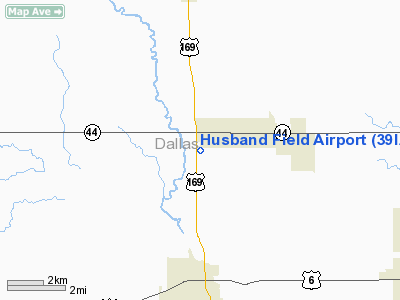
Location &
QuickFacts
|
FAA
Information Effective: |
2007-07-05 |
|
Airport
Identifier: |
39IA |
|
Airport
Status: |
Operational |
|
Longitude/Latitude: |
094-01-12.8330W/41-40-45.9540N
-94.020231/41.679432 (Estimated) |
|
Elevation: |
1010 ft / 307.85 m (Surveyed) |
|
Land: |
15 acres |
|
From
nearest city: |
3 nautical miles W of Dallas Center, IA |
|
Location: |
Dallas County, IA |
|
Magnetic Variation: |
04E (1985) |
Owner & Manager
|
Ownership: |
Privately owned |
|
Owner: |
Alan & Shae Foster |
|
Address: |
2464 N Ave
Dallas Center, IA 50063 |
|
Phone
number: |
515-993-4147 |
|
Manager: |
Alan F. Foster |
|
Address: |
2464 N Ave
Dallas Center, IA 50063 |
|
Phone number: |
515-993-4147 |
Airport Operations and Facilities
|
Airport Use: |
Private |
|
Wind indicator: |
Yes |
|
Segmented Circle: |
No |
|
Control Tower: |
No |
|
Landing fee charge: |
No |
|
Sectional chart: |
Omaha |
|
Region: |
ACE - Central |
|
Boundary ARTCC: |
ZMP - Minneapolis |
|
Tie-in FSS: |
FOD - Fort Dodge |
|
FSS on Airport: |
No |
|
FSS Phone: |
515-955-8114 |
|
FSS Toll Free: |
1-800-WX-BRIEF |
Airport Services
|
Bottled
Oxygen: |
NONE |
|
Bulk
Oxygen: |
NONE |
|
Runway Information
Runway 17/35
|
Dimension: |
2400 x 100 ft / 731.5 x 30.5 m |
|
Surface: |
TURF, Poor Condition |
|
|
Runway 17
|
Runway 35
|
|
Traffic
Pattern: |
Left |
Left |
|
Markings: |
None, |
None, |
|
Displaced
threshold: |
790.00 ft |
0.00 ft |
|
Runway End
Identifier: |
No |
No |
|
Centerline
Lights: |
No |
No |
|
Touchdown
Lights: |
No |
No |
|
Obstruction: |
3 ft fence
+45' PLINE AT 1700' APCH RATIO 50-1 FROM DSPLCD THR. |
, 50:1 slope to clear |
|
Radio Navigation Aids
|
ID |
Type |
Name |
Ch |
Freq |
Var |
Dist |
|
PRO |
NDB |
Perry |
|
251.00 |
06E |
11.0 nm |
|
GCT |
NDB |
Guthrie Center |
|
518.00 |
05E |
18.5 nm |
|
IKV |
NDB |
Ankeny |
|
275.00 |
03E |
20.5 nm |
|
BNW |
NDB |
Boone |
|
407.00 |
03E |
23.7 nm |
|
EFW |
NDB |
Jefferson |
|
391.00 |
03E |
24.7 nm |
|
GFZ |
NDB |
Greenfield |
|
338.00 |
04E |
28.6 nm |
|
ADU |
NDB |
Audubon |
|
266.00 |
04E |
39.9 nm |
|
CIN |
NDB |
Carroll |
|
397.00 |
04E |
40.7 nm |
|
UNE |
NDB |
Union County |
|
379.00 |
04E |
45.8 nm |
|
EBS |
NDB |
Webster City |
|
323.00 |
03E |
46.3 nm |
|
OXV |
NDB |
Knoxville |
|
284.00 |
03E |
46.9 nm |
|
AIO |
NDB |
Atlantic |
|
365.00 |
04E |
49.0 nm |
|
CNC |
NDB |
Chariton |
|
335.00 |
05E |
49.7 nm |
|
TNU |
VOR/DME |
Newton |
072X |
112.50 |
03E |
41.4 nm |
|
DSM |
VORTAC |
Des Moines |
122X |
117.50 |
07E |
22.2 nm |
|
DSM |
VOT |
Des Moines |
|
109.20 |
|
17.7 nm |
Remarks
-
RWY 17/35
UNUSABLE AFTER HEAVY RAINS.
-
ULTRALIGHT ON AND
INVOF ARPT.
-
EXISTED PRIOR TO 1959.
Based Aircraft
|
Aircraft based
on field: |
16 |
|
Single Engine
Airplanes: |
8 |
|
Ultralights: |
8 |
Operational Statistics
Time Period:
1985-08-30 -
1986-08-29
|
Aircraft
Operations: |
97/Week |
|
General
Aviation Local: |
100.0% |
Husband Field Airport
Address:
Dallas County, IA
Tel:
515-993-4147
Images
and information placed above are from
http://www.airport-data.com/airport/39IA/
We
thank them for the data!
|
General Info |
| Country |
United
States |
| State |
IOWA
|
| FAA ID |
39IA
|
| Latitude |
41-40-45.954N |
|
Longitude |
094-01-12.833W |
|
Elevation |
1010
feet |
| Near
City |
DALLAS
CENTER |
We don't guarantee the information is fresh and accurate. The data may
be wrong or outdated.
For more up-to-date information please refer to other sources.
|
|


