 |
|
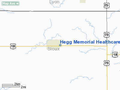
Hegg Memorial Healthcare Center Heliport |
|
|
Location &
QuickFacts
|
FAA
Information Effective: |
2007-07-05 |
|
Airport
Identifier: |
8IA1 |
|
Airport
Status: |
Operational |
|
Longitude/Latitude: |
096-17-01.0920W/43-12-05.4340N
-96.283637/43.201509 (Estimated) |
|
Elevation: |
1256 ft / 382.83 m (Estimated) |
|
Land: |
0 acres |
|
From
nearest city: |
0 nautical miles N of Rock Valley, IA |
|
Location: |
Sioux County, IA |
|
Magnetic Variation: |
05E (1995) |
Owner & Manager
|
Ownership: |
Privately owned |
|
Owner: |
Hegg Mem Healthcare Center |
|
Address: |
1202 21st Ave
Rock Valley, IA 51247 |
|
Phone
number: |
712-476-5305 |
|
Manager: |
Terry Dejong Adminstrator |
|
Address: |
1202 21st Ave
Rock Valley, IA 51247 |
|
Phone number: |
712-476-5305 |
Airport Operations and Facilities
|
Airport
Use: |
Private
MEDICAL. |
|
Wind
indicator: |
Yes |
|
Segmented Circle: |
No |
|
Control
Tower: |
No |
|
Lighting
Schedule: |
PHONE REQ
FOR PERIMETER LGTS CALL (712) 476-5305. |
|
Sectional chart: |
Omaha |
|
Region: |
ACE - Central |
|
Boundary
ARTCC: |
ZMP - Minneapolis |
|
Tie-in
FSS: |
FOD - Fort Dodge |
|
FSS on
Airport: |
No |
|
FSS
Phone: |
515-955-8114 |
|
FSS Toll
Free: |
1-800-WX-BRIEF |
|
Runway Information
Helipad H1
|
Dimension: |
60 x 60 ft / 18.3 x 18.3 m |
|
Surface: |
CONC, |
|
|
Runway H1
|
Runway
|
|
Traffic
Pattern: |
Left |
Left |
|
Radio Navigation Aids
|
ID |
Type |
Name |
Ch |
Freq |
Var |
Dist |
|
SOY |
NDB |
Sioux Center |
|
368.00 |
06E |
5.8 nm |
|
ORC |
NDB |
Orange City |
|
521.00 |
05E |
16.0 nm |
|
SHL |
NDB |
Sheldon |
|
338.00 |
05E |
19.7 nm |
|
ISB |
NDB |
Sibley |
|
269.00 |
05E |
25.3 nm |
|
FS |
NDB |
Rokky |
|
245.00 |
06E |
29.6 nm |
|
VMR |
NDB |
Vermillion |
|
375.00 |
06E |
38.9 nm |
|
CKP |
NDB |
Pilot Rock |
|
423.00 |
05E |
42.8 nm |
|
OI |
NDB |
Tommi |
|
305.00 |
07E |
45.3 nm |
|
GAK |
NDB |
Sioux Gateway |
|
233.00 |
06E |
47.9 nm |
|
PQN |
NDB/DME |
Pipestone |
028X |
284.00 |
06E |
47.2 nm |
|
DDL |
VOR/DME |
Sheldon |
023X |
108.60 |
05E |
19.7 nm |
|
OTG |
VOR/DME |
Worthington |
043X |
110.60 |
08E |
40.7 nm |
|
SPW |
VOR/DME |
Spencer |
037X |
110.00 |
05E |
47.5 nm |
|
FSD |
VORTAC |
Sioux Falls |
097X |
115.00 |
09E |
34.6 nm |
Remarks
-
PRVDD CLEAR APCH/DEP
PATHS FOR A 8:1 GLIDE SLOPE; A CLEAR TRANSITIONAL SFC FOR A 2:1 SLOPE; AND A
PLINE ALONG EAST/WEST HWY BURIED OR REMOVED.
Hegg Memorial Healthcare Center Heliport
Address:
Sioux County, IA
Tel:
712-476-5305
Images
and information placed above are from
http://www.airport-data.com/airport/8IA1/
We
thank them for the data!
|
General Info |
| Country |
United
States |
| State |
IOWA
|
| FAA ID |
8IA1
|
| Latitude |
43-12-05.434N |
|
Longitude |
096-17-01.092W |
|
Elevation |
1256
feet |
| Near
City |
ROCK
VALLEY |
We don't guarantee the information is fresh and accurate. The data may
be wrong or outdated.
For more up-to-date information please refer to other sources.
|
|


