 |
|
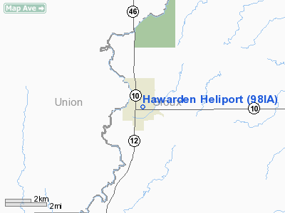
Location &
QuickFacts
|
FAA
Information Effective: |
2007-07-05 |
|
Airport
Identifier: |
98IA |
|
Airport
Status: |
Operational |
|
Longitude/Latitude: |
096-28-51.1100W/42-59-54.9570N
-96.480864/42.998599 (Estimated) |
|
Elevation: |
1174 ft / 357.84 m (Estimated) |
|
Land: |
1 acres |
|
From
nearest city: |
0 nautical miles N of Hawarden, IA |
|
Location: |
Sioux County, IA |
|
Magnetic Variation: |
06E (1995) |
Owner & Manager
|
Ownership: |
Publicly owned |
|
Owner: |
City Of Hawarden |
|
Address: |
Box 231
Hawarden, IA 51023 |
|
Phone number: |
712-551-2565 |
|
Manager: |
Craig Coffey, City Admin |
|
Address: |
Box 231
Hawarden, IA 51023 |
|
Phone number: |
712-551-2565 |
Airport
Operations and Facilities
|
Airport
Use: |
Private |
|
Wind
indicator: |
Yes |
|
Segmented Circle: |
No |
|
Control
Tower: |
No |
|
Lighting
Schedule: |
PHONE REQ
FOR PERIMETER LGTS CALL (712) 551-2565. |
|
Sectional chart: |
Omaha |
|
Region: |
ACE - Central |
|
Boundary
ARTCC: |
ZMP - Minneapolis |
|
Tie-in
FSS: |
FOD - Fort Dodge |
|
FSS on
Airport: |
No |
|
FSS
Phone: |
515-955-8114 |
|
FSS Toll
Free: |
1-800-WX-BRIEF |
|
Runway Information
Helipad H1
|
Dimension: |
40 x 40 ft / 12.2 x 12.2 m |
|
Surface: |
CONC, Good Condition |
|
|
Runway H1
|
Runway
|
|
Traffic
Pattern: |
Left |
Left |
|
Radio Navigation Aids
|
ID |
Type |
Name |
Ch |
Freq |
Var |
Dist |
|
SOY |
NDB |
Sioux Center |
|
368.00 |
06E |
15.1 nm |
|
ORC |
NDB |
Orange City |
|
521.00 |
05E |
18.5 nm |
|
VMR |
NDB |
Vermillion |
|
375.00 |
06E |
24.5 nm |
|
SHL |
NDB |
Sheldon |
|
338.00 |
05E |
31.2 nm |
|
OI |
NDB |
Tommi |
|
305.00 |
07E |
32.4 nm |
|
FS |
NDB |
Rokky |
|
245.00 |
06E |
33.5 nm |
|
GAK |
NDB |
Sioux Gateway |
|
233.00 |
06E |
35.7 nm |
|
ISB |
NDB |
Sibley |
|
269.00 |
05E |
38.9 nm |
|
SU |
NDB |
Salix |
|
414.00 |
07E |
41.2 nm |
|
CKP |
NDB |
Pilot Rock |
|
423.00 |
05E |
43.9 nm |
|
DDL |
VOR/DME |
Sheldon |
023X |
108.60 |
05E |
31.2 nm |
|
YKN |
VOR/DME |
Yankton |
051X |
111.40 |
07E |
40.1 nm |
|
SUX |
VORTAC |
Sioux City |
112X |
116.50 |
09E |
39.9 nm |
|
FSD |
VORTAC |
Sioux Falls |
097X |
115.00 |
09E |
41.3 nm |
Remarks
-
PRVDD CLEAR APCH/DEP
PATHSFOR A MIN 8:1 GS; A CLEAR 2:1 TRANSITIONAL SFC; PLINES E; S & N OF
HELIPAD MKD & HAWARDEN POLICE DEPT PRVD CTL OF PU ACCESS DURING FLIGHT OPNS.
Hawarden Heliport
Address:
Sioux County, IA
Tel:
712-551-2565
Images
and information placed above are from
http://www.airport-data.com/airport/98IA/
We
thank them for the data!
|
General Info |
| Country |
United
States |
| State |
IOWA
|
| FAA ID |
98IA
|
| Latitude |
42-59-54.957N |
|
Longitude |
096-28-51.110W |
|
Elevation |
1174
feet |
| Near
City |
HAWARDEN
|
We don't guarantee the information is fresh and accurate. The data may
be wrong or outdated.
For more up-to-date information please refer to other sources.
|
|


