 |
|
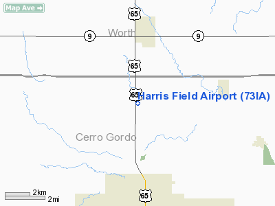
Location &
QuickFacts
|
FAA
Information Effective: |
2007-07-05 |
|
Airport
Identifier: |
73IA |
|
Airport
Status: |
Operational |
|
Longitude/Latitude: |
093-12-30.0000W/43-14-08.0000N
-93.208333/43.235556 (Estimated) |
|
Elevation: |
1145 ft / 349.00 m (Estimated) |
|
Land: |
5 acres |
|
From
nearest city: |
5 nautical miles N of Mason City, IA |
|
Location: |
Cerro Gordo County, IA |
|
Magnetic Variation: |
() |
Owner & Manager
|
Ownership: |
Privately owned |
|
Owner: |
David Harris |
|
Address: |
23811 Orchid Ave
Mason City, IA 50401 |
|
Phone
number: |
641-423-3582 |
|
Manager: |
David Harris |
|
Address: |
23811 Orchid Ave
Mason City, IA 50401 |
|
Phone number: |
641-423-3582 |
Airport Operations and Facilities
|
Airport
Use: |
Private |
|
Wind
indicator: |
Yes |
|
Segmented Circle: |
No |
|
Control
Tower: |
No |
|
Region: |
ACE - Central |
|
Boundary
ARTCC: |
ZMP - Minneapolis |
|
Tie-in
FSS: |
FOD - Fort Dodge |
|
FSS
Phone: |
515-955-8114 |
|
FSS Toll
Free: |
1-800-WX-BRIEF |
|
Runway Information
Runway 18/36
|
Dimension: |
3250 x 60 ft / 990.6 x 18.3 m |
|
Surface: |
TURF, Good Condition |
|
|
Runway 18
|
Runway 36
|
|
Traffic
Pattern: |
Left |
Left |
|
Radio Navigation Aids
|
ID |
Type |
Name |
Ch |
Freq |
Var |
Dist |
|
FXY |
NDB |
Forest City |
|
359.00 |
05E |
18.1 nm |
|
IY |
NDB |
Chukk |
|
417.00 |
03E |
21.9 nm |
|
CCY |
NDB |
Charles City |
|
375.00 |
03E |
28.2 nm |
|
HPT |
NDB |
Hampton |
|
230.00 |
03E |
30.7 nm |
|
CAV |
NDB |
Clarion |
|
387.00 |
03E |
38.1 nm |
|
EAG |
NDB |
Eagle Grove |
|
302.00 |
03E |
44.2 nm |
|
SBU |
NDB |
Blue Earth |
|
332.00 |
04E |
44.5 nm |
|
IFA |
NDB |
Iowa Falls |
|
368.00 |
03E |
45.7 nm |
|
AXA |
NDB |
Algona |
|
403.00 |
03E |
47.6 nm |
|
CJJ |
NDB |
Cresco |
|
293.00 |
02E |
47.8 nm |
|
JAY |
VOR/DME |
Austin |
019X |
108.20 |
03E |
24.1 nm |
|
AEL |
VOR/DME |
Albert Lea |
035X |
109.80 |
05E |
27.7 nm |
|
RST |
VOR/DME |
Rochester |
057X |
112.00 |
05E |
42.3 nm |
|
MCW |
VORTAC |
Mason City |
096X |
114.90 |
06E |
10.0 nm |
Remarks
-
PRVDD A CLEAR
APCH TO EA RY FOR A 20:1 GLIDE SLOPE AND A CLEAR TRANSITIONAL SFC FOR A 7:1
SLOPE.
Based Aircraft
|
Aircraft based
on field: |
2 |
|
Single Engine
Airplanes: |
2 |
Harris Field Airport
Address:
Cerro Gordo County, IA
Tel:
641-423-3582
Images
and information placed above are from
http://www.airport-data.com/airport/73IA/
We
thank them for the data!
We don't guarantee the information is fresh and accurate. The data may
be wrong or outdated.
For more up-to-date information please refer to other sources.
|
|


