 |
|
|
|
|
|
Location &
QuickFacts
|
FAA
Information Effective: |
2007-07-05 |
|
Airport
Identifier: |
HNR |
|
Airport
Status: |
Operational |
|
Longitude/Latitude: |
095-20-22.7000W/41-35-03.8000N
-95.339639/41.584389 (Estimated) |
|
Elevation: |
1231 ft / 375.21 m (Surveyed) |
|
Land: |
131 acres |
|
From
nearest city: |
3 nautical miles SW of Harlan, IA |
|
Location: |
Shelby County, IA |
|
Magnetic Variation: |
05E (1995) |
Owner & Manager
|
Ownership: |
Publicly owned |
|
Owner: |
City Of Harlan |
|
Address: |
City Hall/box 650
Harlan, IA 51537 |
|
Phone number: |
712-755-5137 |
|
Manager: |
Olie Pash |
|
Address: |
610 Hwy 59
Harlan, IA 51537 |
|
Phone number: |
712-744-3366
HOME PHONE 712-755-2646. |
Airport
Operations and Facilities
|
Airport
Use: |
Open to public |
|
Wind
indicator: |
Yes |
|
Segmented Circle: |
No |
|
Control
Tower: |
No |
|
Lighting
Schedule: |
DUSK-DAWN
ACTVT MIRL RY 15/33 & PAPI RYS 15 & 33 - CTAF. |
|
Beacon
Color: |
Clear-Green (lighted land airport) |
|
Landing
fee charge: |
No |
|
Sectional chart: |
Omaha |
|
Region: |
ACE - Central |
|
Boundary
ARTCC: |
ZMP - Minneapolis |
|
Tie-in
FSS: |
FOD - Fort Dodge |
|
FSS on
Airport: |
No |
|
FSS
Phone: |
515-955-8114 |
|
FSS Toll
Free: |
1-800-WX-BRIEF |
|
NOTAMs
Facility: |
HNR (NOTAM-d service avaliable) |
|
Federal Agreements: |
NGY |
Airport Communications
|
CTAF: |
122.800 |
|
Unicom: |
122.800 |
Airport Services
|
Fuel
available: |
100LLA MOGAS |
|
Airframe
Repair: |
MINOR |
|
Power
Plant Repair: |
MINOR |
|
Bottled
Oxygen: |
NONE |
|
Bulk
Oxygen: |
NONE |
|
Runway Information
Runway 03/21
|
Dimension: |
1700 x 120 ft / 518.2 x 36.6 m |
|
Surface: |
TURF, Fair Condition |
|
|
Runway 03
|
Runway 21
|
|
Longitude: |
095-20-25.6000W |
095-20-12.0000W |
|
Latitude: |
41-34-54.6000N |
41-35-07.9600N |
|
Elevation: |
1198.00 ft |
1195.00 ft |
|
Alignment: |
37 |
127 |
|
Traffic
Pattern: |
Left |
Left |
|
Obstruction: |
8 ft fence, 165.0 ft from runway, 20:1 slope to clear |
10 ft fence, 295.0 ft from runway, 29:1 slope to clear |
|
Runway 15/33
|
Dimension: |
4100 x 75 ft / 1249.7 x 22.9 m |
|
Surface: |
ASPH-CONC, Fair Condition |
|
Weight Limit: |
Single wheel: 20000 lbs.
Dual wheel: 25000 lbs. |
|
Edge Lights: |
Medium |
|
|
Runway 15
|
Runway 33
|
|
Longitude: |
095-20-35.6000W |
095-20-12.3570W |
|
Latitude: |
41-35-23.6000N |
41-34-46.9160N |
|
Elevation: |
1231.00 ft |
1194.00 ft |
|
Alignment: |
127 |
127 |
|
Traffic
Pattern: |
Left |
Left |
|
Markings: |
Non-precision instrument, Fair Condition |
Non-precision instrument, Fair Condition |
|
Crossing
Height: |
34.00 ft |
34.00 ft |
|
VASI: |
2-light PAPI on left side |
2-light PAPI on left side |
|
Visual
Glide Angle: |
4.00° |
3.00° |
|
Obstruction: |
80 ft tree, 1825.0 ft from runway, 232 ft right of
centerline, 20:1 slope to clear |
25 ft pline, 625.0 ft from runway, 17:1 slope to clear |
|
Radio Navigation Aids
|
ID |
Type |
Name |
Ch |
Freq |
Var |
Dist |
|
HNR |
NDB |
Harlan |
|
272.00 |
05E |
0.3 nm |
|
AIO |
NDB |
Atlantic |
|
365.00 |
04E |
17.1 nm |
|
ADU |
NDB |
Audubon |
|
266.00 |
04E |
20.3 nm |
|
DNS |
NDB |
Denison |
|
350.00 |
04E |
24.1 nm |
|
OM |
NDB |
Gerfi |
|
320.00 |
05E |
30.7 nm |
|
RDK |
NDB |
Red Oak |
|
230.00 |
04E |
34.4 nm |
|
CIN |
NDB |
Carroll |
|
397.00 |
04E |
37.2 nm |
|
GCT |
NDB |
Guthrie Center |
|
518.00 |
05E |
41.1 nm |
|
MEY |
NDB |
Mapleton |
|
335.00 |
05E |
41.2 nm |
|
MLE |
NDB |
Millard |
|
371.00 |
06E |
42.0 nm |
|
GFZ |
NDB |
Greenfield |
|
338.00 |
04E |
43.2 nm |
|
CRZ |
NDB |
Corning |
|
278.00 |
04E |
44.1 nm |
|
PMV |
NDB |
Plattsmouth |
|
329.00 |
06E |
46.4 nm |
|
OFF |
TACAN |
Offutt |
054X |
|
05E |
37.8 nm |
|
TQE |
VOR |
Tekamah |
|
108.40 |
07E |
39.1 nm |
|
OVR |
VORTAC |
Omaha |
110X |
116.30 |
08E |
30.8 nm |
|
OMA |
VOT |
Omaha |
|
109.00 |
|
30.2 nm |
Remarks
-
PAT DEREN,
CHAIRMAN, ARPT COMM.
-
RY 15 IS CALM
WIND RY.
Based
Aircraft
|
Aircraft based
on field: |
33 |
|
Single Engine
Airplanes: |
30 |
|
Multi Engine
Airplanes: |
3 |
Operational Statistics
Time Period:
2005-07-25 -
2006-07-24
|
Aircraft
Operations: |
43/Day |
|
General
Aviation Local: |
43.2% |
|
General
Aviation Itinerant: |
56.8% |
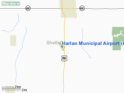
Harlan Municipal Airport
Address:
Shelby County, IA
Tel:
712-755-5137, 712-744-3366
Images
and information placed above are from
http://www.airport-data.com/airport/HNR/
We
thank them for the data!
|
General Info |
| Country |
United
States |
| State |
IOWA
|
| FAA ID |
HNR
|
| Latitude |
41-35-03.800N |
|
Longitude |
095-20-22.700W |
|
Elevation |
1231
feet |
| Near
City |
HARLAN
|
We don't guarantee the information is fresh and accurate. The data may
be wrong or outdated.
For more up-to-date information please refer to other sources.
|
|


