 |
|
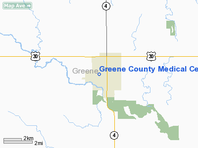
Greene County Medical Center Heliport |
|
|
Location &
QuickFacts
|
FAA
Information Effective: |
2007-07-05 |
|
Airport
Identifier: |
3IA2 |
|
Airport
Status: |
Operational |
|
Longitude/Latitude: |
094-23-15.8870W/42-00-59.9390N
-94.387746/42.016650 (Estimated) |
|
Elevation: |
1050 ft / 320.04 m (Estimated) |
|
Land: |
0 acres |
|
From
nearest city: |
0 nautical miles SW of Jefferson, IA |
|
Location: |
Greene County, IA |
|
Magnetic Variation: |
04E (1985) |
Owner & Manager
|
Ownership: |
Publicly owned |
|
Owner: |
Greene County Medical Center |
|
Address: |
1000 W Lincolnway
Jefferson, IA 50129 |
|
Phone number: |
515-386-2114 |
|
Manager: |
Karen Bossard |
|
Address: |
1000 W. Lincolnway
Jefferson, IA 50129 |
|
Phone number: |
515-386-2114 |
Airport
Operations and Facilities
|
Airport
Use: |
Private
MEDICAL. |
|
Wind
indicator: |
Yes |
|
Segmented Circle: |
No |
|
Control
Tower: |
No |
|
Lighting
Schedule: |
DUSK-DAWN |
|
Landing
fee charge: |
No |
|
Sectional chart: |
Omaha |
|
Region: |
ACE - Central |
|
Boundary
ARTCC: |
ZMP - Minneapolis |
|
Tie-in
FSS: |
FOD - Fort Dodge |
|
FSS on
Airport: |
No |
|
FSS
Phone: |
515-955-8114 |
|
FSS Toll
Free: |
1-800-WX-BRIEF |
|
Runway Information
Helipad H1
|
Dimension: |
40 x 30 ft / 12.2 x 9.1 m |
|
Surface: |
CONC, Good Condition |
|
|
Runway H1
|
Runway
|
|
Traffic
Pattern: |
Left |
Left |
|
Markings: |
Basic, |
, |
|
Radio Navigation Aids
|
ID |
Type |
Name |
Ch |
Freq |
Var |
Dist |
|
EFW |
NDB |
Jefferson |
|
391.00 |
03E |
2.0 nm |
|
PRO |
NDB |
Perry |
|
251.00 |
06E |
15.1 nm |
|
CIN |
NDB |
Carroll |
|
397.00 |
04E |
17.8 nm |
|
GCT |
NDB |
Guthrie Center |
|
518.00 |
05E |
20.2 nm |
|
BNW |
NDB |
Boone |
|
407.00 |
03E |
24.0 nm |
|
ADU |
NDB |
Audubon |
|
266.00 |
04E |
30.5 nm |
|
SKI |
NDB |
Sac City |
|
356.00 |
04E |
34.3 nm |
|
EBS |
NDB |
Webster City |
|
323.00 |
03E |
34.4 nm |
|
IKV |
NDB |
Ankeny |
|
275.00 |
03E |
41.6 nm |
|
GFZ |
NDB |
Greenfield |
|
338.00 |
04E |
41.6 nm |
|
DNS |
NDB |
Denison |
|
350.00 |
04E |
44.3 nm |
|
POH |
NDB |
Pocahontas |
|
428.00 |
06E |
45.4 nm |
|
EAG |
NDB |
Eagle Grove |
|
302.00 |
03E |
46.7 nm |
|
AIO |
NDB |
Atlantic |
|
365.00 |
04E |
47.2 nm |
|
FOD |
VORTAC |
Fort Dodge |
082X |
113.50 |
07E |
36.0 nm |
|
DSM |
VORTAC |
Des Moines |
122X |
117.50 |
07E |
48.1 nm |
|
DSM |
VOT |
Des Moines |
|
109.20 |
|
43.0 nm |
Remarks
-
CONDL: APPROACH
PATHS ARE MAINTAINED FOR AN 8:1 GLIDE SLOPE; TRANSITIONAL SURFACES ARE
MAINTAINED FOR 2:1 SLOPE.
Greene County Medical Center Heliport
Address:
Greene County, IA
Tel:
515-386-2114
Images
and information placed above are from
http://www.airport-data.com/airport/3IA2/
We
thank them for the data!
|
General Info |
| Country |
United
States |
| State |
IOWA
|
| FAA ID |
3IA2
|
| Latitude |
42-00-59.939N |
|
Longitude |
094-23-15.887W |
|
Elevation |
1050
feet |
| Near
City |
JEFFERSON |
We don't guarantee the information is fresh and accurate. The data may
be wrong or outdated.
For more up-to-date information please refer to other sources.
|
|


