 |
|
|
|
|
|
Location &
QuickFacts
|
FAA
Information Effective: |
2007-07-05 |
|
Airport
Identifier: |
4D8 |
|
Airport
Status: |
Operational |
|
Longitude/Latitude: |
095-09-32.5860W/43-19-59.4710N
-95.159052/43.333186 (Estimated) |
|
Elevation: |
1439 ft / 438.61 m (Surveyed) |
|
Land: |
48 acres |
|
From
nearest city: |
1 nautical miles NW of Milford, IA |
|
Location: |
Dickinson County, IA |
|
Magnetic Variation: |
05E (1980) |
Owner & Manager
|
Ownership: |
Publicly owned |
|
Owner: |
City Of Milford |
|
Address: |
Po Box 536
Milford, IA 51351 |
|
Phone number: |
712-338-2741 |
|
Manager: |
John Shaw |
|
Address: |
26 Arpt Dr.
Milford, IA 51351 |
|
Phone number: |
712-338-4930 |
Airport
Operations and Facilities
|
Airport
Use: |
Open to public |
|
Wind
indicator: |
Yes |
|
Segmented Circle: |
No |
|
Control
Tower: |
No |
|
Lighting
Schedule: |
DUSK-DAWN |
|
Landing
fee charge: |
No |
|
Sectional chart: |
Omaha |
|
Region: |
ACE - Central |
|
Boundary
ARTCC: |
ZMP - Minneapolis |
|
Tie-in
FSS: |
FOD - Fort Dodge |
|
FSS on
Airport: |
No |
|
FSS
Phone: |
515-955-8114 |
|
FSS Toll
Free: |
1-800-WX-BRIEF |
|
NOTAMs
Facility: |
FOD (NOTAM-d service avaliable) |
Airport Communications
Airport Services
|
Fuel
available: |
100LL
FOR FUEL CALL (712) 337-0247/336-2525 - POLICE DEPT. |
|
Airframe
Repair: |
NONE |
|
Power
Plant Repair: |
NONE |
|
Bottled
Oxygen: |
NONE |
|
Bulk
Oxygen: |
NONE |
|
Runway Information
Runway 09/27
|
Dimension: |
2873 x 50 ft / 875.7 x 15.2 m |
|
Surface: |
ASPH, Good Condition |
|
Edge Lights: |
Low |
|
|
Runway 09
|
Runway 27
|
|
Longitude: |
095-09-48.0600W |
095-09-09.1900W |
|
Latitude: |
43-20-05.1100N |
43-20-05.1800N |
|
Elevation: |
1437.00 ft |
1436.00 ft |
|
Alignment: |
90 |
127 |
|
Traffic
Pattern: |
Left |
Left |
|
Markings: |
Basic, Good Condition |
Basic, Good Condition |
|
Displaced
threshold: |
60.00 ft |
360.00 ft |
|
Obstruction: |
15 ft road, 420.0 ft from runway, 14:1 slope to clear
APCH SLOPE 31:1 TO DSPLCD THLD. |
41 ft tree, 517.0 ft from runway, 40 ft left of
centerline, 7:1 slope to clear
RWY 27 APCH SLOPE 21:1 TO DSPLCD THLD. |
|
Runway 18/36
|
Dimension: |
1990 x 100 ft / 606.6 x 30.5 m |
|
Surface: |
TURF, Fair Condition |
|
|
Runway 18
|
Runway 36
|
|
Longitude: |
095-09-36.8900W |
095-09-36.8900W |
|
Latitude: |
43-20-04.4000N |
43-19-44.7500N |
|
Elevation: |
1434.00 ft |
1435.00 ft |
|
Alignment: |
127 |
0 |
|
Traffic
Pattern: |
Left |
Left |
|
Displaced
threshold: |
0.00 ft |
400.00 ft |
|
Obstruction: |
5 ft fence, 155.0 ft from runway, 31:1 slope to clear |
64 ft tree, 974.0 ft from runway, 150 ft left of
centerline, 15:1 slope to clear
RY 36 APCH SLOPE 21:1 TO DSPLSD THLD. |
|
Radio Navigation Aids
|
ID |
Type |
Name |
Ch |
Freq |
Var |
Dist |
|
LTU |
NDB |
Little Sioux |
|
326.00 |
05E |
12.4 nm |
|
PUF |
NDB |
Puff |
|
345.00 |
04E |
18.4 nm |
|
MJQ |
NDB |
Jackson |
|
353.00 |
04E |
20.3 nm |
|
EGQ |
NDB |
Emmetsburg |
|
410.00 |
04E |
24.2 nm |
|
ISB |
NDB |
Sibley |
|
269.00 |
05E |
26.0 nm |
|
SHL |
NDB |
Sheldon |
|
338.00 |
05E |
30.4 nm |
|
MWM |
NDB |
Windom |
|
203.00 |
03E |
34.7 nm |
|
CKP |
NDB |
Pilot Rock |
|
423.00 |
05E |
40.1 nm |
|
AXA |
NDB |
Algona |
|
403.00 |
03E |
41.7 nm |
|
POH |
NDB |
Pocahontas |
|
428.00 |
06E |
41.8 nm |
|
SLB |
NDB |
Storm Lake |
|
434.00 |
04E |
44.2 nm |
|
ORC |
NDB |
Orange City |
|
521.00 |
05E |
44.5 nm |
|
SOY |
NDB |
Sioux Center |
|
368.00 |
06E |
46.7 nm |
|
JYG |
NDB |
St James |
|
260.00 |
04E |
47.3 nm |
|
SBU |
NDB |
Blue Earth |
|
332.00 |
04E |
49.0 nm |
|
EST |
VOR |
Estherville |
|
110.40 |
07E |
18.7 nm |
|
SPW |
VOR/DME |
Spencer |
037X |
110.00 |
05E |
10.4 nm |
|
OTG |
VOR/DME |
Worthington |
043X |
110.60 |
08E |
26.4 nm |
|
DDL |
VOR/DME |
Sheldon |
023X |
108.60 |
05E |
30.4 nm |
|
FRM |
VOR/DME |
Fairmont |
039X |
110.20 |
07E |
37.2 nm |
Remarks
-
RY 27 IS CALM
WIND RY.
-
PRVDD RWY APCHS
IS MAINT FOR MIN 20:1 GLIDE SLOPE & TRSNL SFC MAINT FOR 7:1 SLOPE.
Based
Aircraft
|
Aircraft based
on field: |
11 |
|
Single Engine
Airplanes: |
10 |
|
Ultralights: |
1 |
Operational Statistics
Time Period: 2004-09-21 - 2005-09-20
|
Aircraft
Operations: |
34/Week |
|
General
Aviation Local: |
19.8% |
|
General
Aviation Itinerant: |
80.2% |
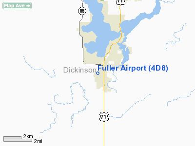
Fuller Airport
Address:
Dickinson County, IA
Tel:
712-338-2741, 712-338-4930
Images
and information placed above are from
http://www.airport-data.com/airport/4D8/
We
thank them for the data!
|
General Info |
| Country |
United
States |
| State |
IOWA
|
| FAA ID |
4D8
|
| Latitude |
43-19-59.471N |
|
Longitude |
095-09-32.586W |
|
Elevation |
1439
feet |
| Near
City |
MILFORD
|
We don't guarantee the information is fresh and accurate. The data may
be wrong or outdated.
For more up-to-date information please refer to other sources.
|
|


