 |
|
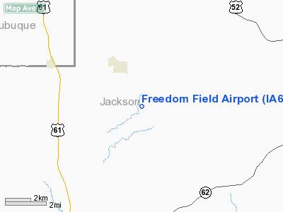
Location &
QuickFacts
|
FAA
Information Effective: |
2007-07-05 |
|
Airport
Identifier: |
IA68 |
|
Airport
Status: |
Operational |
|
Longitude/Latitude: |
090-36-02.4670W/42-16-00.0490N
-90.600685/42.266680 (Estimated) |
|
Elevation: |
1055 ft / 321.56 m (Estimated) |
|
Land: |
0 acres |
|
From
nearest city: |
2 nautical miles SE of La Motte, IA |
|
Location: |
Jackson County, IA |
|
Magnetic Variation: |
01E (1985) |
Owner & Manager
|
Ownership: |
Privately owned |
|
Owner: |
Robert Clasen |
|
Address: |
3027 N.w. 83 Place
Ankeny, IA 50021 |
|
Phone
number: |
515-964-9471 |
|
Manager: |
Robert Clasen |
|
Address: |
3027 N.w. 83 Place
Ankeny, IA 50021 |
|
Phone number: |
515-964-9471 |
Airport Operations and Facilities
|
Airport
Use: |
Private |
|
Wind
indicator: |
Yes |
|
Segmented Circle: |
No |
|
Control
Tower: |
No |
|
Landing
fee charge: |
No |
|
Sectional chart: |
Chicago |
|
Region: |
ACE - Central |
|
Boundary
ARTCC: |
ZAU - Chicago |
|
Tie-in
FSS: |
FOD - Fort Dodge |
|
FSS on
Airport: |
No |
|
FSS
Phone: |
515-955-8114 |
|
FSS Toll
Free: |
1-800-WX-BRIEF |
|
Runway Information
Runway 03/21
|
Dimension: |
2200 x 50 ft / 670.6 x 15.2 m |
|
Surface: |
TURF, |
|
|
Runway 03
|
Runway 21
|
|
Traffic
Pattern: |
Left |
Left |
|
Radio Navigation Aids
|
ID |
Type |
Name |
Ch |
Freq |
Var |
Dist |
|
OQW |
NDB |
Maquoketa |
|
386.00 |
02E |
14.4 nm |
|
MXO |
NDB |
Monticello |
|
397.00 |
01E |
24.2 nm |
|
PVB |
NDB |
Platteville |
|
203.00 |
01E |
26.4 nm |
|
CWI |
NDB |
Clinton |
|
377.00 |
01E |
29.0 nm |
|
MRJ |
NDB |
Mineral Point |
|
365.00 |
00W |
40.9 nm |
|
FEP |
NDB |
Freeport |
|
335.00 |
00E |
45.2 nm |
|
BOZ |
NDB |
Whiteside |
|
254.00 |
01E |
49.4 nm |
|
DBQ |
VORTAC |
Dubuque |
105X |
115.80 |
04E |
9.4 nm |
|
CVA |
VORTAC |
Davenport |
085X |
113.80 |
04E |
34.0 nm |
|
DVN |
VOT |
Davenport Municipal |
|
111.80 |
|
39.4 nm |
Remarks
-
PRVDD THAT ALL
TFC PATS TO/FROM FREEDOM FIELD ARE CONDUCTED TO THE WEST OF RWY 03/21 TO AVOID
CONFLICT WITH TFC PAT/OPERNS OF THE HOFF ARPT. PRVDD THAT THE APCH TO EACH RWY
IS MAINTAINED FOR A MINIMUM 20:1 GLIDE SLOPE AND THE TRANSITIONAL SURFACE BE
MAINTAINED FOR A 7:1 SLOPE.
Based
Aircraft
|
Aircraft based
on field: |
5 |
|
Single Engine
Airplanes: |
5 |
Freedom Field Airport
Address:
Jackson County, IA
Tel:
515-964-9471
Images
and information placed above are from
http://www.airport-data.com/airport/IA68/
We
thank them for the data!
|
General Info |
| Country |
United
States |
| State |
IOWA
|
| FAA ID |
IA68
|
| Latitude |
42-16-00.049N |
|
Longitude |
090-36-02.467W |
|
Elevation |
1055
feet |
| Near
City |
LA MOTTE
|
We don't guarantee the information is fresh and accurate. The data may
be wrong or outdated.
For more up-to-date information please refer to other sources.
|
|


