 |
|
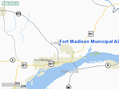
Fort Madison Municipal Airport |
|
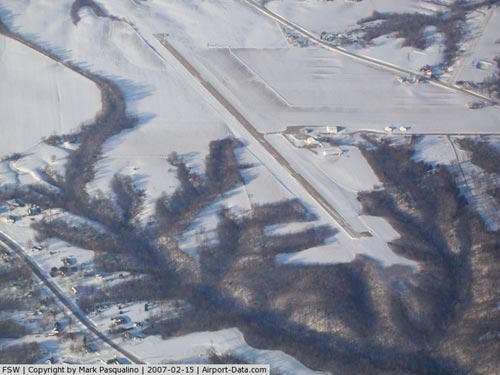 |
(Click on the photo to enlarge) |
Location &
QuickFacts
|
FAA
Information Effective: |
2007-07-05 |
|
Airport
Identifier: |
FSW |
|
Airport
Status: |
Operational |
|
Longitude/Latitude: |
091-19-36.5430W/40-39-33.3450N
-91.326818/40.659262 (Estimated) |
|
Elevation: |
724 ft / 220.68 m (Surveyed) |
|
Land: |
206 acres |
|
From
nearest city: |
2 nautical miles N of Fort Madison, IA |
|
Location: |
Lee County, IA |
|
Magnetic Variation: |
02E (1985) |
Owner & Manager
|
Ownership: |
Publicly owned |
|
Owner: |
City Of Fort Madison
VERN PECK CHMN ARPT CMSN; CALL 319-470-9851. |
|
Address: |
Ave E & 8 Th
Fort Madison, IA 52627 |
|
Phone
number: |
319-372-7700 |
|
Manager: |
Steve Hohl |
|
Address: |
50 Arpt Rd.
Fort Madison, IA 52627 |
|
Phone number: |
319-372-1138 |
Airport Operations and Facilities
|
Airport
Use: |
Open to public |
|
Wind
indicator: |
Yes |
|
Segmented Circle: |
No |
|
Control
Tower: |
No |
|
Lighting
Schedule: |
DUSK-DAWN
ACTVT MIRL RY 16/34 AND REIL RY 34 AND PAPI RY 34 - CTAF. |
|
Beacon
Color: |
Clear-Green (lighted land airport) |
|
Landing
fee charge: |
No |
|
Sectional chart: |
Chicago |
|
Region: |
ACE - Central |
|
Boundary
ARTCC: |
ZAU - Chicago |
|
Tie-in
FSS: |
FOD - Fort Dodge |
|
FSS on
Airport: |
No |
|
FSS
Phone: |
515-955-8114 |
|
FSS Toll
Free: |
1-800-WX-BRIEF |
|
NOTAMs
Facility: |
FSW (NOTAM-d service avaliable) |
|
Federal Agreements: |
NGY |
Airport Communications
|
CTAF: |
122.800 |
|
Unicom: |
122.800 |
Airport Services
|
Fuel
available: |
100LLA
SELF SERVE CREDIT CARD |
|
Airframe
Repair: |
NONE |
|
Power
Plant Repair: |
NONE |
|
Bottled
Oxygen: |
NONE |
|
Bulk
Oxygen: |
NONE |
|
Runway Information
Runway 08/26
|
Dimension: |
1200 x 100 ft / 365.8 x 30.5 m |
|
Surface: |
TURF, Fair Condition |
|
|
Runway 08
|
Runway 26
|
|
Longitude: |
091-19-41.0000W |
091-19-17.5420W |
|
Latitude: |
40-39-35.0000N |
40-39-33.4450N |
|
Traffic
Pattern: |
Left |
Left |
|
Obstruction: |
63 ft trees, 1327.0 ft from runway, 133 ft right of
centerline, 21:1 slope to clear |
33 ft pline, 673.0 ft from runway, 20:1 slope to clear |
|
Runway 16/34
|
Dimension: |
4002 x 75 ft / 1219.8 x 22.9 m |
|
Surface: |
CONC, Good Condition |
|
Surface
Treatment: |
Wire Comb or Wire Tine |
|
Weight Limit: |
Single wheel: 19000 lbs.
Dual wheel: 25000 lbs. |
|
Edge Lights: |
Non-standard lighting system
RY 16/34 NSTD MIRL LAST 2,000 FT HAS CLEAR GLOBES. |
|
|
Runway 16
|
Runway 34
|
|
Longitude: |
091-19-45.7920W |
091-19-33.9840W |
|
Latitude: |
40-39-52.0420N |
40-39-13.5360N |
|
Elevation: |
712.00 ft |
714.00 ft |
|
Alignment: |
127 |
127 |
|
Traffic
Pattern: |
Left |
Left |
|
Markings: |
Non-precision instrument, Good Condition |
Non-precision instrument, Good Condition |
|
VASI: |
|
2-light PAPI on left side |
|
Runway End
Identifier: |
|
Yes |
|
Obstruction: |
40 ft trees, 1100.0 ft from runway, 225 ft right of
centerline, 22:1 slope to clear |
24 ft trees, 267.0 ft from runway, 127 ft left of
centerline, 2:1 slope to clear |
|
Radio Navigation Aids
|
ID |
Type |
Name |
Ch |
Freq |
Var |
Dist |
|
EOK |
NDB |
Keokuk |
|
366.00 |
02E |
12.7 nm |
|
MPZ |
NDB |
Mount Pleasant |
|
212.00 |
02E |
19.0 nm |
|
JZY |
NDB |
Macomb |
|
251.00 |
01E |
36.0 nm |
|
FFL |
NDB |
Fairfield |
|
332.00 |
03E |
36.8 nm |
|
AWG |
NDB |
Washington |
|
219.00 |
02E |
40.5 nm |
|
UI |
NDB |
Quincy |
|
293.00 |
02E |
46.5 nm |
|
DDD |
VOR/DME |
Port City |
112X |
116.50 |
01E |
43.3 nm |
|
GBG |
VOR/DME |
Galesburg |
035X |
109.80 |
03E |
43.9 nm |
|
BRL |
VORTAC |
Burlington |
051X |
111.40 |
05E |
18.7 nm |
|
UIN |
VORTAC |
Quincy |
083X |
113.60 |
05E |
48.8 nm |
Based
Aircraft
|
Aircraft based
on field: |
6 |
|
Single Engine
Airplanes: |
6 |
Operational Statistics
Time Period:
2006-05-25 -
2007-05-24
|
Aircraft
Operations: |
98/Week |
|
Air Taxi: |
15.2% |
|
General
Aviation Local: |
52.2% |
|
General
Aviation Itinerant: |
32.6% |
Fort Madison Municipal Airport
Address:
Lee County, IA
Tel:
319-372-7700,
319-372-1138
Images
and information placed above are from
http://www.airport-data.com/airport/FSW/
We
thank them for the data!
|
General Info |
| Country |
United
States |
| State |
IOWA
|
| FAA ID |
FSW
|
| Latitude |
40-39-33.345N |
|
Longitude |
091-19-36.543W |
|
Elevation |
724 feet
|
| Near
City |
FORT
MADISON |
We don't guarantee the information is fresh and accurate. The data may
be wrong or outdated.
For more up-to-date information please refer to other sources.
|
|


