 |
|
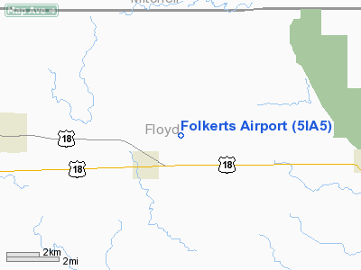
Location &
QuickFacts
|
FAA
Information Effective: |
2007-07-05 |
|
Airport
Identifier: |
5IA5 |
|
Airport
Status: |
Operational |
|
Longitude/Latitude: |
092-52-40.7070W/43-08-34.8940N
-92.877974/43.143026 (Estimated) |
|
Elevation: |
1150 ft / 350.52 m (Estimated) |
|
Land: |
0 acres |
|
From
nearest city: |
2 nautical miles NE of Rudd, IA |
|
Location: |
Floyd County, IA |
|
Magnetic Variation: |
03E (1985) |
Owner & Manager
|
Ownership: |
Privately owned |
|
Owner: |
Melvin D Folkerts |
|
Address: |
1767 150th St
Rudd, IA 50471 |
|
Phone number: |
515-395-2732 |
|
Manager: |
Melvin D Folkerts |
|
Address: |
1767 150th Street
Rudd, IA 50471 |
|
Phone number: |
515-395-2732 |
Airport
Operations and Facilities
|
Airport
Use: |
Private |
|
Wind
indicator: |
Yes |
|
Segmented Circle: |
No |
|
Control
Tower: |
No |
|
Landing
fee charge: |
No |
|
Sectional chart: |
Chicago |
|
Region: |
ACE - Central |
|
Boundary
ARTCC: |
ZMP - Minneapolis |
|
Tie-in
FSS: |
FOD - Fort Dodge |
|
FSS on
Airport: |
No |
|
FSS
Phone: |
515-955-8114 |
|
FSS Toll
Free: |
1-800-WX-BRIEF |
|
Runway
Information
Runway E/W
|
Dimension: |
2600 x 82 ft / 792.5 x 25.0 m |
|
Surface: |
TURF, |
|
|
Runway E
|
Runway W
|
|
Traffic
Pattern: |
Left |
Left |
|
Obstruction: |
|
15 ft road, 0.0 ft from runway |
|
Radio Navigation Aids
|
ID |
Type |
Name |
Ch |
Freq |
Var |
Dist |
|
IY |
NDB |
Chukk |
|
417.00 |
03E |
6.6 nm |
|
CCY |
NDB |
Charles City |
|
375.00 |
03E |
12.7 nm |
|
HPT |
NDB |
Hampton |
|
230.00 |
03E |
29.4 nm |
|
FXY |
NDB |
Forest City |
|
359.00 |
05E |
33.0 nm |
|
CJJ |
NDB |
Cresco |
|
293.00 |
02E |
35.3 nm |
|
IFA |
NDB |
Iowa Falls |
|
368.00 |
03E |
43.5 nm |
|
CAV |
NDB |
Clarion |
|
387.00 |
03E |
45.5 nm |
|
OLZ |
NDB |
Oelwein |
|
260.00 |
02E |
48.3 nm |
|
XWY |
NDB |
West Union |
|
278.00 |
02E |
49.6 nm |
|
JAY |
VOR/DME |
Austin |
019X |
108.20 |
03E |
26.1 nm |
|
AEL |
VOR/DME |
Albert Lea |
035X |
109.80 |
05E |
38.9 nm |
|
RST |
VOR/DME |
Rochester |
057X |
112.00 |
05E |
40.4 nm |
|
MCW |
VORTAC |
Mason City |
096X |
114.90 |
06E |
20.0 nm |
|
ALO |
VORTAC |
Waterloo |
059X |
112.20 |
06E |
41.1 nm |
Remarks
-
PRVDD APCHS TO
ARPT ARE MAINT FOR MIN 20:1 GLIDE SLOPE & TRSNL SFC MAINT FOR A 7:1 SLOPE.
Based
Aircraft
|
Aircraft based
on field: |
3 |
|
Single Engine
Airplanes: |
2 |
|
Ultralights: |
1 |
Folkerts Airport
Address:
Floyd County, IA
Tel:
515-395-2732
Images
and information placed above are from
http://www.airport-data.com/airport/5IA5/
We
thank them for the data!
|
General Info |
| Country |
United
States |
| State |
IOWA
|
| FAA ID |
5IA5
|
| Latitude |
43-08-34.894N |
|
Longitude |
092-52-40.707W |
|
Elevation |
1150
feet |
| Near
City |
RUDD
|
We don't guarantee the information is fresh and accurate. The data may
be wrong or outdated.
For more up-to-date information please refer to other sources.
|
|


