 |
|
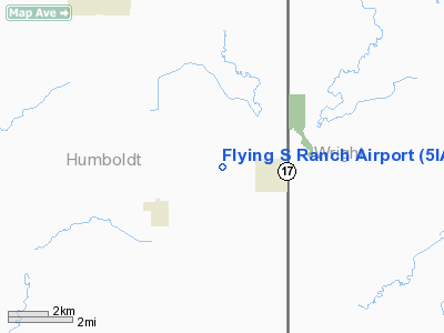
Location &
QuickFacts
|
FAA
Information Effective: |
2007-07-05 |
|
Airport
Identifier: |
5IA6 |
|
Airport
Status: |
Operational |
|
Longitude/Latitude: |
094-00-41.8290W/42-49-49.8910N
-94.011619/42.830525 (Estimated) |
|
Elevation: |
1145 ft / 349.00 m (Estimated) |
|
Land: |
0 acres |
|
From
nearest city: |
2 nautical miles W of Renwick, IA |
|
Location: |
Humboldt County, IA |
|
Magnetic Variation: |
04E (1990) |
Owner & Manager
|
Ownership: |
Privately owned |
|
Owner: |
Jeff Schneider |
|
Address: |
3186 150th St
Renwick, IA 50577 |
|
Phone number: |
515-824-3708 |
|
Manager: |
Jeff Schneider |
|
Address: |
3186 150th St
Renwick, IA 50577 |
|
Phone number: |
515-824-3708 |
Airport
Operations and Facilities
|
Airport
Use: |
Private |
|
Wind
indicator: |
Yes |
|
Segmented Circle: |
No |
|
Control
Tower: |
No |
|
Sectional chart: |
Omaha |
|
Region: |
ACE - Central |
|
Boundary
ARTCC: |
ZMP - Minneapolis |
|
Tie-in
FSS: |
FOD - Fort Dodge |
|
FSS
Phone: |
515-955-8114 |
|
FSS Toll
Free: |
1-800-WX-BRIEF |
|
Runway Information
Runway 17/35
|
Dimension: |
2500 x 100 ft / 762.0 x 30.5 m |
|
Surface: |
TURF, |
|
|
Runway 17
|
Runway 35
|
|
Traffic
Pattern: |
Left |
Left |
|
Radio Navigation Aids
|
ID |
Type |
Name |
Ch |
Freq |
Var |
Dist |
|
EAG |
NDB |
Eagle Grove |
|
302.00 |
03E |
8.6 nm |
|
CAV |
NDB |
Clarion |
|
387.00 |
03E |
12.3 nm |
|
AXA |
NDB |
Algona |
|
403.00 |
03E |
18.9 nm |
|
EBS |
NDB |
Webster City |
|
323.00 |
03E |
24.2 nm |
|
POH |
NDB |
Pocahontas |
|
428.00 |
06E |
28.5 nm |
|
FXY |
NDB |
Forest City |
|
359.00 |
05E |
29.8 nm |
|
EGQ |
NDB |
Emmetsburg |
|
410.00 |
04E |
34.6 nm |
|
HPT |
NDB |
Hampton |
|
230.00 |
03E |
35.3 nm |
|
IFA |
NDB |
Iowa Falls |
|
368.00 |
03E |
39.2 nm |
|
PUF |
NDB |
Puff |
|
345.00 |
04E |
44.7 nm |
|
SBU |
NDB |
Blue Earth |
|
332.00 |
04E |
46.2 nm |
|
BNW |
NDB |
Boone |
|
407.00 |
03E |
47.2 nm |
|
EST |
VOR |
Estherville |
|
110.40 |
07E |
47.4 nm |
|
FOD |
VORTAC |
Fort Dodge |
082X |
113.50 |
07E |
18.2 nm |
|
MCW |
VORTAC |
Mason City |
096X |
114.90 |
06E |
33.9 nm |
Remarks
-
PRVDD APCH
MAINTAINED FOR A 20:1 GLIDE SLOPE AND TRANSITIONAL SURFACES FOR A 7:1 SLOPE.
Based
Aircraft
|
Aircraft based
on field: |
2 |
|
Single Engine
Airplanes: |
2 |
Flying S Ranch Airport
Address:
Humboldt County, IA
Tel:
515-824-3708
Images
and information placed above are from
http://www.airport-data.com/airport/5IA6/
We
thank them for the data!
|
General Info |
| Country |
United
States |
| State |
IOWA
|
| FAA ID |
5IA6
|
| Latitude |
42-49-49.891N |
|
Longitude |
094-00-41.829W |
|
Elevation |
1145
feet |
| Near
City |
RENWICK
|
We don't guarantee the information is fresh and accurate. The data may
be wrong or outdated.
For more up-to-date information please refer to other sources.
|
|


