 |
|
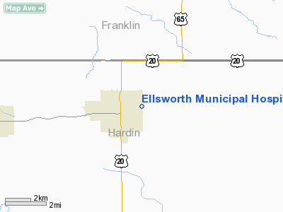
Ellsworth Municipal Hospital Heliport |
Location &
QuickFacts
|
FAA
Information Effective: |
2007-07-05 |
|
Airport
Identifier: |
4IA1 |
|
Airport
Status: |
Operational |
|
Longitude/Latitude: |
093-14-32.7300W/42-31-28.9270N
-93.242425/42.524702 (Estimated) |
|
Elevation: |
1138 ft / 346.86 m (Estimated) |
|
Land: |
0 acres |
|
From
nearest city: |
0 nautical miles N of Iowa Falls, IA |
|
Location: |
Hardin County, IA |
|
Magnetic Variation: |
04E (1985) |
Owner & Manager
|
Ownership: |
Privately owned |
|
Owner: |
Ellsworth Municipal Hospital |
|
Address: |
110 Rocksylvania Ave
Iowa Falls, IA 50126 |
|
Phone
number: |
515-648-4631 |
|
Manager: |
Rick Vogel |
|
Address: |
110 Rocksylvania Ave
Iowa Falls, IA 50126 |
|
Phone number: |
515-648-4631 |
Airport Operations and Facilities
|
Airport
Use: |
Private
MEDICAL. |
|
Wind
indicator: |
Yes |
|
Segmented Circle: |
No |
|
Control
Tower: |
No |
|
Sectional chart: |
Omaha |
|
Region: |
ACE - Central |
|
Boundary
ARTCC: |
ZMP - Minneapolis |
|
Tie-in
FSS: |
FOD - Fort Dodge |
|
FSS on
Airport: |
No |
|
FSS
Phone: |
515-955-8114 |
|
FSS Toll
Free: |
1-800-WX-BRIEF |
|
Runway Information
Helipad H1
|
Dimension: |
50 x 50 ft / 15.2 x 15.2 m |
|
Surface: |
CONC, |
|
|
Runway H1
|
Runway
|
|
Traffic
Pattern: |
Left |
Left |
|
Radio Navigation Aids
|
ID |
Type |
Name |
Ch |
Freq |
Var |
Dist |
|
IFA |
NDB |
Iowa Falls |
|
368.00 |
03E |
3.1 nm |
|
HPT |
NDB |
Hampton |
|
230.00 |
03E |
12.1 nm |
|
CAV |
NDB |
Clarion |
|
387.00 |
03E |
26.4 nm |
|
EBS |
NDB |
Webster City |
|
323.00 |
03E |
28.2 nm |
|
MIW |
NDB |
Marshalltown |
|
239.00 |
03E |
28.8 nm |
|
EAG |
NDB |
Eagle Grove |
|
302.00 |
03E |
31.6 nm |
|
BNW |
NDB |
Boone |
|
407.00 |
03E |
39.2 nm |
|
CCY |
NDB |
Charles City |
|
375.00 |
03E |
43.0 nm |
|
IY |
NDB |
Chukk |
|
417.00 |
03E |
43.1 nm |
|
FXY |
NDB |
Forest City |
|
359.00 |
05E |
45.8 nm |
|
JWJ |
VOR/DME |
Elmwood |
031X |
109.40 |
03E |
28.9 nm |
|
TNU |
VOR/DME |
Newton |
072X |
112.50 |
03E |
44.9 nm |
|
MCW |
VORTAC |
Mason City |
096X |
114.90 |
06E |
34.5 nm |
|
ALO |
VORTAC |
Waterloo |
059X |
112.20 |
06E |
37.4 nm |
|
FOD |
VORTAC |
Fort Dodge |
082X |
113.50 |
07E |
46.9 nm |
Remarks
-
PRVDD
INGRESS/EGRESS FROM 350 DEGS TO 085 DEGS; PARKING LOT CLEARED PRIOR TO
HELICOPTER OPERATIONS; APCH/DEP PATHS CLEAR FOR A 8:1 GLIDE SLOPE; AND
TRANSITIONAL SFC CLEAR FOR A 2:1 SLOPE.
Ellsworth Municipal Hospital Heliport
Address:
Hardin County, IA
Tel:
515-648-4631
Images
and information placed above are from
http://www.airport-data.com/airport/4IA1/
We
thank them for the data!
|
General Info |
| Country |
United
States |
| State |
IOWA
|
| FAA ID |
4IA1
|
| Latitude |
42-31-28.927N |
|
Longitude |
093-14-32.730W |
|
Elevation |
1138
feet |
| Near
City |
IOWA
FALLS |
We don't guarantee the information is fresh and accurate. The data may
be wrong or outdated.
For more up-to-date information please refer to other sources.
|
|


