 |
|
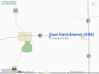
Location &
QuickFacts
|
FAA
Information Effective: |
2007-07-05 |
|
Airport
Identifier: |
03IA |
|
Airport
Status: |
Operational |
|
Longitude/Latitude: |
092-27-40.6680W/41-34-55.0060N
-92.461297/41.581946 (Estimated) |
|
Elevation: |
954 ft / 290.78 m (Estimated) |
|
Land: |
0 acres |
|
From
nearest city: |
3 nautical miles E of Montezuma, IA |
|
Location: |
Poweshiek County, IA |
|
Magnetic Variation: |
03E (1985) |
Owner & Manager
|
Ownership: |
Privately owned |
|
Owner: |
Sylvan E Veverka |
|
Address: |
108 Hwy 85
Montezuma, IA 50171 |
|
Phone number: |
515-623-3641 |
|
Address: |
|
Airport Operations and Facilities
|
Airport Use: |
Private |
|
Wind indicator: |
Yes |
|
Segmented Circle: |
No |
|
Control Tower: |
No |
|
Landing fee charge: |
No |
|
Sectional chart: |
Chicago |
|
Region: |
ACE - Central |
|
Boundary ARTCC: |
ZAU - Chicago |
|
Tie-in FSS: |
FOD - Fort Dodge |
|
FSS on Airport: |
No |
|
FSS Phone: |
515-955-8114 |
|
FSS Toll Free: |
1-800-WX-BRIEF |
Airport Services
|
Airframe
Repair: |
NONE |
|
Power
Plant Repair: |
NONE |
|
Runway Information
Runway N/S
|
Dimension: |
2000 x 150 ft / 609.6 x 45.7 m |
|
Surface: |
TURF, |
|
|
Runway N
|
Runway S
|
|
Traffic
Pattern: |
Left |
Left |
|
Radio Navigation Aids
|
ID |
Type |
Name |
Ch |
Freq |
Var |
Dist |
|
GGI |
NDB |
Grinnell |
|
248.00 |
02E |
14.3 nm |
|
TZT |
NDB |
Belle Plaine |
|
371.00 |
02E |
19.9 nm |
|
OOA |
NDB |
Oskaloosa |
|
414.00 |
03E |
21.5 nm |
|
PEA |
NDB |
Pella |
|
257.00 |
02E |
24.2 nm |
|
OXV |
NDB |
Knoxville |
|
284.00 |
03E |
34.1 nm |
|
MIW |
NDB |
Marshalltown |
|
239.00 |
03E |
37.7 nm |
|
AWG |
NDB |
Washington |
|
219.00 |
02E |
39.9 nm |
|
FFL |
NDB |
Fairfield |
|
332.00 |
03E |
40.4 nm |
|
VTI |
NDB |
Garrison |
|
338.00 |
03E |
43.2 nm |
|
TNU |
VOR/DME |
Newton |
072X |
112.50 |
03E |
31.5 nm |
|
OTM |
VOR/DME |
Ottumwa |
053X |
111.60 |
06E |
33.8 nm |
|
CID |
VOR/DME |
Cedar Rapids |
088X |
114.10 |
05E |
35.4 nm |
|
JWJ |
VOR/DME |
Elmwood |
031X |
109.40 |
03E |
37.6 nm |
|
IOW |
VORTAC |
Iowa City |
109X |
116.20 |
05E |
38.3 nm |
Based Aircraft
|
Aircraft based
on field: |
1 |
|
Single Engine
Airplanes: |
1 |
East Field Airport
Address:
Poweshiek County, IA
Tel:
515-623-3641
Images
and information placed above are from
http://www.airport-data.com/airport/03IA/
We
thank them for the data!
|
General Info |
| Country |
United
States |
| State |
IOWA
|
| FAA ID |
03IA
|
| Latitude |
41-34-55.006N |
|
Longitude |
092-27-40.668W |
|
Elevation |
954 feet
|
| Near
City |
MONTEZUMA |
We don't guarantee the information is fresh and accurate. The data may
be wrong or outdated.
For more up-to-date information please refer to other sources.
|
|


