 |
|
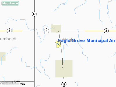
Eagle Grove Municipal Airport |
|
|
Location & QuickFacts
|
FAA Information Effective: |
2007-07-05 |
|
Airport Identifier: |
EAG |
|
Airport Status: |
Operational |
|
Longitude/Latitude: |
093-54-58.0070W/42-42-35.2960N
-93.916113/42.709804 (Estimated) |
|
Elevation: |
1133 ft / 345.34 m (Surveyed) |
|
Land: |
150 acres |
|
From nearest city: |
3 nautical miles N of Eagle Grove, IA |
|
Location: |
Wright County, IA |
|
Magnetic Variation: |
03E (1995) |
Owner & Manager
|
Ownership: |
Publicly owned |
|
Owner: |
City Of Eagle Grove
DON GARRETT ARPT CMSN CHMN; PHONE 515-448-4073. |
|
Address: |
210 East Broadway
Eagle Grove, IA 50533 |
|
Phone number: |
515-448-4343 |
|
Manager: |
Ryan Heiar
FBO - TINY SCHUTT; HOME 515-532-3459. |
|
Address: |
2355 Hwy 17
Eagle Grove, IA 50533 |
|
Phone number: |
515-448-4042 |
Airport Operations and Facilities
|
Airport Use: |
Open to public |
|
Wind indicator: |
Yes |
|
Segmented Circle: |
No |
|
Control Tower: |
No |
|
Lighting Schedule: |
DUSK-DAWN
ACTVT MIRL RY 13/31 & REIL RYS 13 & 31 - CTAF. |
|
Beacon Color: |
Clear-Green (lighted land airport) |
|
Landing fee charge: |
No |
|
Sectional chart: |
Omaha |
|
Region: |
ACE - Central |
|
Boundary ARTCC: |
ZMP - Minneapolis |
|
Tie-in FSS: |
FOD - Fort Dodge |
|
FSS on Airport: |
No |
|
FSS Phone: |
515-955-8114 |
|
FSS Toll Free: |
1-800-WX-BRIEF |
|
NOTAMs Facility: |
FOD (NOTAM-d service avaliable) |
|
Federal Agreements: |
1 |
Airport Communications
|
CTAF: |
122.800 |
|
Unicom: |
122.800 |
Airport Services
|
Fuel available: |
100LL |
|
Airframe Repair: |
MINOR |
|
Power Plant Repair: |
MINOR |
|
Bottled Oxygen: |
NONE |
|
Bulk Oxygen: |
NONE |
|
Runway Information
Runway 01/19
|
Dimension: |
2360 x 115 ft / 719.3 x 35.1
m |
|
Surface: |
TURF, Good Condition |
|
|
Runway 01
|
Runway 19
|
|
Longitude: |
093-55-00.8070W |
093-54-50.8060W |
|
Latitude: |
42-42-22.3960N |
42-42-44.8960N |
|
Traffic
Pattern: |
Left |
Left |
|
Obstruction: |
4 ft fence, 110.0 ft from runway, 60 ft left of centerline, 27:1 slope
to clear |
8 ft brush, 165.0 ft from runway, 45 ft left of centerline, 20:1 slope
to clear |
|
Runway 13/31
|
Dimension: |
3500 x 60 ft / 1066.8 x 18.3
m |
|
Surface: |
CONC, Good Condition |
|
Edge Lights: |
Medium |
|
|
Runway 13
|
Runway 31
|
|
Longitude: |
093-55-15.7670W |
093-54-43.4190W |
|
Latitude: |
42-42-48.9160N |
42-42-23.8900N |
|
Elevation: |
1131.00 ft |
1129.00 ft |
|
Alignment: |
127 |
127 |
|
Traffic
Pattern: |
Left |
Left |
|
Markings: |
Non-precision instrument, Fair Condition |
Non-precision instrument, Fair Condition |
|
Displaced
threshold: |
129.00 ft |
0.00 ft |
|
Runway End
Identifier: |
Yes |
Yes |
|
Obstruction: |
, 50:1 slope to clear
DSPLCD THR ALLOWS A 20:1 CLNC OVER ROAD.
+15 ROAD 184' FM THR 120' R. |
28 ft pline, 1405.0 ft from runway, 75 ft left of centerline, 43:1 slope
to clear |
|
Radio Navigation Aids
|
ID |
Type |
Name |
Ch |
Freq |
Var |
Dist |
|
EAG |
NDB |
Eagle Grove |
|
302.00 |
03E |
0.3 nm |
|
CAV |
NDB |
Clarion |
|
387.00 |
03E |
7.3 nm |
|
EBS |
NDB |
Webster City |
|
323.00 |
03E |
16.3 nm |
|
AXA |
NDB |
Algona |
|
403.00 |
03E |
27.3 nm |
|
HPT |
NDB |
Hampton |
|
230.00 |
03E |
30.5 nm |
|
IFA |
NDB |
Iowa Falls |
|
368.00 |
03E |
32.0 nm |
|
POH |
NDB |
Pocahontas |
|
428.00 |
06E |
32.4 nm |
|
FXY |
NDB |
Forest City |
|
359.00 |
05E |
34.1 nm |
|
BNW |
NDB |
Boone |
|
407.00 |
03E |
39.5 nm |
|
EGQ |
NDB |
Emmetsburg |
|
410.00 |
04E |
42.0 nm |
|
EFW |
NDB |
Jefferson |
|
391.00 |
03E |
45.9 nm |
|
FOD |
VORTAC |
Fort Dodge |
082X |
113.50 |
07E |
17.8 nm |
|
MCW |
VORTAC |
Mason City |
096X |
114.90 |
06E |
34.7 nm |
Remarks
Based Aircraft
|
Aircraft based
on field: |
8 |
|
Single Engine
Airplanes: |
7 |
|
Multi Engine
Airplanes: |
1 |
Operational Statistics
Time
Period:
2003-05-13 - 2004-05-11
|
Aircraft
Operations: |
132/Week |
|
General
Aviation Local: |
55.7% |
|
General
Aviation Itinerant: |
44.3% |
Eagle Grove Municipal Airport
Address:
Wright County, IA
Tel:
515-448-4343,
515-448-4042
Images
and information placed above are from
http://www.airport-data.com/airport/EAG/
We
thank them for the data!
| General Info
|
| Country |
United States
|
| State |
IOWA
|
| FAA ID |
EAG
|
| Latitude |
42-42-35.296N
|
| Longitude |
093-54-58.007W
|
| Elevation |
1133 feet
|
| Near City |
EAGLE GROVE
|
We don't guarantee the information is fresh and accurate. The data may
be wrong or outdated.
For more up-to-date information please refer to other sources.
|
|


