 |
|
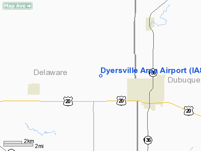
Location &
QuickFacts
|
FAA
Information Effective: |
2007-07-05 |
|
Airport
Identifier: |
IA80 |
|
Airport
Status: |
Operational |
|
Longitude/Latitude: |
091-10-47.4920W/42-29-45.9790N
-91.179859/42.496105 (Estimated) |
|
Elevation: |
980 ft / 298.70 m (Estimated) |
|
Land: |
7 acres |
|
From
nearest city: |
2 nautical miles NW of Dyersville, IA |
|
Location: |
Dubuque County, IA |
|
Magnetic Variation: |
01E (1995) |
Owner & Manager
|
Ownership: |
Privately owned |
|
Owner: |
Dyersville Area Airports |
|
Address: |
104 5th St Se
Dyersville, IA 52040 |
|
Phone
number: |
563-875-8590
ALTERNATE PHONE # 563-8757121. |
|
Manager: |
David Kramer |
|
Address: |
104 5th St Se
Dyersville, IA 52040-8704 |
|
Phone number: |
563-875-8590 |
Airport Operations and Facilities
|
Airport
Use: |
Private |
|
Wind
indicator: |
Yes |
|
Segmented Circle: |
No |
|
Control
Tower: |
No |
|
Region: |
ACE - Central |
|
Boundary
ARTCC: |
ZAU - Chicago |
|
Tie-in
FSS: |
FOD - Fort Dodge |
|
FSS
Phone: |
515-955-8114 |
|
FSS Toll
Free: |
1-800-WX-BRIEF |
|
Runway Information
Runway 13/31
|
Dimension: |
2400 x 80 ft / 731.5 x 24.4 m |
|
Surface: |
TURF, |
|
|
Runway 13
|
Runway 31
|
|
Traffic
Pattern: |
Left |
Right |
|
Radio Navigation Aids
|
ID |
Type |
Name |
Ch |
Freq |
Var |
Dist |
|
MXO |
NDB |
Monticello |
|
397.00 |
01E |
17.9 nm |
|
OQW |
NDB |
Maquoketa |
|
386.00 |
02E |
33.1 nm |
|
IIB |
NDB |
Wapsie |
|
206.00 |
02E |
34.3 nm |
|
PVB |
NDB |
Platteville |
|
203.00 |
01E |
34.9 nm |
|
OLZ |
NDB |
Oelwein |
|
260.00 |
02E |
37.0 nm |
|
XWY |
NDB |
West Union |
|
278.00 |
02E |
37.8 nm |
|
VTI |
NDB |
Garrison |
|
338.00 |
03E |
40.8 nm |
|
MRJ |
NDB |
Mineral Point |
|
365.00 |
00W |
48.3 nm |
|
CID |
VOR/DME |
Cedar Rapids |
088X |
114.10 |
05E |
45.5 nm |
|
DBQ |
VORTAC |
Dubuque |
105X |
115.80 |
04E |
21.6 nm |
|
UKN |
VORTAC |
Waukon |
113X |
116.60 |
05E |
49.7 nm |
Remarks
-
PRVDD A CLEAR
APCH TO EA RY FOR A 20:1 GLIDE SLOPE; A CLEAR TRANSITIONAL SFC FOR A 7:1
SLOPE; AND TFC PATTERNS REMAIN NORTH OF THE ARPT.
Dyersville Area Airport
Address:
Dubuque County, IA
Tel:
563-875-8590
Images
and information placed above are from
http://www.airport-data.com/airport/IA80/
We
thank them for the data!
|
General Info |
| Country |
United
States |
| State |
IOWA
|
| FAA ID |
IA80
|
| Latitude |
42-29-45.979N |
|
Longitude |
091-10-47.492W |
|
Elevation |
980 feet
|
| Near
City |
DYERSVILLE |
We don't guarantee the information is fresh and accurate. The data may
be wrong or outdated.
For more up-to-date information please refer to other sources.
|
|


