 |
|
| Dubuque Regional Airport |
 |
| IATA: DBQ â ICAO: KDBQ â FAA LID: DBQ
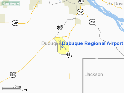
Location of Dubuque Regional Airport
|
| Summary |
| Airport type |
Public |
| Operator |
City of Dubuque |
| Location |
Dubuque, Iowa |
| Elevation AMSL |
1,077 ft / 328 m |
| Coordinates |
42°24â²07â³N 90°42â²34â³W / 42.40194°N 90.70944°W / 42.40194; -90.70944Coordinates: 42°24â²07â³N 90°42â²34â³W / 42.40194°N 90.70944°W / 42.40194; -90.70944 |
| Website |
www.flydbq.com/ |
| Runways |
| Direction |
Length |
Surface |
| ft |
m |
| 13/31 |
6,502 |
1,982 |
Concrete |
| 18/36 |
6,327 |
1,928 |
Concrete |
| Statistics (2008) |
| Aircraft operations |
51,748 |
Dubuque Regional Airport (IATA: DBQ, ICAO: KDBQ, FAA LID: DBQ) is a public airport located 6 miles (10 km) south of Dubuque, Iowa along U.S. Highway 61. The airport's site is a parcel of land about 1,100 acre (4 km²) large. There are two runways for this airport.
The airport is owned by the city of Dubuque, and is operated as a department of the city government. The city council appoints people to the Airport Commission board, which oversee the airport. People on the Airport Commission serve four year terms. For day to day operations, the Commission hires an airport manager to run the airport.
DBQ is mostly used for general aviation. There is also a charter service which is run by Chartaire, Inc.. The airport also offers maintenance and refueling services, including services for jets.
The University of Dubuque has a flight operations center at the airport. This operations center provides for pilot training in the school's aviation programs. This includes both ground school and actual flight training. The University has two hangars with exclusively their aircraft and a third hangar that is shared.
American Eagle Airlines provides service to and from O'Hare International Airport in Chicago three times a day, which generally take under an hour. At one time propeller driven aircraft were used, but American Eagle has since upgraded to using regional jets.
Northwest Airlines announced on February 7, 2008 that its regional partner Mesaba Airlines operating as Northwest Airlink will once again return with service to Dubuque with twice daily flights to and from Minneapolis-Saint Paul International Airport using Saab 340 aircraft. These flights began on June 20, 2008.
On July 2, 2009, the merged Delta/Northwest Airlines announced it would discontinue all service to Dubuque citing weakened demand throughout its system. This left DBQ with only one airline providing commercial service.
The terminal features free WI-FI internet access. The airport also recently installed enclosed walkways at the gates, allowing passengers to walk to and from the planes without having to go outdoors. Layout
The airline terminal has a small cafe (FlyDBQ Cafe), ATM, vending, and gaming machines. The terminal has 3 gates for airline passengers and a jet bridge. The terminal also has a baggage carousel, desks for three airlines and rental car service (Avis Rent a Car).
Airlines and destinations
| Airlines |
Destinations |
| American Eagle |
Chicago-O'Hare |
Safety
The airport has been recognized by the Federal Aviation Administration a number of times for its strong commitment to safety. It won the FAA's "Airport Safety Enhancement Award" in 1994, 1997, 2000, and 2003. In order to receive this honor, an airport must be free from discrepancies during an inspection for three consecutive years. In 2008, the Dubuque Regional Airport marked 18 consecutive years of perfect safety inspections in accordance with FAR Part 139. That record is unmatched among the approximately 600 certified U.S. airports.
Expansion
In order to update aging facilities and accommodate continued growth, the City of Dubuque announced in 2007 that it intends to build a new, larger airport terminal building in the coming years. The new $23 million facility is a part of the airport's master improvement plan, however, no timeline has been given for the completion of the building.
The city has also expressed an interest in courting additional airlines to serve the airport. Up until recently, Dubuque Regional had up to 3 air carriers. Two were eliminated when the airline industry met hard financial times following the terrorist attacks on September 11, 2001. However, with strong passenger numbers, a growing tourism industry, and financial stability among air carriers, expanded service seems increasingly likely in Dubuque.
The above content comes from Wikipedia and is published under free licenses – click here to read more.
Location &
QuickFacts
|
FAA
Information Effective: |
2007-07-05 |
|
Airport
Identifier: |
DBQ |
|
Airport
Status: |
Operational |
|
Longitude/Latitude: |
090-42-34.1000W/42-24-07.2000N
-90.709472/42.402000 (Estimated) |
|
Elevation: |
1076 ft / 327.96 m (Surveyed) |
|
Land: |
1140 acres |
|
From
nearest city: |
7 nautical miles SW of Dubuque, IA |
|
Location: |
Dubuque County, IA |
|
Magnetic Variation: |
03E (1975) |
Owner & Manager
|
Ownership: |
Publicly owned |
|
Owner: |
City Of Dubuque |
|
Address: |
11000 Arpt Rd
Dubuque, IA 52003 |
|
Phone
number: |
563-589-4128 |
|
Manager: |
Mr. Robert Grierson, A.a.e. |
|
Address: |
11000 Airport Road
Dubuque, IA 52003 |
|
Phone number: |
563-589-4136 |
Airport
Operations and Facilities
|
Airport
Use: |
Open to public |
|
Wind
indicator: |
Yes |
|
Segmented Circle: |
Yes |
|
Control
Tower: |
Yes |
|
Lighting
Schedule: |
ATC-CTL
WHEN ATCT CLSD ACTVT HIRL RYS 13/31 & 18/36; MALSR RYS 31 & 36; MALS
RY 13; VASI RY 13 & PAPI RYS 18, 31 & 36 - CTAF. |
|
Beacon
Color: |
Clear-Green (lighted land airport) |
|
Landing
fee charge: |
No |
|
Sectional chart: |
Chicago |
|
Region: |
ACE - Central |
|
Boundary
ARTCC: |
ZAU - Chicago |
|
Tie-in
FSS: |
FOD - Fort Dodge |
|
FSS on
Airport: |
No |
|
FSS
Phone: |
515-955-8114 |
|
FSS Toll
Free: |
1-800-WX-BRIEF |
|
NOTAMs
Facility: |
DBQ (NOTAM-d service avaliable) |
|
Certification type/date: |
I A S 05/1973
PPR FOR UNSKED ACR OPNS CALL AMGR (563) 589-4136. ARFF INDEX B LEVEL
EQUIP IS PROVIDED. |
|
Federal Agreements: |
NGY3 |
Airport Communications
|
CTAF: |
119.500 |
|
Unicom: |
122.950 |
Airport Services
|
Fuel
available: |
100LLA1+
FUEL SVC AVBL 24 HRS.
FOR FUEL
2200-0500 CALL 563-589-4136. |
|
Airframe
Repair: |
MAJOR |
|
Power
Plant Repair: |
MAJOR |
|
Bottled
Oxygen: |
HIGH |
|
Bulk
Oxygen: |
HIGH |
|
Runway Information
Runway 13/31
|
Dimension: |
6502 x 100 ft / 1981.8 x 30.5 m |
|
Surface: |
CONC, Good Condition |
|
Surface
Treatment: |
Saw-cut or plastic Grooved |
|
Weight Limit: |
Single wheel: 75000 lbs.
Dual wheel: 125000 lbs.
Dual tandem wheel: 215000 lbs. |
|
Edge Lights: |
High |
|
|
Runway 13
|
Runway 31
|
|
Longitude: |
090-42-55.8594W |
090-41-54.5204W |
|
Latitude: |
42-24-33.5186N |
42-23-48.1568N |
|
Elevation: |
1076.00 ft |
1062.00 ft |
|
Alignment: |
127 |
127 |
|
ILS Type: |
|
ILS |
|
Traffic
Pattern: |
Left |
Left |
|
Markings: |
Precision instrument, Good Condition |
Precision instrument, Good Condition |
|
Crossing
Height: |
35.00 ft |
50.00 ft |
|
VASI: |
4-box on right side |
4-light PAPI on left side |
|
Visual
Glide Angle: |
3.00° |
3.00° |
|
Approach
lights: |
MALS |
MALSR |
|
Obstruction: |
63 ft twr, 2450.0 ft from runway, 600 ft right of
centerline, 35:1 slope to clear |
122 ft pole, 4475.0 ft from runway, 50 ft right of
centerline, 35:1 slope to clear |
|
Runway 18/36
|
Dimension: |
6327 x 150 ft / 1928.5 x 45.7 m |
|
Surface: |
CONC, |
|
Surface
Treatment: |
Saw-cut or plastic Grooved |
|
Weight Limit: |
Single wheel: 75000 lbs.
Dual wheel: 173000 lbs.
Dual tandem wheel: 275000 lbs. |
|
Edge Lights: |
High |
|
|
Runway 18
|
Runway 36
|
|
Longitude: |
090-42-43.3405W |
090-42-43.2580W |
|
Latitude: |
42-24-34.6423N |
42-23-32.1522N |
|
Elevation: |
1073.00 ft |
1033.00 ft |
|
Alignment: |
127 |
127 |
|
ILS Type: |
|
ILS/DME |
|
Traffic
Pattern: |
Left |
Left |
|
Markings: |
Precision instrument, Good Condition |
Precision instrument, Good Condition |
|
Crossing
Height: |
35.00 ft |
50.00 ft |
|
VASI: |
4-light PAPI on left side |
4-light PAPI on left side |
|
Visual
Glide Angle: |
3.00° |
3.00° |
|
RVR
Equipment: |
|
touchdown |
|
Approach
lights: |
|
MALSR |
|
Radio Navigation Aids
|
ID |
Type |
Name |
Ch |
Freq |
Var |
Dist |
|
PVB |
NDB |
Platteville |
|
203.00 |
01E |
21.0 nm |
|
OQW |
NDB |
Maquoketa |
|
386.00 |
02E |
21.1 nm |
|
MXO |
NDB |
Monticello |
|
397.00 |
01E |
22.5 nm |
|
MRJ |
NDB |
Mineral Point |
|
365.00 |
00W |
36.2 nm |
|
CWI |
NDB |
Clinton |
|
377.00 |
01E |
38.4 nm |
|
CVA |
VORTAC |
Davenport |
085X |
113.80 |
04E |
42.9 nm |
|
DVN |
VOT |
Davenport Municipal |
|
111.80 |
|
47.9 nm |
Remarks
-
WATERFOWL ON & INVOF ARPT.
-
100LL SELF
SERVICE FUEL STATION AVBL AT T-HGRS.
Based
Aircraft
|
Aircraft based
on field: |
76 |
|
Single Engine
Airplanes: |
65 |
|
Multi Engine
Airplanes: |
9 |
|
Jet Engine
Airplanes: |
2 |
Major Carriers Serving
This Airport
|
American Eagle Airlines Inc. |
100.0% |
Most Popular
Destinations
|
Chicago O'hare Intl (ORD) |
100.0% |
Most Popular Aircraft
|
N682AE |
2.6% |
|
N935AE |
2.3% |
|
N617AE |
2.3% |
|
N687JS |
2.3% |
|
N619AE |
2.0% |
|
N610AE |
1.7% |
|
N659AE |
1.7% |
|
N623AE |
1.7% |
|
N685AE |
1.7% |
|
N612AE |
1.7% |
Operational Statistics
Time Period:
2004-10-01 -
2005-09-30
|
Aircraft
Operations: |
151/Day |
|
Commerical: |
8.1% |
|
General
Aviation Local: |
44.3% |
|
General
Aviation Itinerant: |
47.4% |
|
Military: |
0.2% |
Dubuque Regional Airport
Address:
Dubuque County, IA
Tel:
563-589-4128,
563-589-4136
Images
and information placed above are from
http://www.airport-data.com/airport/DBQ/
We
thank them for the data!
|
General Info |
| Country |
United
States |
| State |
IOWA
|
| FAA ID |
DBQ
|
| Latitude |
42-24-07.161N |
|
Longitude |
090-42-34.146W |
|
Elevation |
1076
feet |
| Near
City |
DUBUQUE
|
We don't guarantee the information is fresh and accurate. The data may
be wrong or outdated.
For more up-to-date information please refer to other sources.
|
|


