 |
|
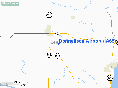
Location &
QuickFacts
|
FAA
Information Effective: |
2007-07-05 |
|
Airport
Identifier: |
IA65 |
|
Airport
Status: |
Operational |
|
Longitude/Latitude: |
091-32-30.5670W/40-37-15.1380N
-91.541824/40.620872 (Estimated) |
|
Elevation: |
700 ft / 213.36 m (Estimated) |
|
Land: |
0 acres |
|
From
nearest city: |
2 nautical miles SE of Donnellson, IA |
|
Location: |
Lee County, IA |
|
Magnetic Variation: |
02E (1985) |
Owner & Manager
|
Ownership: |
Privately owned |
|
Owner: |
Stephen M. Hohl |
|
Address: |
803 Pine
Donnellson, IA 52625 |
|
Phone number: |
319-835-9039 |
|
Manager: |
Stephen Hohl |
|
Address: |
803 Pine
319-835-9039 |
|
Phone number: |
319-835-9039 |
Airport Operations and Facilities
|
Airport Use: |
Private |
|
Wind indicator: |
Yes |
|
Segmented Circle: |
No |
|
Control Tower: |
No |
|
Landing fee charge: |
No |
|
Sectional chart: |
Chicago |
|
Region: |
ACE - Central |
|
Boundary ARTCC: |
ZKC - Kansas City |
|
Tie-in FSS: |
FOD - Fort Dodge |
|
FSS on Airport: |
No |
|
FSS Phone: |
515-955-8114 |
|
FSS Toll Free: |
1-800-WX-BRIEF |
Airport Services
|
Runway Information
Runway 09/27
|
Dimension: |
2500 x 75 ft / 762.0 x 22.9 m |
|
Surface: |
TURF, |
|
|
Runway 09
|
Runway 27
|
|
Traffic
Pattern: |
Left |
Left |
|
Radio Navigation Aids
|
ID |
Type |
Name |
Ch |
Freq |
Var |
Dist |
|
EOK |
NDB |
Keokuk |
|
366.00 |
02E |
10.6 nm |
|
MPZ |
NDB |
Mount Pleasant |
|
212.00 |
02E |
19.4 nm |
|
FFL |
NDB |
Fairfield |
|
332.00 |
03E |
31.0 nm |
|
AWG |
NDB |
Washington |
|
219.00 |
02E |
40.0 nm |
|
BEX |
NDB |
Bloomfield |
|
269.00 |
02E |
41.2 nm |
|
JZY |
NDB |
Macomb |
|
251.00 |
01E |
45.2 nm |
|
UI |
NDB |
Quincy |
|
293.00 |
02E |
46.1 nm |
|
OTM |
VOR/DME |
Ottumwa |
053X |
111.60 |
06E |
43.3 nm |
|
DDD |
VOR/DME |
Port City |
112X |
116.50 |
01E |
48.2 nm |
|
BRL |
VORTAC |
Burlington |
051X |
111.40 |
05E |
28.7 nm |
|
UIN |
VORTAC |
Quincy |
083X |
113.60 |
05E |
48.0 nm |
Remarks
-
PRVDD APCH TO
EACH RWY MAINTD FOR MIN 20:1 APCH RATIO AND TRSNL SFC MAINTD FOR 7:1.
Based
Aircraft
|
Aircraft based
on field: |
3 |
|
Single Engine
Airplanes: |
2 |
|
Ultralights: |
1 |
Donnellson Airport
Address:
Lee County, IA
Tel:
319-835-9039
Images
and information placed above are from
http://www.airport-data.com/airport/IA65/
We
thank them for the data!
|
General Info |
| Country |
United
States |
| State |
IOWA
|
| FAA ID |
IA65
|
| Latitude |
40-37-15.138N |
|
Longitude |
091-32-30.567W |
|
Elevation |
700 feet
|
| Near
City |
DONNELLSON |
We don't guarantee the information is fresh and accurate. The data may
be wrong or outdated.
For more up-to-date information please refer to other sources.
|
|


