|
 |
|
||||
|
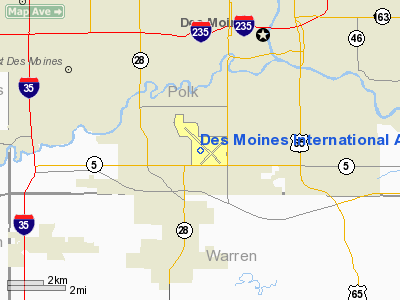
Des Moines International Airport (IATA: DSM, ICAO: KDSM, FAA LID: DSM) is a small hub primary airport located three miles (5 km) southwest of the central business district of Des Moines, a city in Polk County, Iowa, United States. This airport is publicly owned by the City of Des Moines. The airport serves the Des Moines metropolitan area with 16 connections to major airline hubs. Recently, it was reported that DSM is now the 85th busiest airport in the Unites States by passenger traffic. History
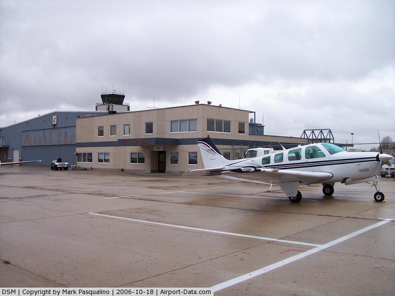
During the 1920s, the Des Moines area had several small private airports that catered to general aviation and airmail. In 1929, the Iowa General Assembly passed a law allowing cities to sell bonds and levy assessments in order to build municipal airports. Over 80 different sites were considered for the Des Moines Airport until a decision was made to build on 160 acres (0.65 km²) of farmland on the south side of the city. Construction of the airport began in 1932 and was completed in 1933. The airport's first passenger terminal was built shortly after the airport was completed. It was replaced by a new terminal in 1950 that has been expanded and renovated several times since then. The airport itself has expanded several times from its original 160-acre (0.65 km) site and now covers 2,300 acres (9.3 km²) of land. The airport was originally governed by the City of Des Moines' Parks Department. A separate Aviation Department was established by the city during the 1960s, and in 1982, a separate Aviation Policy Advisory Board was established. The airport was renamed the Des Moines International Airport in 1986 to acknowledge the presence of a United States Customs Service office at the airport. Eppley Airfield in Omaha and the Kansas City International Airport compete with Des Moines International for business. Many Des Moines passengers use these airports due to occasional lower ticket prices. The airport handled a record 1,990,167 passengers in 2004; that figure dropped to 1,903,573 in 2005 but increased to 1,959,393 in 2006. In 2007 the airport saw 1,982,485 passengers go through the airport, an increase over the past year. In 2008 the airport saw a decrease in passenger traffic due to the economic downturn seeing passenger traffic drop to a 5-year low of 1,896,389. In August 2007, Des Moines International was chosen by Mesaba Airlines, also called Northwest Airlink, to build a maintenance facility at the airport. This facility serves as the hub of maintenance for the whole airline. The facility opened on February 9, 2009. In February 2009, Delta Air Lines announced that the airline was bringing service to Salt Lake City from DSM after canceling service in 2008; The service was canceled again shortly after it started. Delta Air Lines also announced that DSM was getting a second flight to New York. Also, Allegiant Air announced that DSM was getting a new service between DSM and Los Angeles. In August 2009, US Airways announced it will provide non-stop service from DSM to Washington, D.C.'s Ronald Reagan Washington National Airport. However, this will swap with Delta Air Lines, a deal in which Delta traded spots at Ronald Reagan Washington National Airport for slots at LaGuardia Airport. On November 4, 2009 Des Moines International Airport was announced as one of AirTran Airways newest destinations. AirTran, based in Atlanta, GA, will offer new regional jet service from DSM to General Mitchell International Airport in Milwaukee, WI. This will be DSM's second low-cost airline, however its first with a hub and spoke type system, with many options for connecting flights throughout the country. SkyWest Airlines/AirTran will fly three daily round-trip flights on 50-seat, Bombardier CRJ200 regional aircraft to and from Milwaukee starting February 11, 2010. AirTran Airways announced on November 27, 2009 that it will begin service between Des Moines and Orlando. The carrier will operate one round-trip flight each Saturday and Sunday on Boeing 717 jets. Service is set to begin on March 6, 2010. Des Moines already has service to the Orlando area into Orlando International Airport on Allegiant. AirTran will fly into MCO.. AirTran says the demand is so great that they are increasing the number of flights per week from 2 to 3. AirTran also says that Milwaukee and Orlando are only the first destinations that AirTran plans to serve out of DSM. On February 23, 2010, Branson Air Express announced new flights from Des Moines to Branson, Missouri. The flight will be 5 times a week and will be on an Embraer 145 aircraft. The airline will also offer connecting flights out of Branson to destinations such as: Austin, TX (AUS); Houston, TX Hobby (HOU); Terre Haute, IN (HUF); and Shreveport, LA (SHV). This will be the ninth airline operating out of DSM. ExpansionInterior renovation work began in 2009 on the airport and is scheduled to be completed in 2010. The project includes new carpets, paint, gate counters, seating, a new ceiling, signage, and a fire sprinkler system. Also included in the upgrade is a common-use project allowing any airline to use any gate at the airport. A new restroom is also being added to the C concourse to allow for future concourse expansion. The airport is modernizing baggage handling capabilities with expanded processing facilities as well. In addition to work inside the passenger terminal, the airport is planning a rental car facility, new parking facilities, a new 5,000 foot (to be extended to 9,000 feet in a later phase) runway, and a new GA apron. The new GA apron is partially in response to the failure of a reliever proposal in Adel, Iowa and restricted space in the current GA area. StatisticsAircraft based on the field: 125 Single engine airplanes: 56 Multi engine airplanes: 28 Jet airplanes: 23 Helicopters: 1 Military aircraft: 17 Aircraft operations: avg 333/day 36% commercial, 34% local general aviation, 27% transient general aviation, 3% military 1,982,633 passengers used the airport in 2007, down from the 2004 record of 1,990,167. Airlines and destinations
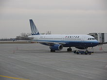
Delta Air Lines is the largest operator out of DSM Handling 32% of passengers, followed by United Airlines (27%), American Eagle (18%), and Allegiant Airlines (10%) The Des Moines Terminal is divided into 2 concourses; concourse A with gates A1-A5, and concourse C, with gates C1-C7.
Delta Connection offers many same-plane connections out of Detroit, such as service to the Westchester County Airport in White Plains, NY, to get more service into the NY area (The only current service is seasonal service to LaGuardia Airport.) Cargo
Aircraft typeDes Moines International is served by a variety of aircraft. United Airlines operates entirely Airbus 319 and 320 aircraft on its Des Moines-Denver route, with a few Airbus aircraft and an occasional Boeing 757, and Embraer 170 aircraft on the Chicago O'Hare route. Allegiant operates the MD-80 family of aircraft on all of its routes out of DSM. AirTran Airways operates Boeing 717s. Delta Air Lines, Continental Airlines, U.S. Airways, and American Airlines only operate regional jets (Embraer and Canadair) out of Des Moines. Also note that Delta operates Canadair aircraft due to the CRJ-900 maintenance facility owned by Mesaba airlines. Northwest previously operated DC-9's and the Airbus family out of Des Moines. Accidents and incidentsOn 2 December 1978, Douglas C-47A N41447 of SMB Stage Line crashed short of the runway while on a cargo flight from Chicago, Illinois. Airframe icing was a factor in the accident. On December 1, 2007, a United Express plane carrying 44 passengers slid off a taxiway while taxiing to the runway for takeoff. No one was injured, but the airport was closed for seven hours after the incident because of the winter storm moving through the area. On March 13, 2008, an Atlanta-bound ASA (Delta 4704) flight was delayed more than five hours when a mouse was discovered shortly before take-off from DSM. Officials delayed the flight to inspect the plane for any damage that the mouse may have caused. Maintenance crews checked wiring and components on the aircraft. The flight took off at 11:39am. On July 8, 2008, a Des Moines bound, Denver originating United Airlines flight was delayed for more than six hours after a passenger found ticks on the plane from Washington, DC to Denver. The plane was further delayed because of storms in Denver. The above content comes from Wikipedia and is published under free licenses – click here to read more.
Runway InformationRunway 05/23
Runway 13/31
Radio Navigation Aids
Remarks
Based Aircraft
Major Carriers Serving This Airport
Most Popular Destinations
Most Popular Aircraft
Operational StatisticsTime Period: 2006-01-01 - 2006-12-31
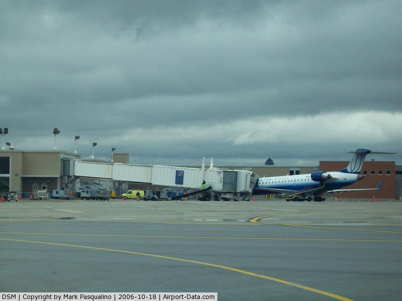
Des Moines International Airport Address: Polk County, IA Tel: 515-256-5100 Images
and information placed above are from We thank them for the data!
We don't guarantee the information is fresh and accurate. The data may
be wrong or outdated.
|
|||||||||||||||||||||||||||||||||||||||||||||||||||||||||||||||||||||||||||||||||||||||||||||||||||||||||||||||||||||||||||||||||||||||||||||||||||||||||||||||||||||||||||||||||||||||||||||||||||||||||||||||||||||||||||||||||||||||||||||||||||||||||||||||||||||||||||||||||||||||||||||||||||||||||||||||||||||||||||||||||||||||||||||||||||||||||||||||||||||||||||||||||||||||||||||||||||||||||||||||||||||||||||||||||||||||||||||||||||||||||||||||||||||||||||||||||||||||||||||||||||||||||||||||||||||||||||||||||||||||||||||||||||||||||||||||||||||||||||||||||||||||||||||||||||||

 |
|
Copyright 2004-2024 © by Airports-Worldwide.com, Vyshenskoho st. 36, Lviv 79010, Ukraine Legal Disclaimer |