 |
|
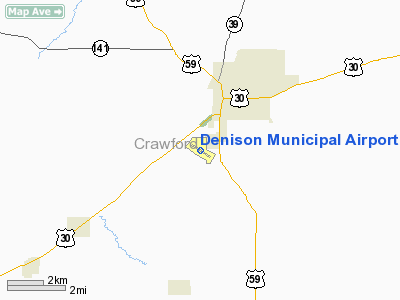
Denison Municipal Airport |
|
|
Location & QuickFacts
|
FAA Information Effective: |
2007-07-05 |
|
Airport Identifier: |
DNS |
|
Airport Status: |
Operational |
|
Longitude/Latitude: |
095-22-50.5950W/41-59-11.1570N
-95.380721/41.986432 (Estimated) |
|
Elevation: |
1276 ft / 388.92 m (Surveyed) |
|
Land: |
205 acres |
|
From nearest city: |
2 nautical miles SW of Denison, IA |
|
Location: |
Crawford County, IA |
|
Magnetic Variation: |
05E (1985) |
Owner & Manager
|
Ownership: |
Publicly owned |
|
Owner: |
City Of Denison
DR. D.W. CRABB - ARPT COMMISSION CHAIRMAN. |
|
Address: |
111 North Main
Denison, IA 51442 |
|
Phone number: |
712-263-3143 |
|
Manager: |
Barry Reid |
|
Address: |
2582 Airport Street
Denison, IA 51442 |
|
Phone number: |
712-263-2781
ALT AMGR PHONE 712-263-2728. |
Airport Operations and Facilities
|
Airport Use: |
Open to public |
|
Wind indicator: |
Yes |
|
Segmented Circle: |
No |
|
Control Tower: |
No |
|
Lighting Schedule: |
DUSK-DAWN
MIRL RY 12/30 PRESET ON LOW INTST; TO INCR INTST AND ACTVT PAPI
RYS 12 AND 30 AND REIL RYS 12 AND 30 - CTAF. |
|
Beacon Color: |
Clear-Green (lighted land airport) |
|
Landing fee charge: |
No |
|
Sectional chart: |
Omaha |
|
Region: |
ACE - Central |
|
Boundary ARTCC: |
ZMP - Minneapolis |
|
Tie-in FSS: |
FOD - Fort Dodge |
|
FSS on Airport: |
No |
|
FSS Phone: |
515-955-8114 |
|
FSS Toll Free: |
1-800-WX-BRIEF |
|
NOTAMs Facility: |
DNS (NOTAM-d service avaliable) |
|
Federal Agreements: |
NGY |
Airport Communications
|
CTAF: |
122.800 |
|
Unicom: |
122.800 |
Airport Services
|
Fuel available: |
100LLA |
|
Airframe Repair: |
MAJOR |
|
Power Plant Repair: |
MAJOR |
|
Bottled Oxygen: |
NONE |
|
Bulk Oxygen: |
NONE |
|
Runway Information
Runway 06/24
|
Dimension: |
1780 x 175 ft / 542.5 x 53.3
m |
|
Surface: |
TURF, Good Condition |
|
|
Runway 06
|
Runway 24
|
|
Longitude: |
095-23-13.9950W |
095-22-50.9940W |
|
Latitude: |
41-59-10.9570N |
41-59-19.9570N |
|
Traffic
Pattern: |
Left |
Left |
|
Obstruction: |
14 ft tree, 441.0 ft from runway, 98 ft right of centerline, 31:1 slope
to clear |
25 ft tree, 652.0 ft from runway, 188 ft left of centerline, 26:1 slope
to clear |
|
Runway 12/30
|
Dimension: |
5000 x 75 ft / 1524.0
x 22.9 m |
|
Surface: |
CONC, Good Condition |
|
Weight Limit: |
Single wheel: 28000 lbs.
Dual wheel: 48000 lbs. |
|
Edge Lights: |
Medium |
|
|
Runway 12
|
Runway 30
|
|
Longitude: |
095-23-13.6060W |
095-22-18.9210W |
|
Latitude: |
41-59-22.6050N |
41-58-54.7910N |
|
Elevation: |
1273.00 ft |
1258.00 ft |
|
Alignment: |
124 |
127 |
|
Traffic
Pattern: |
Left |
Left |
|
Markings: |
Non-precision instrument, Good Condition |
Non-precision instrument, Good Condition |
|
Crossing
Height: |
27.00 ft |
33.00 ft |
|
VASI: |
2-light PAPI on left side |
2-light PAPI on left side |
|
Visual
Glide Angle: |
3.00° |
3.00° |
|
Runway End
Identifier: |
Yes |
Yes |
|
Obstruction: |
, 50:1 slope to clear |
23 ft tree, 771.0 ft from runway, 183 ft left of centerline, 24:1 slope
to clear |
|
Runway 18/36
|
Dimension: |
2025 x 105 ft / 617.2 x 32.0
m |
|
Surface: |
TURF, Good Condition |
|
|
Runway 18
|
Runway 36
|
|
Longitude: |
095-22-50.9940W |
095-22-50.4950W |
|
Latitude: |
41-59-23.9570N |
41-59-02.9570N |
|
Traffic
Pattern: |
Left |
Left |
|
Radio Navigation Aids
|
ID |
Type |
Name |
Ch |
Freq |
Var |
Dist |
|
DNS |
NDB |
Denison |
|
350.00 |
04E |
0.2 nm |
|
MEY |
NDB |
Mapleton |
|
335.00 |
05E |
21.8 nm |
|
HNR |
NDB |
Harlan |
|
272.00 |
05E |
24.6 nm |
|
CIN |
NDB |
Carroll |
|
397.00 |
04E |
26.8 nm |
|
ADU |
NDB |
Audubon |
|
266.00 |
04E |
27.6 nm |
|
SKI |
NDB |
Sac City |
|
356.00 |
04E |
29.6 nm |
|
SLB |
NDB |
Storm Lake |
|
434.00 |
04E |
37.4 nm |
|
AIO |
NDB |
Atlantic |
|
365.00 |
04E |
38.1 nm |
|
OM |
NDB |
Gerfi |
|
320.00 |
05E |
45.3 nm |
|
SU |
NDB |
Salix |
|
414.00 |
07E |
45.4 nm |
|
CKP |
NDB |
Pilot Rock |
|
423.00 |
05E |
45.5 nm |
|
GCT |
NDB |
Guthrie Center |
|
518.00 |
05E |
46.2 nm |
|
EFW |
NDB |
Jefferson |
|
391.00 |
03E |
46.4 nm |
|
TQE |
VOR |
Tekamah |
|
108.40 |
07E |
38.2 nm |
|
SUX |
VORTAC |
Sioux City |
112X |
116.50 |
09E |
47.2 nm |
|
OMA |
VOT |
Omaha |
|
109.00 |
|
47.3 nm |
Remarks
-
RY LGT FOR
RY 12/30 LCTD 25 FT INSIDE BOUNDARY OF RY 06/24.
-
RY 12/30 HAS SOFT SHOULDERS.
-
RY 30 IS
CALM WIND RY.
Based Aircraft
|
Aircraft based
on field: |
21 |
|
Single Engine
Airplanes: |
19 |
|
Multi Engine
Airplanes: |
2 |
Operational Statistics
Time
Period:
2004-11-10 - 2005-11-09
|
Aircraft
Operations: |
203/Week |
|
Air Taxi: |
2.8% |
|
General
Aviation Local: |
48.0% |
|
General
Aviation Itinerant: |
49.0% |
|
Military: |
0.2% |
Denison Municipal Airport
Address:
Crawford County, IA
Tel:
712-263-3143,
712-263-2781
Images
and information placed above are from
http://www.airport-data.com/airport/DNS/
We
thank them for the data!
| General Info
|
| Country |
United States
|
| State |
IOWA
|
| FAA ID |
DNS
|
| Latitude |
41-59-11.157N
|
| Longitude |
095-22-50.595W
|
| Elevation |
1276 feet
|
| Near City |
DENISON
|
We don't guarantee the information is fresh and accurate. The data may
be wrong or outdated.
For more up-to-date information please refer to other sources.
|
|


