 |
|
Location &
QuickFacts
|
FAA
Information Effective: |
2007-07-05 |
|
Airport
Identifier: |
IA51 |
|
Airport
Status: |
Operational |
|
Longitude/Latitude: |
094-00-30.8270W/41-32-29.9590N
-94.008563/41.541655 (Estimated) |
|
Elevation: |
1000 ft / 304.80 m (Estimated) |
|
Land: |
12 acres |
|
From
nearest city: |
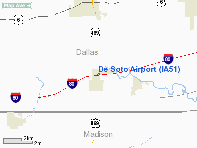
1 nautical miles N of De Soto, IA |
|
Location: |
Dallas County, IA |
|
Magnetic Variation: |
04E (1995) |
Owner & Manager
|
Ownership: |
Privately owned |
|
Owner: |
Ron Ellefson |
|
Address: |
909 Piercer Dr
Desota, IA 50111 |
|
Phone
number: |
712-732-4074 |
|
Manager: |
Ron Ellefson |
|
Address: |
93 Holiday Terrace
De Sota, IA 50111 |
|
Phone number: |
515-834-2225 |
Airport Operations and Facilities
|
Airport Use: |
Private |
|
Segmented Circle: |
No |
|
Control Tower: |
No |
|
Sectional chart: |
Omaha |
|
Region: |
ACE - Central |
|
Boundary ARTCC: |
ZMP - Minneapolis |
|
Tie-in FSS: |
FOD - Fort Dodge |
|
FSS on Airport: |
No |
|
FSS Phone: |
515-955-8114 |
|
FSS Toll Free: |
1-800-WX-BRIEF |
Airport Services
|
Runway Information
Runway 09/27
|
Dimension: |
2600 x 100 ft / 792.5 x 30.5 m |
|
Surface: |
TURF, |
|
|
Runway 09
|
Runway 27
|
|
Traffic
Pattern: |
Left |
Left |
|
Obstruction: |
30 ft pline, 500.0 ft from runway |
|
|
Radio Navigation Aids
|
ID |
Type |
Name |
Ch |
Freq |
Var |
Dist |
|
PRO |
NDB |
Perry |
|
251.00 |
06E |
18.7 nm |
|
GCT |
NDB |
Guthrie Center |
|
518.00 |
05E |
20.9 nm |
|
IKV |
NDB |
Ankeny |
|
275.00 |
03E |
22.1 nm |
|
GFZ |
NDB |
Greenfield |
|
338.00 |
04E |
23.5 nm |
|
BNW |
NDB |
Boone |
|
407.00 |
03E |
31.6 nm |
|
EFW |
NDB |
Jefferson |
|
391.00 |
03E |
32.1 nm |
|
UNE |
NDB |
Union County |
|
379.00 |
04E |
38.3 nm |
|
ADU |
NDB |
Audubon |
|
266.00 |
04E |
41.5 nm |
|
OXV |
NDB |
Knoxville |
|
284.00 |
03E |
42.9 nm |
|
CNC |
NDB |
Chariton |
|
335.00 |
05E |
43.0 nm |
|
CIN |
NDB |
Carroll |
|
397.00 |
04E |
46.1 nm |
|
CRZ |
NDB |
Corning |
|
278.00 |
04E |
47.1 nm |
|
AIO |
NDB |
Atlantic |
|
365.00 |
04E |
47.5 nm |
|
PEA |
NDB |
Pella |
|
257.00 |
02E |
48.7 nm |
|
TNU |
VOR/DME |
Newton |
072X |
112.50 |
03E |
42.9 nm |
|
DSM |
VORTAC |
Des Moines |
122X |
117.50 |
07E |
17.4 nm |
|
DSM |
VOT |
Des Moines |
|
109.20 |
|
15.1 nm |
Remarks
-
PRVDD APCH TO
EACH RY MAINTAINED FOR A MIN 20:1 GLIDE SLOPE & TRANSITIONAL SFC MAINTAINED AT
A 7:1 SLOPE.
Based
Aircraft
|
Aircraft based
on field: |
1 |
|
Single Engine
Airplanes: |
1 |
De Soto Airport
Address:
Dallas County, IA
Tel:
712-732-4074,
515-834-2225
Images
and information placed above are from
http://www.airport-data.com/airport/IA51/
We
thank them for the data!
|
General Info |
| Country |
United
States |
| State |
IOWA
|
| FAA ID |
IA51
|
| Latitude |
41-32-29.959N |
|
Longitude |
094-00-30.827W |
|
Elevation |
1000
feet |
| Near
City |
DE SOTO
|
We don't guarantee the information is fresh and accurate. The data may
be wrong or outdated.
For more up-to-date information please refer to other sources.
|
|


