 |
|
Covenant Medical Center At West Ninth Heliport |
|
|
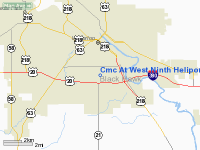
Location
& QuickFacts
|
FAA Information Effective: |
2007-07-05 |
|
Airport
Identifier: |
2IA4 |
|
Airport
Status: |
Operational |
|
Longitude/Latitude: |
092-20-41.4000W/42-27-39.6000N
-92.344833/42.461000 (Estimated) |
|
Elevation: |
922 ft / 281.03 m (Estimated) |
|
Land: |
0 acres |
|
From
nearest city: |
7 nautical miles S of Waterloo, IA |
|
Location: |
Black Hawk County, IA |
|
Magnetic Variation: |
03E (1985) |
Owner
& Manager
|
Ownership: |
Privately owned |
|
Owner: |
Covenant Medical Center |
|
Address: |
3421 West Ninth St.
Waterloo, IA 50702 |
|
Phone
number: |
319-272-8000 |
|
Manager: |
Deb Bagenstos / Marcia Dlouhy |
|
Address: |
3421 West Ninth St.
Waterloo, IA 50702 |
|
Phone number: |
319-272-8076 |
Airport
Operations and Facilities
|
Airport Use: |
Private
MEDICAL. |
|
Wind
indicator: |
Yes |
|
Segmented
Circle: |
No |
|
Control
Tower: |
No |
|
Lighting
Schedule: |
DUSK-DAWN
FOR PERIMETER LGTS CALL 319-272-7050. |
|
Beacon Color: |
Clear-Green-Yellow (heliport) |
|
Landing fee charge: |
No |
|
Sectional chart: |
Chicago |
|
Region: |
ACE - Central |
|
Boundary ARTCC: |
ZAU - Chicago |
|
Tie-in FSS: |
FOD - Fort Dodge |
|
FSS on Airport: |
No |
|
FSS Phone: |
515-955-8114 |
|
FSS Toll Free: |
1-800-WX-BRIEF |
Airport
Services
|
Runway Information
Helipad H1
|
Dimension: |
48 x 48 ft / 14.6 x 14.6 m |
|
Surface: |
CONC, |
|
|
Runway H1 |
Runway |
|
Traffic
Pattern: |
Left |
Left |
|
Radio Navigation
Aids
|
ID |
Type |
Name |
Ch |
Freq |
Var |
Dist |
|
IIB |
NDB |
Wapsie |
|
206.00 |
02E |
17.5 nm |
|
VTI |
NDB |
Garrison |
|
338.00 |
03E |
20.4 nm |
|
OLZ |
NDB |
Oelwein |
|
260.00 |
02E |
21.1 nm |
|
MIW |
NDB |
Marshalltown |
|
239.00 |
03E |
33.1 nm |
|
TZT |
NDB |
Belle Plaine |
|
371.00 |
02E |
34.7 nm |
|
XWY |
NDB |
West Union |
|
278.00 |
02E |
38.2 nm |
|
CCY |
NDB |
Charles City |
|
375.00 |
03E |
38.3 nm |
|
IFA |
NDB |
Iowa Falls |
|
368.00 |
03E |
40.8 nm |
|
HPT |
NDB |
Hampton |
|
230.00 |
03E |
42.1 nm |
|
IY |
NDB |
Chukk |
|
417.00 |
03E |
43.8 nm |
|
GGI |
NDB |
Grinnell |
|
248.00 |
02E |
48.3 nm |
|
JWJ |
VOR/DME |
Elmwood |
031X |
109.40 |
03E |
32.7 nm |
|
CID |
VOR/DME |
Cedar Rapids |
088X |
114.10 |
05E |
42.5 nm |
|
ALO |
VORTAC |
Waterloo |
059X |
112.20 |
06E |
6.2 nm |
Remarks
- CONDL--PROVIDED
CLEAR APPROACH/DEPARTURE PATHS TO LANDING AREA ARE MAINTAINED FOR A
MIN 8:1 GLIDE SLOPE AND TRANSITIONAL SURFACE IS MAINTAINED FOR A 2:1
SLOPE; USERS AVOID COLUMBUS HIGH, WEST HIGH AND CRESTHAVEN SCHOOL BUILDINGS
AND GROUNDS.
Based Aircraft
|
Aircraft
based on field: |
2 |
|
Single
Engine Airplanes: |
1 |
|
Helicopters: |
1 |
Covenant Medical Center At West Ninth Heliport
Address:
Black Hawk County, IA
Tel:
319-272-8000,
319-272-8076
Images
and information placed above are from
http://www.airport-data.com/airport/2IA4/
We
thank them for the data!
| General
Info |
| Country |
United
States |
| State |
IOWA
|
| FAA ID |
2IA4
|
| Latitude |
42-27-39.600N
|
| Longitude |
092-20-41.400W
|
| Elevation |
922 feet
|
| Near City |
WATERLOO
|
We don't guarantee the information is fresh and accurate. The data may
be wrong or outdated.
For more up-to-date information please refer to other sources.
|
|


