 |
|
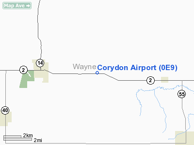
Location &
QuickFacts
|
FAA
Information Effective: |
2007-07-05 |
|
Airport
Identifier: |
0E9 |
|
Airport
Status: |
Operational |
|
Longitude/Latitude: |
093-14-28.7550W/40-45-16.0200N
-93.241321/40.754450 (Estimated) |
|
Elevation: |
1020 ft / 310.90 m (Estimated) |
|
Land: |
100 acres |
|
From
nearest city: |
4 nautical miles E of Corydon, IA |
|
Location: |
Wayne County, IA |
|
Magnetic Variation: |
04E (1980) |
Owner & Manager
|
Ownership: |
Privately owned |
|
Owner: |
Benny Davis |
|
Address: |
Rt 2
Corydon, IA 50060 |
|
Phone number: |
515-872-2032 |
|
Manager: |
Benny Davis |
|
Address: |
Rt 2
Corydon, IA 50060 |
|
Phone number: |
515-872-2032 |
Airport
Operations and Facilities
|
Airport
Use: |
Open to public |
|
Wind
indicator: |
Yes |
|
Segmented Circle: |
No |
|
Control
Tower: |
No |
|
Landing
fee charge: |
No |
|
Sectional chart: |
Omaha |
|
Region: |
ACE - Central |
|
Boundary
ARTCC: |
ZAU - Chicago |
|
Tie-in
FSS: |
FOD - Fort Dodge |
|
FSS on
Airport: |
No |
|
FSS
Phone: |
515-955-8114 |
|
FSS Toll
Free: |
1-800-WX-BRIEF |
|
NOTAMs
Facility: |
FOD (NOTAM-d service avaliable) |
Airport Communications
Airport Services
|
Runway Information
Runway 09/27
|
Dimension: |
3270 x 80 ft / 996.7 x 24.4 m |
|
Surface: |
TURF, Fair Condition |
|
|
Runway 09
|
Runway 27
|
|
Traffic
Pattern: |
Left |
Left |
|
Displaced
threshold: |
1080.00 ft |
0.00 ft |
|
Obstruction: |
62 ft tree, 550.0 ft from runway, 80 ft right of
centerline, 8:1 slope to clear
APCH SLOPE 26:1 TO DSPLCD THLD. |
4 ft road, 120.0 ft from runway, 30:1 slope to clear |
|
Runway 11W/29W
|
Dimension: |
3000 x 100 ft / 914.4 x 30.5 m |
|
Surface: |
WATER, |
|
|
Runway 11W
|
Runway 29W
|
|
Traffic
Pattern: |
Left |
Left |
|
Radio Navigation Aids
|
ID |
Type |
Name |
Ch |
Freq |
Var |
Dist |
|
TVK |
NDB |
Centerville |
|
290.00 |
04E |
16.1 nm |
|
CNC |
NDB |
Chariton |
|
335.00 |
05E |
16.7 nm |
|
OXV |
NDB |
Knoxville |
|
284.00 |
03E |
33.1 nm |
|
BEX |
NDB |
Bloomfield |
|
269.00 |
02E |
36.9 nm |
|
PEA |
NDB |
Pella |
|
257.00 |
02E |
41.4 nm |
|
TRX |
NDB |
Trenton |
|
400.00 |
03E |
43.6 nm |
|
OOA |
NDB |
Oskaloosa |
|
414.00 |
03E |
44.4 nm |
|
OTM |
VOR/DME |
Ottumwa |
053X |
111.60 |
06E |
44.8 nm |
|
LMN |
VORTAC |
Lamoni |
114X |
116.70 |
07E |
34.4 nm |
|
DSM |
VORTAC |
Des Moines |
122X |
117.50 |
07E |
45.0 nm |
|
IRK |
VORTAC |
Kirksville |
093X |
114.60 |
06E |
47.6 nm |
Remarks
-
RY 09 HAS TALL
GRASS & WEEDS HIDING DSPLCD THLD MARKER CONES.
-
PROVIDED
APPROACHES ARE MAINTAINED FOR A 20:1 GLIDE SLOPE AND TRANSITIONAL SURFACES FOR
A 7:1 SLOPE.
Based
Aircraft
|
Aircraft based
on field: |
3 |
|
Single Engine
Airplanes: |
3 |
Corydon Airport
Address:
Wayne County, IA
Tel:
515-872-2032
Images
and information placed above are from
http://www.airport-data.com/airport/0E9/
We
thank them for the data!
|
General Info |
| Country |
United
States |
| State |
IOWA
|
| FAA ID |
0E9
|
| Latitude |
40-45-16.020N |
|
Longitude |
093-14-28.755W |
|
Elevation |
1020
feet |
| Near
City |
CORYDON
|
We don't guarantee the information is fresh and accurate. The data may
be wrong or outdated.
For more up-to-date information please refer to other sources.
|
|


