 |
|
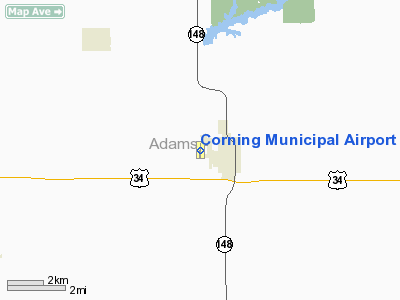
Corning Municipal Airport |
|
|
Location & QuickFacts
|
FAA Information Effective: |
2007-07-05 |
|
Airport Identifier: |
CRZ |
|
Airport Status: |
Operational |
|
Longitude/Latitude: |
094-45-18.1070W/40-59-38.8500N
-94.755030/40.994125 (Estimated) |
|
Elevation: |
1274 ft / 388.32 m (Surveyed) |
|
Land: |
56
acres |
|
From nearest city: |
1 nautical miles W of Corning, IA |
|
Location: |
Adams County, IA |
|
Magnetic Variation: |
04E (1995) |
Owner & Manager
|
Ownership: |
Publicly owned |
|
Owner: |
City Of Corning |
|
Address: |
601 6th
Corning, IA 50841 |
|
Phone number: |
641-322-4230 |
|
Manager: |
Guy Bruce
MAYOR - GUY BRUCE CITY CLERK - IONA M. ALLEN |
|
Address: |
601 6th
Corning, IA 50841 |
|
Phone number: |
641-322-4230 |
Airport Operations and Facilities
|
Airport Use: |
Open to public |
|
Wind indicator: |
Yes |
|
Segmented Circle: |
No |
|
Control Tower: |
No |
|
Lighting Schedule: |
DUSK-DAWN
ACTVT LIRL RY 18/36 & REIL RY 18 - 122.8. |
|
Beacon Color: |
Clear-Green (lighted land airport) |
|
Landing fee charge: |
No |
|
Sectional chart: |
Omaha |
|
Region: |
ACE - Central |
|
Boundary ARTCC: |
ZMP - Minneapolis |
|
Tie-in FSS: |
FOD - Fort Dodge |
|
FSS on Airport: |
No |
|
FSS Phone: |
515-955-8114 |
|
FSS Toll Free: |
1-800-WX-BRIEF |
|
NOTAMs Facility: |
FOD (NOTAM-d service avaliable) |
Airport Communications
Airport Services
|
Fuel available: |
100LLMOGAS |
|
Bottled Oxygen: |
NONE |
|
Bulk Oxygen: |
NONE |
|
Runway Information
Runway 18/36
|
Dimension: |
2684 x 50 ft / 818.1 x 15.2
m |
|
Surface: |
CONC, Good Condition |
|
Edge Lights: |
Non-standard lighting system
RY 18/36 NSTD LIRL; EDGE LIGHTS 58 FT FM CNTRLN. |
|
|
Runway 18
|
Runway 36
|
|
Longitude: |
094-45-17.7920W |
094-45-18.4080W |
|
Latitude: |
40-59-52.1250N |
40-59-25.6120N |
|
Elevation: |
1274.00 ft |
1248.00 ft |
|
Alignment: |
127 |
1 |
|
Traffic
Pattern: |
Right |
Left |
|
Markings: |
Non-precision instrument, Fair Condition |
Non-precision instrument, Fair Condition |
|
Runway End
Identifier: |
Yes |
|
|
Obstruction: |
43 ft tree, 1077.0 ft from runway, 320 ft right of centerline, 20:1
slope to clear |
, 50:1 slope to clear |
|
Radio Navigation Aids
|
ID |
Type |
Name |
Ch |
Freq |
Var |
Dist |
|
CRZ |
NDB |
Corning |
|
278.00 |
04E |
0.2 nm |
|
UNE |
NDB |
Union County |
|
379.00 |
04E |
18.6 nm |
|
ICL |
NDB |
Clarinda |
|
353.00 |
04E |
20.3 nm |
|
RDK |
NDB |
Red Oak |
|
230.00 |
04E |
22.6 nm |
|
GFZ |
NDB |
Greenfield |
|
338.00 |
04E |
24.4 nm |
|
AIO |
NDB |
Atlantic |
|
365.00 |
04E |
27.9 nm |
|
SDA |
NDB |
Shenandoah |
|
411.00 |
05E |
33.0 nm |
|
EVU |
NDB |
Emville |
|
317.00 |
05E |
39.5 nm |
|
ADU |
NDB |
Audubon |
|
266.00 |
04E |
42.4 nm |
|
GCT |
NDB |
Guthrie Center |
|
518.00 |
05E |
43.8 nm |
|
HNR |
NDB |
Harlan |
|
272.00 |
05E |
44.0 nm |
|
LMN |
VORTAC |
Lamoni |
114X |
116.70 |
07E |
43.1 nm |
|
OVR |
VORTAC |
Omaha |
110X |
116.30 |
08E |
45.7 nm |
Remarks
-
CTN: SHARP
DROP BOTH ENDS RWY 18/36.
-
ESTABLISHED PRIOR TO 1959.
Based Aircraft
|
Aircraft based
on field: |
8 |
|
Single Engine
Airplanes: |
7 |
|
Ultralights: |
1 |
Operational Statistics
Time
Period:
2003-05-27 - 2004-05-25
|
Aircraft
Operations: |
16/Week |
|
General
Aviation Local: |
62.5% |
|
General
Aviation Itinerant: |
37.5% |
Corning Municipal Airport
Address:
Adams County, IA
Tel:
641-322-4230
Images
and information placed above are from
http://www.airport-data.com/airport/CRZ/
We
thank them for the data!
| General Info
|
| Country |
United States
|
| State |
IOWA
|
| FAA ID |
CRZ
|
| Latitude |
40-59-38.850N
|
| Longitude |
094-45-18.107W
|
| Elevation |
1274 feet
|
| Near City |
CORNING
|
We don't guarantee the information is fresh and accurate. The data may
be wrong or outdated.
For more up-to-date information please refer to other sources.
|
|


