 |
|
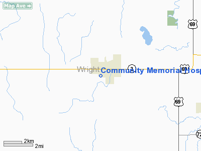
Community Memorial Hospital Heliport |
Location
& QuickFacts
|
FAA Information Effective: |
2007-07-05 |
|
Airport
Identifier: |
4IA5 |
|
Airport
Status: |
Operational |
|
Longitude/Latitude: |
093-44-30.7720W/42-43-29.8990N
-93.741881/42.724972 (Estimated) |
|
Elevation: |
1162 ft / 354.18 m (Estimated) |
|
Land: |
0 acres |
|
From
nearest city: |
0 nautical miles N of Clarion, IA |
|
Location: |
Wright County, IA |
|
Magnetic Variation: |
04E (1990) |
Owner
& Manager
|
Ownership: |
Privately owned |
|
Owner: |
Community Memorial Hospital |
|
Address: |
1316 South Main
Clarion, IA 50525 |
|
Phone number: |
515-532-2811 |
|
Manager: |
Mark Jenison |
|
Address: |
1316 South Main
Clarion, IA 50525 |
|
Phone number: |
515-532-2811 |
Airport
Operations and Facilities
|
Airport Use: |
Private
MEDICAL USE. |
|
Wind
indicator: |
Yes |
|
Segmented
Circle: |
No |
|
Control
Tower: |
No |
|
Lighting
Schedule: |
PHONE REQ
FOR PERIMETER LGTS CALL 515-532-2811. |
|
Sectional
chart: |
Omaha |
|
Region: |
ACE - Central |
|
Boundary
ARTCC: |
ZMP - Minneapolis |
|
Tie-in
FSS: |
FOD - Fort Dodge |
|
FSS
Phone: |
515-955-8114 |
|
FSS
Toll Free: |
1-800-WX-BRIEF |
|
Runway Information
Helipad H1
|
Dimension: |
50 x 50 ft / 15.2 x 15.2 m |
|
Surface: |
CONC, |
|
|
Runway H1 |
Runway |
|
Traffic
Pattern: |
Left |
Left |
|
Radio Navigation
Aids
|
ID |
Type |
Name |
Ch |
Freq |
Var |
Dist |
|
CAV |
NDB |
Clarion |
|
387.00 |
03E |
1.5 nm |
|
EAG |
NDB |
Eagle Grove |
|
302.00 |
03E |
7.5 nm |
|
EBS |
NDB |
Webster City |
|
323.00 |
03E |
18.0 nm |
|
HPT |
NDB |
Hampton |
|
230.00 |
03E |
22.8 nm |
|
IFA |
NDB |
Iowa Falls |
|
368.00 |
03E |
25.8 nm |
|
FXY |
NDB |
Forest City |
|
359.00 |
05E |
31.1 nm |
|
AXA |
NDB |
Algona |
|
403.00 |
03E |
31.7 nm |
|
POH |
NDB |
Pocahontas |
|
428.00 |
06E |
40.0 nm |
|
BNW |
NDB |
Boone |
|
407.00 |
03E |
40.6 nm |
|
EGQ |
NDB |
Emmetsburg |
|
410.00 |
04E |
48.1 nm |
|
FOD |
VORTAC |
Fort Dodge |
082X |
113.50 |
07E |
25.4 nm |
|
MCW |
VORTAC |
Mason City |
096X |
114.90 |
06E |
28.7 nm |
Remarks
- OWNER
DESIRES HELIPORT NOT BE CHARTED.
- PRVDD
APCH/DEP FOR A 8:1 GLIDE SLOPE & A 2:1 TRANSITIONAL SLOPE &
ALL USERS SHALL BE BRIEFED ON PROXIMITY OF CLARION MUNI ARPT & USERS
SHALL AVOID INTERFERING WITH CLARION ARPT TFC.
Community Memorial Hospital Heliport
Address:
Wright County, IA
Tel:
515-532-2811
Images
and information placed above are from
http://www.airport-data.com/airport/4IA5/
We
thank them for the data!
| General
Info |
| Country |
United
States |
| State |
IOWA
|
| FAA ID |
4IA5
|
| Latitude |
42-43-29.899N
|
| Longitude |
093-44-30.772W
|
| Elevation |
1162 feet
|
| Near City |
CLARION
|
We don't guarantee the information is fresh and accurate. The data may
be wrong or outdated.
For more up-to-date information please refer to other sources.
|
|


