 |
|
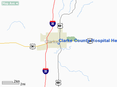
Clarke County Hospital Heliport |
Location
& QuickFacts
|
FAA Information Effective: |
2007-07-05 |
|
Airport
Identifier: |
6IA9 |
|
Airport
Status: |
Operational |
|
Longitude/Latitude: |
093-46-04.7910W/41-01-33.9870N
-93.767998/41.026107 (Estimated) |
|
Elevation: |
1134 ft / 345.64 m (Estimated) |
|
Land: |
0 acres |
|
From
nearest city: |
0 nautical miles N of Osceola, IA |
|
Location: |
Clarke County, IA |
|
Magnetic Variation: |
04E (1990) |
Owner
& Manager
|
Ownership: |
Privately owned |
|
Owner: |
Clarke County Hospital |
|
Address: |
800 S. Fillmore St
Osceola, IA 50213 |
|
Phone
number: |
641-342-5342 |
|
Manager: |
David M. Coates |
|
Address: |
800 S. Fillmore St
Osceola, IA 50213 |
|
Phone number: |
641-342-5342 |
Airport
Operations and Facilities
|
Airport Use: |
Private
MEDICAL. |
|
Segmented
Circle: |
No |
|
Control
Tower: |
No |
|
Sectional
chart: |
Omaha |
|
Region: |
ACE - Central |
|
Boundary
ARTCC: |
ZMP - Minneapolis |
|
Tie-in
FSS: |
FOD - Fort Dodge |
|
FSS
on Airport: |
No |
|
FSS
Phone: |
515-955-8114 |
|
FSS
Toll Free: |
1-800-WX-BRIEF |
|
Runway Information
Helipad H1
|
Dimension: |
50 x 50 ft / 15.2 x 15.2 m |
|
Surface: |
ASPH-CONC, |
|
|
Runway H1 |
Runway |
|
Traffic
Pattern: |
Left |
Left |
|
Radio Navigation
Aids
|
ID |
Type |
Name |
Ch |
Freq |
Var |
Dist |
|
CNC |
NDB |
Chariton |
|
335.00 |
05E |
18.4 nm |
|
UNE |
NDB |
Union County |
|
379.00 |
04E |
26.6 nm |
|
OXV |
NDB |
Knoxville |
|
284.00 |
03E |
33.7 nm |
|
GFZ |
NDB |
Greenfield |
|
338.00 |
04E |
35.5 nm |
|
IKV |
NDB |
Ankeny |
|
275.00 |
03E |
41.5 nm |
|
PEA |
NDB |
Pella |
|
257.00 |
02E |
43.7 nm |
|
TVK |
NDB |
Centerville |
|
290.00 |
04E |
44.4 nm |
|
CRZ |
NDB |
Corning |
|
278.00 |
04E |
44.9 nm |
|
GCT |
NDB |
Guthrie Center |
|
518.00 |
05E |
49.5 nm |
|
DSM |
VORTAC |
Des Moines |
122X |
117.50 |
07E |
25.3 nm |
|
LMN |
VORTAC |
Lamoni |
114X |
116.70 |
07E |
27.4 nm |
|
DSM |
VOT |
Des Moines |
|
109.20 |
|
31.1 nm |
Remarks
- PROVIDED
CLEAR APCH/DEP PATHS TO LNDG AREA FOR A MINIMUM 8:1 GLIDE SLOPE AND
A CLEAR TRANSITIONAL SURFACE FOR A MINIMUM 2:1 GLIDE SLOPE.
Clarke County Hospital Heliport
Address:
Clarke County, IA
Tel:
641-342-5342
Images
and information placed above are from
http://www.airport-data.com/airport/6IA9/
We
thank them for the data!
| General
Info |
| Country |
United
States |
| State |
IOWA
|
| FAA ID |
6IA9
|
| Latitude |
41-01-33.987N
|
| Longitude |
093-46-04.791W
|
| Elevation |
1134 feet
|
| Near City |
OSCEOLA
|
We don't guarantee the information is fresh and accurate. The data may
be wrong or outdated.
For more up-to-date information please refer to other sources.
|
|


