 |
|
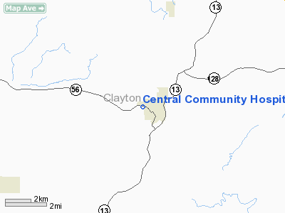
Central Community Hospital Heliport |
|
|
Location
& QuickFacts
|
FAA Information Effective: |
2007-07-05 |
|
Airport
Identifier: |
2IA2 |
|
Airport
Status: |
Operational |
|
Longitude/Latitude: |
091-24-52.4980W/42-51-26.9450N
-91.414583/42.857485 (Estimated) |
|
Elevation: |
774 ft / 235.92 m (Estimated) |
|
Land: |
1 acres |
|
From
nearest city: |
0 nautical miles W of Elkader, IA |
|
Location: |
Clayton County, IA |
|
Magnetic Variation: |
02E (1985) |
Owner
& Manager
|
Ownership: |
Privately owned |
|
Owner: |
Central Community Hospital |
|
Address: |
901 Davidson
Elkader, IA 52043 |
|
Phone number: |
319-245-2250 |
|
Manager: |
Hospital Admin(samuel Curnow) |
|
Address: |
901 Davidson
Elkader, IA 52043 |
|
Phone number: |
319-245-2250 |
Airport
Operations and Facilities
|
Airport Use: |
Private
MEDICAL. |
|
Wind
indicator: |
Yes |
|
Segmented
Circle: |
No |
|
Control
Tower: |
No |
|
Lighting
Schedule: |
PHONE REQ
FOR STROBE LGT CALL - 319-245-2250 |
|
Landing
fee charge: |
No |
|
Sectional
chart: |
Chicago |
|
Region: |
ACE - Central |
|
Boundary
ARTCC: |
ZAU - Chicago |
|
Tie-in
FSS: |
FOD - Fort Dodge |
|
FSS
on Airport: |
No |
|
FSS
Phone: |
515-955-8114 |
|
FSS
Toll Free: |
1-800-WX-BRIEF |
|
Runway Information
Helipad H1
|
Dimension: |
70 x 70 ft / 21.3 x 21.3 m |
|
Surface: |
CONC, |
|
|
Runway H1 |
Runway |
|
Traffic
Pattern: |
Left |
Left |
|
Radio Navigation
Aids
|
ID |
Type |
Name |
Ch |
Freq |
Var |
Dist |
|
XWY |
NDB |
West Union |
|
278.00 |
02E |
17.0 nm |
|
OLZ |
NDB |
Oelwein |
|
260.00 |
02E |
26.9 nm |
|
DEH |
NDB |
Decorah |
|
236.00 |
01E |
28.8 nm |
|
IIB |
NDB |
Wapsie |
|
206.00 |
02E |
34.0 nm |
|
MXO |
NDB |
Monticello |
|
397.00 |
01E |
41.4 nm |
|
CJJ |
NDB |
Cresco |
|
293.00 |
02E |
43.8 nm |
|
CHU |
NDB |
Caledonia |
|
209.00 |
03E |
44.0 nm |
|
PVB |
NDB |
Platteville |
|
203.00 |
01E |
44.3 nm |
|
VTI |
NDB |
Garrison |
|
338.00 |
03E |
46.7 nm |
|
UKN |
VORTAC |
Waukon |
113X |
116.60 |
05E |
26.0 nm |
|
DBQ |
VORTAC |
Dubuque |
105X |
115.80 |
04E |
41.5 nm |
|
ALO |
VORTAC |
Waterloo |
059X |
112.20 |
06E |
47.1 nm |
Central Community Hospital Heliport
Address:
Clayton County, IA
Tel:
319-245-2250
Images
and information placed above are from
http://www.airport-data.com/airport/2IA2/
We
thank them for the data!
| General
Info |
| Country |
United
States |
| State |
IOWA
|
| FAA ID |
2IA2
|
| Latitude |
42-51-26.945N
|
| Longitude |
091-24-52.498W
|
| Elevation |
774 feet
|
| Near City |
ELKADER
|
We don't guarantee the information is fresh and accurate. The data may
be wrong or outdated.
For more up-to-date information please refer to other sources.
|
|


