 |
|
|
|
|
|
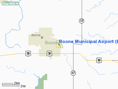
Location
& QuickFacts
|
FAA Information Effective: |
2007-07-05 |
|
Airport
Identifier: |
BNW |
|
Airport
Status: |
Operational |
|
Longitude/Latitude: |
093-50-51.3600W/42-02-58.4510N
-93.847600/42.049570 (Estimated) |
|
Elevation: |
1160 ft / 353.57 m (Surveyed) |
|
Land: |
206 acres |
|
From
nearest city: |
2 nautical miles SE of Boone, IA |
|
Location: |
Boone County, IA |
|
Magnetic Variation: |
03E (1995) |
Owner
& Manager
|
Ownership: |
Publicly owned |
|
Owner: |
City Of Boone
JIM HUGHES, CHAIRMAN ARPT CMSN. |
|
Address: |
923 8th St
Boone, IA 50036 |
|
Phone
number: |
515-432-4211 |
|
Manager: |
Connie Younger |
|
Address: |
424 Cpl Roger Snedden Dr
Boone, IA 50036-7520 |
|
Phone number: |
515-432-1018 |
Airport
Operations and Facilities
|
Airport Use: |
Open to public |
|
Wind
indicator: |
Yes |
|
Segmented
Circle: |
Yes |
|
Control
Tower: |
No |
|
Lighting
Schedule: |
DUSK-DAWN
ACTVT MIRL RY 15/33 & REIL RY 15/33 - CTAF. |
|
Beacon
Color: |
Clear-Green (lighted land airport) |
|
Landing
fee charge: |
No |
|
Sectional
chart: |
Omaha |
|
Region: |
ACE - Central |
|
Boundary
ARTCC: |
ZMP - Minneapolis |
|
Tie-in
FSS: |
FOD - Fort Dodge |
|
FSS
on Airport: |
No |
|
FSS
Phone: |
515-955-8114 |
|
FSS
Toll Free: |
1-800-WX-BRIEF |
|
NOTAMs
Facility: |
BNW (NOTAM-d service avaliable) |
|
Federal Agreements: |
NGY |
Airport
Communications
|
CTAF: |
123.000 |
|
Unicom: |
123.000 |
Airport
Services
|
Fuel available: |
100LLA MOGAS
FOR FUEL ON HOLS OR AFTER HRS CALL (515) 795-2306. |
|
Airframe Repair: |
MINOR |
|
Power Plant Repair: |
MINOR |
|
Bottled
Oxygen: |
NONE |
|
Bulk
Oxygen: |
NONE |
|
Runway Information
Runway 02/20
|
Dimension: |
3298 x 290 ft / 1005.2 x 88.4 m |
|
Surface: |
TURF, Good Condition |
|
|
Runway 02 |
Runway 20 |
|
Longitude: |
093-51-07.4640W |
093-50-48.7750W |
|
Latitude: |
42-02-48.4280N |
42-03-17.8780N |
|
Alignment: |
25 |
127 |
|
Traffic
Pattern: |
Right |
Left |
|
Obstruction: |
, 50:1 slope to clear |
55 ft pole, 1300.0 ft from runway, 23:1 slope
to clear |
|
Runway 15/33
|
Dimension: |
4807 x 75 ft / 1465.2 x 22.9 m |
|
Surface: |
ASPH-CONC, Good Condition |
|
Weight
Limit: |
Single wheel: 30000 lbs. |
|
Edge
Lights: |
Medium |
|
|
Runway 15 |
Runway 33 |
|
Longitude: |
093-51-02.9900W |
093-50-30.4520W |
|
Latitude: |
42-03-15.6400N |
42-02-34.8120N |
|
Elevation: |
1137.00
ft |
1138.00
ft |
|
Alignment: |
127 |
127 |
|
Traffic
Pattern: |
Left |
Right |
|
Markings: |
Non-precision instrument, Good Condition |
Non-precision instrument, Good Condition |
|
Crossing
Height: |
25.00
ft |
25.00
ft |
|
Displaced
threshold: |
140.00
ft |
0.00 ft |
|
VASI: |
2-light PAPI on left side |
2-light PAPI on left side |
|
Visual
Glide Angle: |
3.00° |
3.00° |
|
Runway
End Identifier: |
Yes |
Yes |
|
Obstruction: |
50 ft tree, 1345.0 ft from runway, 100 ft right
of centerline, 22:1 slope to clear |
, 50:1 slope to clear |
|
Decleard
distances: |
Take off run available 4807.00 ft
Take off distance available 4807.00 ft
Actual stop distance available 4807.00 ft
Landing distance available 4667.00 ft |
Take off run available 4667.00 ft
Take off distance available 4807.00 ft
Actual stop distance available 4807.00 ft
Landing distance available 4807.00 ft |
|
Radio Navigation
Aids
|
ID |
Type |
Name |
Ch |
Freq |
Var |
Dist |
|
BNW |
NDB |
Boone |
|
407.00 |
03E |
0.4 nm |
|
PRO |
NDB |
Perry |
|
251.00 |
06E |
19.2 nm |
|
EFW |
NDB |
Jefferson |
|
391.00 |
03E |
22.2 nm |
|
EBS |
NDB |
Webster City |
|
323.00 |
03E |
23.6 nm |
|
IKV |
NDB |
Ankeny |
|
275.00 |
03E |
24.6 nm |
|
GCT |
NDB |
Guthrie Center |
|
518.00 |
05E |
34.3 nm |
|
IFA |
NDB |
Iowa Falls |
|
368.00 |
03E |
36.5 nm |
|
EAG |
NDB |
Eagle Grove |
|
302.00 |
03E |
39.7 nm |
|
MIW |
NDB |
Marshalltown |
|
239.00 |
03E |
41.7 nm |
|
CIN |
NDB |
Carroll |
|
397.00 |
04E |
41.8 nm |
|
CAV |
NDB |
Clarion |
|
387.00 |
03E |
42.0 nm |
|
HPT |
NDB |
Hampton |
|
230.00 |
03E |
49.1 nm |
|
TNU |
VOR/DME |
Newton |
072X |
112.50 |
03E |
36.7 nm |
|
JWJ |
VOR/DME |
Elmwood |
031X |
109.40 |
03E |
42.0 nm |
|
DSM |
VORTAC |
Des Moines |
122X |
117.50 |
07E |
37.9 nm |
|
FOD |
VORTAC |
Fort Dodge |
082X |
113.50 |
07E |
39.2 nm |
|
DSM |
VOT |
Des Moines |
|
109.20 |
|
31.7 nm |
Remarks
- ANG
OPNS AV946-2388 (515) 432-6351.
- PAJA
ON & INVOF ARPT.
- ARPT
MAY BE UNATNDD WHEN WEATHER IS LESS THAT 400 FT CEILING OR 1 MILE VISIBILITY.
Based
Aircraft
|
Aircraft
based on field: |
50 |
|
Single
Engine Airplanes: |
40 |
|
Multi
Engine Airplanes: |
2 |
|
Gliders: |
1 |
|
Military: |
6 |
|
Ultralights: |
1 |
Operational Statistics
Time Period: 2004-11-11
- 2005-11-10
|
Aircraft
Operations: |
80/Day |
|
General
Aviation Local: |
32.6% |
|
General
Aviation Itinerant: |
25.3% |
|
Military: |
42.1% |
Boone Municipal Airport
Address:
Boone County, IA
Tel:
515-432-4211,
515-432-1018
Images
and information placed above are from
http://www.airport-data.com/airport/BNW/
We
thank them for the data!
| General
Info |
| Country |
United
States |
| State |
IOWA
|
| FAA ID |
BNW
|
| Latitude |
42-02-58.450N
|
| Longitude |
093-50-51.260W
|
| Elevation |
1160 feet
|
| Near City |
BOONE
|
We don't guarantee the information is fresh and accurate. The data may
be wrong or outdated.
For more up-to-date information please refer to other sources.
|
|


