 |
|
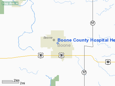
Boone County Hospital Heliport |
Location
& QuickFacts
|
FAA Information Effective: |
2007-07-05 |
|
Airport
Identifier: |
02IA |
|
Airport
Status: |
Operational |
|
Longitude/Latitude: |
093-52-40.8100W/42-03-21.9300N
-93.878003/42.056092 (Estimated) |
|
Elevation: |
1160 ft / 353.57 m (Estimated) |
|
Land: |
0
acres |
|
From
nearest city: |
0 nautical miles N of Boone, IA |
|
Location: |
Boone County, IA |
|
Magnetic Variation: |
03E (2000) |
Owner
& Manager
|
Ownership: |
Privately owned |
|
Owner: |
Boone County Hospital |
|
Address: |
1015 Union Street
Boone, IA 50036 |
|
Phone
number: |
515-432-3140 |
|
Manager: |
Joseph Smith, Admin |
|
Address: |
1015 Union Street
Boone, IA 50036 |
|
Phone
number: |
515-432-3140 |
Airport
Operations and Facilities
|
Airport Use: |
Private
MEDICAL USE. |
|
Wind
indicator: |
Yes |
|
Segmented
Circle: |
No |
|
Control
Tower: |
No |
|
Region: |
ACE - Central |
|
Boundary
ARTCC: |
ZMP - Minneapolis |
|
Responsible
ARTCC: |
ZMP - Minneapolis |
|
Tie-in
FSS: |
FOD - Fort Dodge |
|
FSS
Phone: |
515-955-8114 |
|
FSS
Toll Free: |
1-800-WX-BRIEF |
|
Runway Information
Helipad H1
|
Dimension: |
50 x 50 ft / 15.2 x 15.2 m |
|
Surface: |
CONC,
ROOFTOP. |
|
|
Runway H1 |
Runway |
|
Traffic
Pattern: |
Left |
Left |
|
Radio Navigation
Aids
|
ID |
Type |
Name |
Ch |
Freq |
Var |
Dist |
|
BNW |
NDB |
Boone |
|
407.00 |
03E |
1.1 nm |
|
PRO |
NDB |
Perry |
|
251.00 |
06E |
18.5 nm |
|
EFW |
NDB |
Jefferson |
|
391.00 |
03E |
20.9 nm |
|
EBS |
NDB |
Webster City |
|
323.00 |
03E |
23.2 nm |
|
IKV |
NDB |
Ankeny |
|
275.00 |
03E |
25.7 nm |
|
GCT |
NDB |
Guthrie Center |
|
518.00 |
05E |
33.5 nm |
|
IFA |
NDB |
Iowa Falls |
|
368.00 |
03E |
37.2 nm |
|
EAG |
NDB |
Eagle Grove |
|
302.00 |
03E |
39.2 nm |
|
CIN |
NDB |
Carroll |
|
397.00 |
04E |
40.5 nm |
|
CAV |
NDB |
Clarion |
|
387.00 |
03E |
41.8 nm |
|
MIW |
NDB |
Marshalltown |
|
239.00 |
03E |
43.0 nm |
|
HPT |
NDB |
Hampton |
|
230.00 |
03E |
49.6 nm |
|
TNU |
VOR/DME |
Newton |
072X |
112.50 |
03E |
38.1 nm |
|
JWJ |
VOR/DME |
Elmwood |
031X |
109.40 |
03E |
43.4 nm |
|
FOD |
VORTAC |
Fort Dodge |
082X |
113.50 |
07E |
38.2 nm |
|
DSM |
VORTAC |
Des Moines |
122X |
117.50 |
07E |
38.6 nm |
|
DSM |
VOT |
Des Moines |
|
109.20 |
|
32.4 nm |
Remarks
- OWNER
DESIRES HELIPORT NOT BE CHARTED.
- PRVDD
FATO/APCH SFC/TRANSITIONAL SFC CLEAR OF OBSTNS; OBSTNS MKD/LGTS/MKD;
EMS PERSONNEL USED TO CONTROL PUBLIC ACCESS TO HELIPAD WHEN IN USE;
& FIRE EXTINGUISHER MAINTAINED & COORDINATION W/ BOONE FIRE
DEPT MADE IN EVENT OF A FIRE.
Boone County Hospital Heliport
Address:
Boone County, IA
Tel:
515-432-3140
Images
and information placed above are from
http://www.airport-data.com/airport/02IA/
We
thank them for the data!
| General
Info |
| Country |
United
States |
| State |
IOWA
|
| FAA ID |
02IA
|
| Latitude |
42-03-21.930N
|
| Longitude |
093-52-40.810W
|
| Elevation |
1160 feet
|
| Near City |
BOONE
|
We don't guarantee the information is fresh and accurate. The data may
be wrong or outdated.
For more up-to-date information please refer to other sources.
|
|


