 |
|
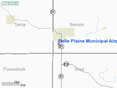
Belle Plaine Municipal Airport |
|
|
Location
& QuickFacts
|
FAA Information Effective: |
2007-07-05 |
|
Airport
Identifier: |
TZT |
|
Airport
Status: |
Operational |
|
Longitude/Latitude: |
092-17-04.4500W/41-52-43.6000N
-92.284569/41.878778 (Estimated) |
|
Elevation: |
771 ft / 235.00 m (Surveyed) |
|
Land: |
96
acres |
|
From
nearest city: |
1 nautical miles SW of Belle Plaine, IA |
|
Location: |
Benton County, IA |
|
Magnetic Variation: |
02E (1995) |
Owner
& Manager
|
Ownership: |
Publicly owned |
|
Owner: |
City Of Belle Plaine |
|
Address: |
8th Ave & 13th St.
Belle Plaine, IA 52208 |
|
Phone
number: |
319-444-2200 |
|
Manager: |
Glenn Speas |
|
Address: |
200 Air Park Dr
Belle Plaine, IA 52208 |
|
Phone number: |
319-434-6158 |
Airport
Operations and Facilities
|
Airport Use: |
Open to public |
|
Wind
indicator: |
Yes |
|
Segmented
Circle: |
Yes |
|
Control
Tower: |
No |
|
Lighting
Schedule: |
RDO-CTL
ACTVT ROTG BCN - 122.8. |
|
Beacon
Color: |
Clear-Green (lighted land airport) |
|
Sectional
chart: |
Chicago |
|
Region: |
ACE - Central |
|
Boundary
ARTCC: |
ZAU - Chicago |
|
Tie-in
FSS: |
FOD - Fort Dodge |
|
FSS
on Airport: |
No |
|
FSS
Phone: |
515-955-8114 |
|
FSS
Toll Free: |
1-800-WX-BRIEF |
|
NOTAMs
Facility: |
FOD (NOTAM-d service avaliable) |
|
Federal Agreements: |
N |
Airport
Communications
Airport
Services
|
Fuel available: |
100LLA |
|
Airframe Repair: |
MINOR |
|
Power Plant Repair: |
MINOR |
|
Runway Information
Runway 18/36
|
Dimension: |
4000 x 75 ft / 1219.2 x 22.9 m |
|
Surface: |
CONC, Good Condition |
|
Edge
Lights: |
Medium |
|
|
Runway 18 |
Runway 36 |
|
Longitude: |
092-17-05.6660W |
092-17-03.1650W |
|
Latitude: |
41-53-03.4910N |
41-52-23.7920N |
|
Elevation: |
771.00
ft |
771.00
ft |
|
Traffic
Pattern: |
Left |
Left |
|
Markings: |
Non-precision instrument, Fair Condition |
Non-precision instrument, Fair Condition |
|
Obstruction: |
78 ft bldg, 2500.0 ft from runway, 29:1 slope
to clear |
46 ft tree, 994.0 ft from runway, 254 ft left
of centerline, 17:1 slope to clear |
|
Radio Navigation
Aids
|
ID |
Type |
Name |
Ch |
Freq |
Var |
Dist |
|
TZT |
NDB |
Belle Plaine |
|
371.00 |
02E |
0.4 nm |
|
GGI |
NDB |
Grinnell |
|
248.00 |
02E |
22.4 nm |
|
VTI |
NDB |
Garrison |
|
338.00 |
03E |
23.7 nm |
|
MIW |
NDB |
Marshalltown |
|
239.00 |
03E |
31.5 nm |
|
IIB |
NDB |
Wapsie |
|
206.00 |
02E |
37.5 nm |
|
OOA |
NDB |
Oskaloosa |
|
414.00 |
03E |
40.3 nm |
|
PEA |
NDB |
Pella |
|
257.00 |
02E |
41.1 nm |
|
AWG |
NDB |
Washington |
|
219.00 |
02E |
45.3 nm |
|
CID |
VOR/DME |
Cedar Rapids |
088X |
114.10 |
05E |
22.3 nm |
|
JWJ |
VOR/DME |
Elmwood |
031X |
109.40 |
03E |
31.2 nm |
|
TNU |
VOR/DME |
Newton |
072X |
112.50 |
03E |
37.4 nm |
|
IOW |
VORTAC |
Iowa City |
109X |
116.20 |
05E |
37.1 nm |
|
ALO |
VORTAC |
Waterloo |
059X |
112.20 |
06E |
41.1 nm |
Remarks
- TREES
ON BOTH SIDES OF APPROACH TO RY 35 PENETRATE THE RY TRANSITIONAL SFC.
- BIRDS
ON & INVOF ARPT.
- DETERMINATION
PENDING.
Based
Aircraft
|
Aircraft
based on field: |
11 |
|
Single
Engine Airplanes: |
6 |
|
Ultralights: |
5 |
Operational Statistics
Time Period: 2004-08-20
- 2005-08-19
|
Aircraft
Operations: |
47/Week |
|
General
Aviation Local: |
57.8% |
|
General
Aviation Itinerant: |
42.2% |
Belle Plaine Municipal Airport
Address:
Benton County, IA
Tel:
319-444-2200,
319-434-6158
Images
and information placed above are from
http://www.airport-data.com/airport/TZT/
We
thank them for the data!
| General
Info |
| Country |
United
States |
| State |
IOWA
|
| FAA ID |
TZT
|
| Latitude |
41-52-43.600N
|
| Longitude |
092-17-04.450W
|
| Elevation |
771 feet
|
| Near City |
BELLE
PLAINE |
We don't guarantee the information is fresh and accurate. The data may
be wrong or outdated.
For more up-to-date information please refer to other sources.
|
|


