 |
|
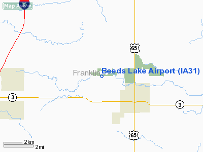
Location
& QuickFacts
|
FAA Information Effective: |
2007-07-05 |
|
Airport
Identifier: |
IA31 |
|
Airport
Status: |
Operational |
|
Longitude/Latitude: |
093-14-45.7270W/42-45-59.9000N
-93.246035/42.766639 (Estimated) |
|
Elevation: |
1148 ft / 349.91 m (Surveyed) |
|
Land: |
78
acres |
|
From
nearest city: |
3 nautical miles NW of Hampton, IA |
|
Location: |
Franklin County, IA |
|
Magnetic Variation: |
03E (1985) |
Owner
& Manager
|
Ownership: |
Privately owned |
|
Owner: |
Edward Doyle |
|
Address: |
Hampton Reminder
Hampton, IA 50441 |
|
Phone
number: |
515-456-4512 |
|
Manager: |
Edward Doyle |
|
Address: |
903 2nd Ave Se
Hampton, IA 50441 |
|
Phone number: |
515-456-4512 |
Airport
Operations and Facilities
|
Airport Use: |
Private |
|
Wind indicator: |
Yes |
|
Segmented Circle: |
No |
|
Control Tower: |
No |
|
Landing fee charge: |
No |
|
Sectional chart: |
Omaha |
|
Region: |
ACE - Central |
|
Boundary ARTCC: |
ZMP - Minneapolis |
|
Tie-in FSS: |
FOD - Fort Dodge |
|
FSS on Airport: |
No |
|
FSS Phone: |
515-955-8114 |
|
FSS Toll Free: |
1-800-WX-BRIEF |
Airport
Services
|
Airframe Repair: |
NONE |
|
Power Plant Repair: |
NONE |
|
Runway Information
Runway 11/29
|
Dimension: |
2390 x 170 ft / 728.5 x 51.8 m |
|
Surface: |
TURF, Good Condition |
|
|
Runway 11 |
Runway 29 |
|
Traffic
Pattern: |
Left |
Left |
|
Obstruction: |
70 ft trees, 100.0 ft from runway, 1:1 slope
to clear |
20 ft road, 60.0 ft from runway, 3:1 slope
to clear |
|
Radio Navigation
Aids
|
ID |
Type |
Name |
Ch |
Freq |
Var |
Dist |
|
HPT |
NDB |
Hampton |
|
230.00 |
03E |
2.6 nm |
|
IFA |
NDB |
Iowa Falls |
|
368.00 |
03E |
17.5 nm |
|
CAV |
NDB |
Clarion |
|
387.00 |
03E |
22.7 nm |
|
EAG |
NDB |
Eagle Grove |
|
302.00 |
03E |
29.5 nm |
|
IY |
NDB |
Chukk |
|
417.00 |
03E |
31.7 nm |
|
FXY |
NDB |
Forest City |
|
359.00 |
05E |
32.6 nm |
|
CCY |
NDB |
Charles City |
|
375.00 |
03E |
33.4 nm |
|
EBS |
NDB |
Webster City |
|
323.00 |
03E |
33.8 nm |
|
MIW |
NDB |
Marshalltown |
|
239.00 |
03E |
42.1 nm |
|
AXA |
NDB |
Algona |
|
403.00 |
03E |
49.0 nm |
|
JWJ |
VOR/DME |
Elmwood |
031X |
109.40 |
03E |
42.1 nm |
|
MCW |
VORTAC |
Mason City |
096X |
114.90 |
06E |
20.1 nm |
|
ALO |
VORTAC |
Waterloo |
059X |
112.20 |
06E |
39.5 nm |
|
FOD |
VORTAC |
Fort Dodge |
082X |
113.50 |
07E |
47.3 nm |
Remarks
- NO
SNOW REMOVAL - CALL FOR CONDITIONS - 515-456-4512.
Based
Aircraft
|
Aircraft
based on field: |
7 |
|
Single
Engine Airplanes: |
6 |
|
Multi
Engine Airplanes: |
1 |
Operational Statistics
Time Period: 1992-06-23
- 1993-06-22
|
Aircraft
Operations: |
77/Week |
|
General
Aviation Local: |
50.0% |
|
General
Aviation Itinerant: |
50.0% |
Beeds Lake Airport
Address:
Franklin County, IA
Tel:
515-456-4512
Images
and information placed above are from
http://www.airport-data.com/airport/IA31/
We
thank them for the data!
| General
Info |
| Country |
United
States |
| State |
IOWA
|
| FAA ID |
IA31
|
| Latitude |
42-45-59.900N
|
| Longitude |
093-14-45.727W
|
| Elevation |
1148 feet
|
| Near City |
HAMPTON
|
We don't guarantee the information is fresh and accurate. The data may
be wrong or outdated.
For more up-to-date information please refer to other sources.
|
|


