 |
|
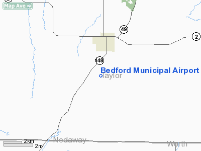
Bedford Municipal Airport |
|
|
Location
& QuickFacts
|
FAA Information Effective: |
2007-07-05 |
|
Airport
Identifier: |
Y46 |
|
Airport
Status: |
Operational |
|
Longitude/Latitude: |
094-43-45.8880W/40-38-15.9560N
-94.729413/40.637766 (Estimated) |
|
Elevation: |
1201 ft / 366.06 m (Surveyed) |
|
Land: |
83
acres |
|
From
nearest city: |
2 nautical miles S of Bedford, IA |
|
Location: |
Taylor County, IA |
|
Magnetic Variation: |
05E (1985) |
Owner
& Manager
|
Ownership: |
Publicly owned |
|
Owner: |
City Of Bedford |
|
Address: |
621 Court
Bedford, IA 50833 |
|
Phone
number: |
712-523-2210 |
|
Manager: |
Jerry Schweitzer
AFT HRS CALL 712-523-2385. |
|
Address: |
502 Jefferson
Bedford, IA 50833 |
|
Phone number: |
712-523-2385 |
Airport
Operations and Facilities
|
Airport Use: |
Open to public |
|
Wind
indicator: |
Yes |
|
Segmented
Circle: |
No |
|
Control
Tower: |
No |
|
Landing
fee charge: |
No |
|
Sectional
chart: |
Omaha |
|
Region: |
ACE - Central |
|
Boundary
ARTCC: |
ZMP - Minneapolis |
|
Tie-in
FSS: |
FOD - Fort Dodge |
|
FSS
on Airport: |
No |
|
FSS
Phone: |
515-955-8114 |
|
FSS
Toll Free: |
1-800-WX-BRIEF |
|
NOTAMs
Facility: |
FOD (NOTAM-d service avaliable) |
Airport
Communications
Airport
Services
|
Airframe Repair: |
NONE |
|
Power Plant Repair: |
NONE |
|
Runway Information
Runway 18/36
|
Dimension: |
2710 x 100 ft / 826.0 x 30.5 m |
|
Surface: |
TURF, Good Condition |
|
|
Runway 18 |
Runway 36 |
|
Traffic
Pattern: |
Left |
Left |
|
Obstruction: |
10 ft tree, 277.0 ft from runway, 22 ft left
of centerline, 27:1 slope to clear |
, 50:1 slope to clear |
|
Radio Navigation
Aids
|
ID |
Type |
Name |
Ch |
Freq |
Var |
Dist |
|
ICL |
NDB |
Clarinda |
|
353.00 |
04E |
14.6 nm |
|
EVU |
NDB |
Emville |
|
317.00 |
05E |
19.4 nm |
|
CRZ |
NDB |
Corning |
|
278.00 |
04E |
21.6 nm |
|
UNE |
NDB |
Union County |
|
379.00 |
04E |
25.9 nm |
|
SDA |
NDB |
Shenandoah |
|
411.00 |
05E |
31.7 nm |
|
RDK |
NDB |
Red Oak |
|
230.00 |
04E |
32.9 nm |
|
GFZ |
NDB |
Greenfield |
|
338.00 |
04E |
43.3 nm |
|
AZN |
NDB |
Amazon |
|
233.00 |
06E |
46.0 nm |
|
AIO |
NDB |
Atlantic |
|
365.00 |
04E |
48.2 nm |
|
LMN |
VORTAC |
Lamoni |
114X |
116.70 |
07E |
34.8 nm |
|
STJ |
VORTAC |
St Joseph |
102X |
115.50 |
08E |
41.7 nm |
Remarks
- SHARP
DROP AT BOTH ENDS RY 18/36.
- ARPT
CONSTRUCTED PRIOR TO 1958.
Based
Aircraft
|
Aircraft
based on field: |
8 |
|
Single
Engine Airplanes: |
6 |
|
Helicopters: |
1 |
|
Ultralights: |
1 |
Operational Statistics
Time Period: 2003-06-20
- 2004-06-18
|
Aircraft
Operations: |
15/Week |
|
General
Aviation Local: |
33.3% |
|
General
Aviation Itinerant: |
66.7% |
Bedford Municipal Airport
Address:
Taylor County, IA
Tel:
712-523-2210,
712-523-2385
Images
and information placed above are from
http://www.airport-data.com/airport/Y46/
We
thank them for the data!
| General
Info |
| Country |
United
States |
| State |
IOWA
|
| FAA ID |
Y46
|
| Latitude |
40-38-15.956N
|
| Longitude |
094-43-45.888W
|
| Elevation |
1201 feet
|
| Near City |
BEDFORD
|
We don't guarantee the information is fresh and accurate. The data may
be wrong or outdated.
For more up-to-date information please refer to other sources.
|
|


