 |
|
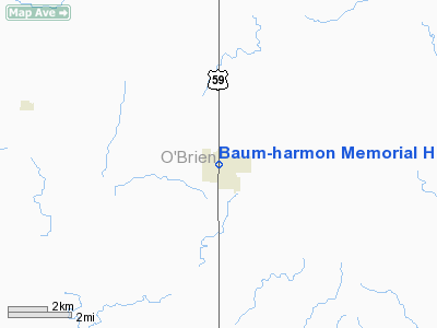
Baum-Harmon Memorial Hospital Heliport |
Location
& QuickFacts
|
FAA Information Effective: |
2007-07-05 |
|
Airport
Identifier: |
IA96 |
|
Airport
Status: |
Operational |
|
Longitude/Latitude: |
095-37-26.0350W/43-05-17.9170N
-95.623899/43.088310 (Estimated) |
|
Elevation: |
1520 ft / 463.30 m (Estimated) |
|
Land: |
0
acres |
|
From
nearest city: |
0 nautical miles N of Primghar, IA |
|
Location: |
O Brien County, IA |
|
Magnetic Variation: |
06E (1985) |
Owner
& Manager
|
Ownership: |
Publicly owned |
|
Owner: |
Baum Harmon Memorial Hospital |
|
Address: |
255 North Welch Ave
Primghar, IA 51245 |
|
Phone
number: |
712-757-3905 |
|
Manager: |
Baum Harmon Memorial Hospital |
|
Address: |
255 North Welch Ave
Primghar, IA 51245 |
|
Phone number: |
712-757-3905 |
Airport
Operations and Facilities
|
Airport Use: |
Private
MEDICAL USE. |
|
Wind
indicator: |
Yes |
|
Segmented
Circle: |
No |
|
Control
Tower: |
No |
|
Sectional
chart: |
Omaha |
|
Region: |
ACE - Central |
|
Boundary
ARTCC: |
ZMP - Minneapolis |
|
Tie-in
FSS: |
FOD - Fort Dodge |
|
FSS
Phone: |
515-955-8114 |
|
FSS
Toll Free: |
1-800-WX-BRIEF |
|
Runway Information
Helipad H1
|
Dimension: |
60 x 60 ft / 18.3 x 18.3 m |
|
Surface: |
CONC, |
|
|
Runway H1 |
Runway |
|
Traffic
Pattern: |
Left |
Left |
|
Radio Navigation
Aids
|
ID |
Type |
Name |
Ch |
Freq |
Var |
Dist |
|
SHL |
NDB |
Sheldon |
|
338.00 |
05E |
11.9 nm |
|
ISB |
NDB |
Sibley |
|
269.00 |
05E |
17.7 nm |
|
ORC |
NDB |
Orange City |
|
521.00 |
05E |
20.0 nm |
|
CKP |
NDB |
Pilot Rock |
|
423.00 |
05E |
21.6 nm |
|
LTU |
NDB |
Little Sioux |
|
326.00 |
05E |
21.7 nm |
|
SOY |
NDB |
Sioux Center |
|
368.00 |
06E |
25.0 nm |
|
SLB |
NDB |
Storm Lake |
|
434.00 |
04E |
33.8 nm |
|
EGQ |
NDB |
Emmetsburg |
|
410.00 |
04E |
40.2 nm |
|
PUF |
NDB |
Puff |
|
345.00 |
04E |
41.9 nm |
|
MJQ |
NDB |
Jackson |
|
353.00 |
04E |
43.6 nm |
|
POH |
NDB |
Pocahontas |
|
428.00 |
06E |
47.6 nm |
|
EST |
VOR |
Estherville |
|
110.40 |
07E |
43.1 nm |
|
DDL |
VOR/DME |
Sheldon |
023X |
108.60 |
05E |
11.8 nm |
|
SPW |
VOR/DME |
Spencer |
037X |
110.00 |
05E |
19.1 nm |
|
OTG |
VOR/DME |
Worthington |
043X |
110.60 |
08E |
33.6 nm |
Remarks
- OWNER
DESIRES ARPT NOT BE CHARTED.
- PRVDD
CLEAR APCH/DEP PATHS FOR AN 8:1 GLIDE SLOPE & TRANSITIONAL SURFACE
FOR A 2:1 SLOPE ARE MAINTAINED.
Baum-harmon Memorial Hospital Heliport
Address:
O Brien County, IA
Tel:
712-757-3905
Images
and information placed above are from
http://www.airport-data.com/airport/IA96/
We
thank them for the data!
| General
Info |
| Country |
United
States |
| State |
IOWA
|
| FAA ID |
IA96
|
| Latitude |
43-05-17.917N
|
| Longitude |
095-37-26.035W
|
| Elevation |
1520 feet
|
| Near City |
PRIMGHAR
|
We don't guarantee the information is fresh and accurate. The data may
be wrong or outdated.
For more up-to-date information please refer to other sources.
|
|


