 |
|
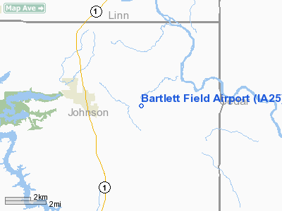
Location
& QuickFacts
|
FAA Information Effective: |
2007-07-05 |
|
Airport
Identifier: |
IA25 |
|
Airport
Status: |
Operational |
|
Longitude/Latitude: |
091-26-23.6090W/41-48-02.0490N
-91.439891/41.800569 (Estimated) |
|
Elevation: |
820 ft / 249.94 m (Estimated) |
|
Land: |
0
acres |
|
From
nearest city: |
3 nautical miles E of Solon, IA |
|
Location: |
Johnson County, IA |
|
Magnetic Variation: |
02E (1985) |
Owner
& Manager
|
Ownership: |
Privately owned |
|
Owner: |
James Bartlett |
|
Address: |
4926 180th St. Ne
Solon, IA 52333 |
|
Phone number: |
319-644-3760 |
|
Manager: |
James Bartlett |
|
Address: |
Route 1
Solon, IA 52333 |
|
Phone number: |
319-644-3760 |
Airport
Operations and Facilities
|
Airport Use: |
Private |
|
Wind indicator: |
Yes |
|
Segmented Circle: |
No |
|
Control Tower: |
No |
|
Landing fee charge: |
No |
|
Sectional chart: |
Chicago |
|
Region: |
ACE - Central |
|
Boundary ARTCC: |
ZAU - Chicago |
|
Tie-in FSS: |
FOD - Fort Dodge |
|
FSS on Airport: |
No |
|
FSS Phone: |
515-955-8114 |
|
FSS Toll Free: |
1-800-WX-BRIEF |
Airport
Services
|
Airframe Repair: |
NONE |
|
Power Plant Repair: |
NONE |
|
Runway
Information
Runway E/W
|
Dimension: |
2500 x 100 ft / 762.0 x 30.5 m |
|
Surface: |
TURF, |
|
|
Runway E |
Runway W |
|
Traffic
Pattern: |
Left |
Left |
|
Radio Navigation
Aids
|
ID |
Type |
Name |
Ch |
Freq |
Var |
Dist |
|
MXO |
NDB |
Monticello |
|
397.00 |
01E |
27.6 nm |
|
AWG |
NDB |
Washington |
|
219.00 |
02E |
33.0 nm |
|
OQW |
NDB |
Maquoketa |
|
386.00 |
02E |
34.7 nm |
|
VTI |
NDB |
Garrison |
|
338.00 |
03E |
36.2 nm |
|
TZT |
NDB |
Belle Plaine |
|
371.00 |
02E |
38.1 nm |
|
IIB |
NDB |
Wapsie |
|
206.00 |
02E |
45.3 nm |
|
CWI |
NDB |
Clinton |
|
377.00 |
01E |
49.9 nm |
|
CID |
VOR/DME |
Cedar Rapids |
088X |
114.10 |
05E |
16.3 nm |
|
DDD |
VOR/DME |
Port City |
112X |
116.50 |
01E |
29.2 nm |
|
IOW |
VORTAC |
Iowa City |
109X |
116.20 |
05E |
18.6 nm |
|
CVA |
VORTAC |
Davenport |
085X |
113.80 |
04E |
43.2 nm |
|
MZV |
VORTAC |
Moline |
091X |
114.40 |
05E |
46.2 nm |
|
DBQ |
VORTAC |
Dubuque |
105X |
115.80 |
04E |
48.7 nm |
|
DVN |
VOT |
Davenport Municipal |
|
111.80 |
|
40.0 nm |
Based
Aircraft
|
Aircraft
based on field: |
1 |
|
Single
Engine Airplanes: |
1 |
Bartlett Field Airport
Address:
Johnson County, IA
Tel:
319-644-3760
Images
and information placed above are from
http://www.airport-data.com/airport/IA25/
We
thank them for the data!
| General
Info |
| Country |
United
States |
| State |
IOWA
|
| FAA ID |
IA25
|
| Latitude |
41-48-02.049N
|
| Longitude |
091-26-23.609W
|
| Elevation |
820 feet
|
| Near City |
SOLON
|
We don't guarantee the information is fresh and accurate. The data may
be wrong or outdated.
For more up-to-date information please refer to other sources.
|
|


