 |
|
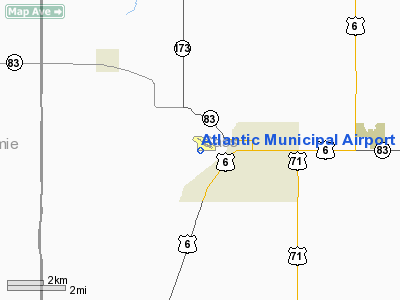
Atlantic Municipal Airport |
|
|
Location
& QuickFacts
|
FAA Information Effective: |
2007-07-05 |
|
Airport
Identifier: |
AIO |
|
Airport
Status: |
Operational |
|
Longitude/Latitude: |
095-02-55.4770W/41-24-13.8300N
-95.048744/41.403842 (Estimated) |
|
Elevation: |
1182 ft / 360.27 m (Surveyed) |
|
Land: |
127 acres |
|
From
nearest city: |
2 nautical miles W of Atlantic, IA |
|
Location: |
Cass County, IA |
|
Magnetic Variation: |
04E (1995) |
Owner
& Manager
|
Ownership: |
Publicly owned |
|
Owner: |
City Of Atlantic |
|
Address: |
23 E. 4th St.
Atlantic, IA 50022 |
|
Phone number: |
712-243-4810 |
|
Manager: |
Robt. Petis |
|
Address: |
59706 Highland Rd
Atlantic, IA 50022 |
|
Phone number: |
712-243-3056 |
Airport
Operations and Facilities
|
Airport Use: |
Open to public |
|
Wind
indicator: |
Yes |
|
Segmented
Circle: |
No |
|
Control
Tower: |
No |
|
Lighting
Schedule: |
DUSK-DAWN
ACTVT MIRL RYS 02/20 &12/30 & REIL RYS 12 &
30 - CTAF. |
|
Beacon
Color: |
Clear-Green (lighted land airport) |
|
Landing
fee charge: |
No |
|
Sectional
chart: |
Omaha |
|
Region: |
ACE - Central |
|
Traffic
Pattern Alt: |
800 ft |
|
Boundary
ARTCC: |
ZMP - Minneapolis |
|
Tie-in
FSS: |
FOD - Fort Dodge |
|
FSS
on Airport: |
No |
|
FSS
Phone: |
515-955-8114 |
|
FSS
Toll Free: |
1-800-WX-BRIEF |
|
NOTAMs
Facility: |
AIO (NOTAM-d service avaliable) |
|
Federal Agreements: |
N1 |
Airport
Communications
|
CTAF: |
122.700 |
|
Unicom: |
122.700 |
Airport
Services
|
Fuel available: |
100LL |
|
Airframe Repair: |
MINOR |
|
Power Plant Repair: |
MINOR |
|
Bottled
Oxygen: |
NONE |
|
Bulk
Oxygen: |
NONE |
|
Runway Information
Runway 02/20
|
Dimension: |
5000 x 75 ft / 1524.0 x 22.9 m |
|
Surface: |
CONC, |
|
Edge
Lights: |
Medium |
|
|
Runway 02 |
Runway 20 |
|
Longitude: |
095-03-14.6554W |
095-02-50.3054W |
|
Latitude: |
41-23-42.6613N |
41-24-28.5301N |
|
Elevation: |
1145.00
ft |
1149.00
ft |
|
Alignment: |
22 |
127 |
|
Traffic
Pattern: |
Left |
Left |
|
Runway 12/30
|
Dimension: |
3133 x 75 ft / 954.9 x 22.9 m |
|
Surface: |
ASPH, Good Condition |
|
Weight
Limit: |
Single wheel: 12500 lbs. |
|
Edge
Lights: |
Medium |
|
|
Runway 12 |
Runway 30 |
|
Longitude: |
095-03-01.5287W |
095-02-27.0686W |
|
Latitude: |
41-24-35.4117N |
41-24-18.5370N |
|
Elevation: |
1165.00
ft |
1144.00
ft |
|
Alignment: |
123 |
127 |
|
Traffic
Pattern: |
Left |
Left |
|
Markings: |
Non-precision instrument, Good Condition |
Non-precision instrument, Good Condition |
|
Displaced
threshold: |
290.00
ft |
0.00 ft |
|
VASI: |
pulsating/steady burning on left side |
pulsating/steady burning on left side |
|
Runway
End Identifier: |
Yes
REIL OTS INDEFLY. |
Yes |
|
Obstruction: |
52 ft tree, 469.0 ft from runway, 126 ft right
of centerline, 5:1 slope to clear
APCH SLOPE 20:1 TO DSPLCD THLD. |
19 ft road, 735.0 ft from runway, 190 ft left
of centerline, 28:1 slope to clear
RY 30 - 10 FT TREE @ 170 FT - 100 FT R. |
|
Decleard
distances: |
Take off run available 3133.00 ft
Take off distance available 3133.00 ft
Actual stop distance available 3133.00 ft
Landing distance available 2843.00 ft |
Take off run available 3133.00 ft
Take off distance available 3133.00 ft
Actual stop distance available 2893.00 ft
Landing distance available 2893.00 ft |
|
Radio Navigation
Aids
|
ID |
Type |
Name |
Ch |
Freq |
Var |
Dist |
|
AIO |
NDB |
Atlantic |
|
365.00 |
04E |
0.1 nm |
|
HNR |
NDB |
Harlan |
|
272.00 |
05E |
16.8 nm |
|
ADU |
NDB |
Audubon |
|
266.00 |
04E |
18.3 nm |
|
RDK |
NDB |
Red Oak |
|
230.00 |
04E |
25.1 nm |
|
GFZ |
NDB |
Greenfield |
|
338.00 |
04E |
27.7 nm |
|
CRZ |
NDB |
Corning |
|
278.00 |
04E |
27.8 nm |
|
GCT |
NDB |
Guthrie Center |
|
518.00 |
05E |
32.3 nm |
|
DNS |
NDB |
Denison |
|
350.00 |
04E |
37.9 nm |
|
CIN |
NDB |
Carroll |
|
397.00 |
04E |
40.3 nm |
|
ICL |
NDB |
Clarinda |
|
353.00 |
04E |
40.7 nm |
|
OM |
NDB |
Gerfi |
|
320.00 |
05E |
41.0 nm |
|
UNE |
NDB |
Union County |
|
379.00 |
04E |
41.6 nm |
|
SDA |
NDB |
Shenandoah |
|
411.00 |
05E |
42.4 nm |
|
PRO |
NDB |
Perry |
|
251.00 |
06E |
47.4 nm |
|
PMV |
NDB |
Plattsmouth |
|
329.00 |
06E |
47.9 nm |
|
EFW |
NDB |
Jefferson |
|
391.00 |
03E |
48.4 nm |
|
MLE |
NDB |
Millard |
|
371.00 |
06E |
49.7 nm |
|
OFF |
TACAN |
Offutt |
054X |
|
05E |
42.1 nm |
|
OVR |
VORTAC |
Omaha |
110X |
116.30 |
08E |
34.2 nm |
|
OMA |
VOT |
Omaha |
|
109.00 |
|
38.4 nm |
Remarks
- CREEK
200 FT FM RY END 30.
- MODEL
AIRPLANE ACTVTY.
Based
Aircraft
|
Aircraft
based on field: |
24 |
|
Single
Engine Airplanes: |
19 |
|
Multi
Engine Airplanes: |
2 |
|
Ultralights: |
3 |
Operational Statistics
Time Period: 2003-10-23
- 2004-10-21
|
Aircraft
Operations: |
97/Week |
|
General
Aviation Local: |
61.8% |
|
General
Aviation Itinerant: |
38.2% |
Atlantic Municipal Airport
Address:
Cass County, IA
Tel:
712-243-4810, 712-243-3056
Images
and information placed above are from
http://www.airport-data.com/airport/AIO/
We
thank them for the data!
| General
Info |
| Country |
United
States |
| State |
IOWA
|
| FAA ID |
AIO
|
| Latitude |
41-24-26.162N
|
| Longitude |
095-02-48.863W
|
| Elevation |
1182 feet
|
| Near City |
ATLANTIC
|
We don't guarantee the information is fresh and accurate. The data may
be wrong or outdated.
For more up-to-date information please refer to other sources.
|
|


