 |
|
| Ames Municipal Airport |
| IATA: AMW â ICAO: KAMW â FAA LID: AMW |
| Summary |
| Airport type |
Public |
| Owner |
City of Ames |
| Serves |
Ames, Iowa |
| Location |
2 miles SE |
| Coordinates |
41°59â²31â³N 93°37â²18â³W / 41.99194°N 93.62167°W / 41.99194; -93.62167 |
| Runways |
| Direction |
Length |
Surface |
| ft |
m |
| 1/19 |
5,701 |
1,738 |
Asphalt |
| 13/31 |
3,491 |
1,064 |
Concrete |
| Statistics (2006) |
| Aircraft operations |
33,751 |
| Based aircraft |
70 |
| Source: Federal Aviation Administration |
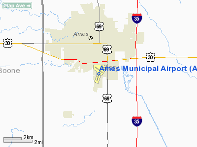
Ames Municipal Airport (IATA: AMW, ICAO: KAMW, FAA LID: AMW) is a city-owned, public-use airport located two miles (3 km) southeast of the central business district of Ames, a city in Story County, Iowa, United States.
Facilities and aircraft
Ames Municipal Airport covers an area of 700 acres (283 ha) which contains an asphalt paved runway 1/19 measuring 5,701 x 100 ft (1,738 x 30 m) and a concrete runway 13/31 measuring 3,491 x 75 ft (1,064 x 30 m).
For the 12-month period ending September 30, 2009, the airport had 33,751 aircraft operations: 94% general aviation, 5% air taxi and 1% military. There are 70 aircraft based at the airport: 63% single-engine, 14% multi-engine, 0% jet, 19% glider and 4% ultralight.
From May 10, 2010 through June 11, 2010, there were between five and six arrivals/departures at Ames each day.
According to NTSB records, the airport has had no fatal accidents since 1962 (the earliest year which can be searched in their database).
The above content comes from Wikipedia and is published under free licenses – click here to read more.
Location
& QuickFacts
|
FAA Information Effective: |
2007-07-05 |
|
Airport
Identifier: |
AMW |
|
Airport
Status: |
Operational |
|
Longitude/Latitude: |
093-37-18.5580W/41-59-31.3620N
-93.621822/41.992045 (Estimated) |
|
Elevation: |
955 ft / 291.08 m (Surveyed) |
|
Land: |
700 acres |
|
From
nearest city: |
2 nautical miles SE of Ames, IA |
|
Location: |
Story County, IA |
|
Magnetic Variation: |
03E (2000) |
Owner
& Manager
|
Ownership: |
Publicly owned |
|
Owner: |
City Of Ames |
|
Address: |
515 Clark Ave
Ames, IA 50010 |
|
Phone number: |
515-239-5160 |
|
Manager: |
Steve Salvo |
|
Address: |
515 Clark Ave
Ames, IA 50010 |
|
Phone number: |
515-239-5279 |
Airport
Operations and Facilities
|
Airport Use: |
Open to public |
|
Wind
indicator: |
Yes |
|
Segmented
Circle: |
Yes |
|
Control
Tower: |
No |
|
Lighting
Schedule: |
DUSK-DAWN
ACTVT MIRL RYS 01/19 & 13/31; MALSR RY 01; VASI RYS
13 & 31 & 19 - 126.0. |
|
Beacon
Color: |
Clear-Green (lighted land airport) |
|
Landing
fee charge: |
No |
|
Sectional
chart: |
Omaha |
|
Region: |
ACE - Central |
|
Boundary
ARTCC: |
ZMP - Minneapolis |
|
Tie-in
FSS: |
FOD - Fort Dodge |
|
FSS
on Airport: |
No |
|
FSS
Phone: |
515-955-8114 |
|
FSS
Toll Free: |
1-800-WX-BRIEF |
|
NOTAMs
Facility: |
AMW (NOTAM-d service avaliable) |
|
Federal Agreements: |
NGY |
Airport
Communications
|
CTAF: |
122.700 |
|
Unicom: |
122.700 |
Airport
Services
|
Fuel available: |
100
A |
|
Airframe Repair: |
MAJOR |
|
Power Plant Repair: |
MAJOR |
|
Bottled
Oxygen: |
NONE |
|
Runway Information
Runway 01/19
|
Dimension: |
5700 x 100 ft / 1737.4 x 30.5 m |
|
Surface: |
ASPH, Good Condition |
|
Weight
Limit: |
Single wheel: 30000 lbs.
Dual wheel: 38000 lbs. |
|
Edge
Lights: |
Medium |
|
|
Runway 01 |
Runway 19 |
|
Longitude: |
093-37-29.1250W |
093-37-07.5620W |
|
Latitude: |
41-58-57.7300N |
41-59-51.6940N |
|
Elevation: |
955.00
ft |
919.00
ft |
|
Alignment: |
17 |
127 |
|
ILS
Type: |
ILS |
|
|
Traffic
Pattern: |
Right |
Left |
|
Markings: |
Precision instrument, Good Condition |
Non-precision instrument, Good Condition |
|
Crossing
Height: |
0.00 ft |
40.00
ft |
|
VASI: |
|
4-box on left side |
|
Visual
Glide Angle: |
0.00° |
3.00° |
|
Approach
lights: |
MALSR |
|
|
Obstruction: |
78 ft tree, 2380.0 ft from runway, 350 ft left
of centerline, 27:1 slope to clear |
87 ft tree, 2400.0 ft from runway, 345 ft left
of centerline, 25:1 slope to clear |
|
Runway 13/31
|
Dimension: |
3492 x 100 ft / 1064.4 x 30.5 m |
|
Surface: |
ASPH, Good Condition |
|
Weight
Limit: |
Single wheel: 17000 lbs. |
|
Edge
Lights: |
Medium |
|
|
Runway 13 |
Runway 31 |
|
Longitude: |
093-37-34.9140W |
093-37-02.9040W |
|
Latitude: |
41-59-54.6640N |
41-59-29.7690N |
|
Elevation: |
925.00
ft |
920.00
ft |
|
Alignment: |
127 |
127 |
|
Traffic
Pattern: |
Right |
Left |
|
Markings: |
Non-precision instrument, Good Condition |
Non-precision instrument, Good Condition |
|
Crossing
Height: |
43.00
ft |
36.00
ft |
|
VASI: |
4-box on left side |
4-box on left side |
|
Visual
Glide Angle: |
3.00° |
3.00° |
|
Obstruction: |
84 ft tree, 2750.0 ft from runway, 112 ft right
of centerline, 30:1 slope to clear |
42 ft tree, 1225.0 ft from runway, 575 ft right
of centerline, 24:1 slope to clear |
|
Radio Navigation
Aids
|
ID |
Type |
Name |
Ch |
Freq |
Var |
Dist |
|
BNW |
NDB |
Boone |
|
407.00 |
03E |
11.0 nm |
|
IKV |
NDB |
Ankeny |
|
275.00 |
03E |
17.8 nm |
|
PRO |
NDB |
Perry |
|
251.00 |
06E |
26.0 nm |
|
EBS |
NDB |
Webster City |
|
323.00 |
03E |
29.2 nm |
|
EFW |
NDB |
Jefferson |
|
391.00 |
03E |
32.2 nm |
|
MIW |
NDB |
Marshalltown |
|
239.00 |
03E |
32.2 nm |
|
IFA |
NDB |
Iowa Falls |
|
368.00 |
03E |
33.2 nm |
|
GCT |
NDB |
Guthrie Center |
|
518.00 |
05E |
40.8 nm |
|
GGI |
NDB |
Grinnell |
|
248.00 |
02E |
43.4 nm |
|
EAG |
NDB |
Eagle Grove |
|
302.00 |
03E |
44.9 nm |
|
CAV |
NDB |
Clarion |
|
387.00 |
03E |
45.7 nm |
|
PEA |
NDB |
Pella |
|
257.00 |
02E |
46.6 nm |
|
HPT |
NDB |
Hampton |
|
230.00 |
03E |
47.5 nm |
|
OXV |
NDB |
Knoxville |
|
284.00 |
03E |
47.7 nm |
|
TNU |
VOR/DME |
Newton |
072X |
112.50 |
03E |
26.1 nm |
|
JWJ |
VOR/DME |
Elmwood |
031X |
109.40 |
03E |
32.6 nm |
|
DSM |
VORTAC |
Des Moines |
122X |
117.50 |
07E |
33.4 nm |
|
FOD |
VORTAC |
Fort Dodge |
082X |
113.50 |
07E |
47.7 nm |
|
DSM |
VOT |
Des Moines |
|
109.20 |
|
27.3 nm |
Remarks
- BE
ALERT FOR GLIDER & ULTRALIGHT OPNS INVOF ARPT.
- BIRD
ACTIVITY ON & INVOF ARPT SPRING & FALL.
- RY
01 IS CALM WIND RY.
Based
Aircraft
|
Aircraft
based on field: |
66 |
|
Single
Engine Airplanes: |
47 |
|
Multi
Engine Airplanes: |
8 |
|
Jet Engine
Airplanes: |
2 |
|
Gliders: |
6 |
|
Ultralights: |
3 |
Operational Statistics
Time Period: 2005-10-12
- 2006-10-11
|
Aircraft
Operations: |
112/Day |
|
Air Taxi: |
4.9% |
|
General
Aviation Local: |
37.5% |
|
General
Aviation Itinerant: |
56.3% |
|
Military: |
1.2% |
Ames Municipal Airport
Address:
Story County, IA
Tel:
515-239-5160, 515-239-5279
Images
and information placed above are from
http://www.airport-data.com/airport/AMW/
We
thank them for the data!
| General
Info |
| Country |
United
States |
| State |
IOWA
|
| FAA ID |
AMW
|
| Latitude |
41-59-31.362N
|
| Longitude |
093-37-18.558W
|
| Elevation |
955 feet
|
| Near City |
AMES
|
We don't guarantee the information is fresh and accurate. The data may
be wrong or outdated.
For more up-to-date information please refer to other sources.
|
|


