 |
|
|
|
|
|
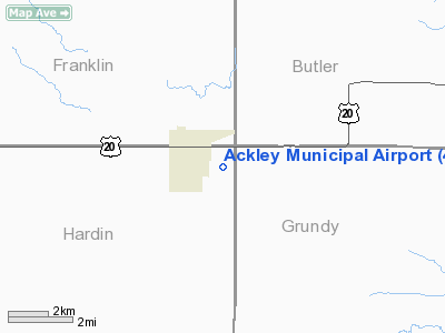
Location
& QuickFacts
|
FAA Information Effective: |
2007-07-05 |
|
Airport
Identifier: |
4C7 |
|
Airport
Status: |
Operational |
|
Longitude/Latitude: |
093-01-59.7000W/42-32-51.0000N
-93.033250/42.547500 (Estimated) |
|
Elevation: |
1070 ft / 326.14 m (Surveyed) |
|
Land: |
15
acres |
|
From
nearest city: |
1 nautical miles SE of Ackley, IA |
|
Location: |
Hardin County, IA |
|
Magnetic Variation: |
03E (1985) |
Owner
& Manager
|
Ownership: |
Privately owned |
|
Owner: |
M. Hunt |
|
Address: |
Hwy 20 East
Ackley, IA 50601 |
|
Phone
number: |
641-847-2402 |
|
Manager: |
Dale Brass |
|
Address: |
109 Main
Ackley, IA 50601 |
|
Phone
number: |
641-847-2135
AFTER 5:30 PM, CONTACT NUMBER IS 641-847-3395. |
Airport
Operations and Facilities
|
Airport Use: |
Open to public |
|
Wind
indicator: |
Yes |
|
Segmented
Circle: |
No |
|
Control
Tower: |
No |
|
Landing
fee charge: |
No |
|
Sectional
chart: |
Omaha |
|
Region: |
ACE - Central |
|
Boundary
ARTCC: |
ZAU - Chicago |
|
Tie-in
FSS: |
FOD - Fort Dodge |
|
FSS
on Airport: |
No |
|
FSS
Phone: |
515-955-8114 |
|
FSS
Toll Free: |
1-800-WX-BRIEF |
|
NOTAMs
Facility: |
FOD (NOTAM-d service avaliable) |
Airport
Communications
Airport
Services
|
Airframe Repair: |
NONE |
|
Power Plant Repair: |
NONE |
|
Bottled
Oxygen: |
NONE |
|
Bulk
Oxygen: |
NONE |
|
Runway Information
Runway 15/33
|
Dimension: |
2725 x 100 ft / 830.6 x 30.5 m |
|
Surface: |
TURF, Fair Condition |
|
|
Runway 15 |
Runway 33 |
|
Elevation: |
1070.00
ft |
0.00 ft |
|
Traffic
Pattern: |
Left |
Left |
|
Obstruction: |
7 ft fence, 154.0 ft from runway, 27 ft left
of centerline, 22:1 slope to clear |
14 ft road, 280.0 ft from runway, 20:1 slope
to clear |
|
Radio Navigation
Aids
|
ID |
Type |
Name |
Ch |
Freq |
Var |
Dist |
|
IFA |
NDB |
Iowa Falls |
|
368.00 |
03E |
11.1 nm |
|
HPT |
NDB |
Hampton |
|
230.00 |
03E |
13.7 nm |
|
MIW |
NDB |
Marshalltown |
|
239.00 |
03E |
26.8 nm |
|
CAV |
NDB |
Clarion |
|
387.00 |
03E |
34.2 nm |
|
CCY |
NDB |
Charles City |
|
375.00 |
03E |
36.5 nm |
|
EBS |
NDB |
Webster City |
|
323.00 |
03E |
37.6 nm |
|
IY |
NDB |
Chukk |
|
417.00 |
03E |
37.7 nm |
|
EAG |
NDB |
Eagle Grove |
|
302.00 |
03E |
40.0 nm |
|
BNW |
NDB |
Boone |
|
407.00 |
03E |
47.0 nm |
|
OLZ |
NDB |
Oelwein |
|
260.00 |
02E |
47.5 nm |
|
IIB |
NDB |
Wapsie |
|
206.00 |
02E |
48.3 nm |
|
FXY |
NDB |
Forest City |
|
359.00 |
05E |
48.8 nm |
|
VTI |
NDB |
Garrison |
|
338.00 |
03E |
49.1 nm |
|
JWJ |
VOR/DME |
Elmwood |
031X |
109.40 |
03E |
26.8 nm |
|
TNU |
VOR/DME |
Newton |
072X |
112.50 |
03E |
46.0 nm |
|
ALO |
VORTAC |
Waterloo |
059X |
112.20 |
06E |
28.1 nm |
|
MCW |
VORTAC |
Mason City |
096X |
114.90 |
06E |
35.4 nm |
Remarks
- ARPT
CLSD NOV-APR.
- RADIO
CONTROLLED AIRCRAFT ACTIVITY.
Operational
Statistics
Time Period: 2002-12-04
- 2003-12-03
|
Aircraft
Operations: |
38/Month |
|
General
Aviation Itinerant: |
100.0% |
Ackley Municipal Airport
Address:
Hardin County, IA
Tel:
641-847-2402,
641-847-2135
Images
and information placed above are from
http://www.airport-data.com/airport/4C7/
We
thank them for the data!
| General
Info |
| Country |
United
States |
| State |
IOWA
|
| FAA ID |
4C7
|
| Latitude |
42-32-44.922N
|
| Longitude |
093-02-02.718W
|
| Elevation |
1070 feet
|
| Near City |
ACKLEY
|
We don't guarantee the information is fresh and accurate. The data may
be wrong or outdated.
For more up-to-date information please refer to other sources.
|
|


