 |
|
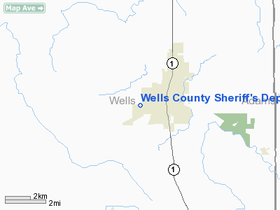
Wells County Sheriff's Department Heliport |
Location & QuickFacts
|
FAA
Information Effective: |
2008-06-05 |
|
Airport
Identifier: |
65IN |
| Airport
Status: |
Operational |
|
Longitude/Latitude: |
085-11-45.8930W/40-44-02.1680N
-85.196081/40.733936 (Estimated) |
|
Elevation: |
830
ft / 252.98 m (Estimated) |
|
Land: |
0 acres |
| From
nearest city: |
0
nautical miles N of Bluffton, IN |
|
Location: |
Wells County, IN |
|
Magnetic Variation: |
03W
(1985) |
Owner & Manager
|
Ownership: |
Privately
owned |
| Owner: |
Wells
County Sheriff's Dept |
|
Address: |
1525 E Corning Road
Bluffton,
IN 46714 |
| Phone
number: |
219-824-3426 |
|
Manager: |
Timothy K. Meade, Sheriff |
| Address: |
1525
E Corning Road
Bluffton,
IN 46714 |
|
Phone
number: |
219-824-3426 |
Airport
Operations and Facilities
|
Airport
Use: |
Private |
|
Wind indicator: |
Yes |
|
Segmented Circle: |
No |
|
Control
Tower: |
No |
| Lighting
Schedule: |
PHONE
REQ
FOR PERIMETER LGTS CALL 219-824-3426. |
|
Sectional
chart: |
Detroit |
| Region: |
AGL
- Great Lakes |
|
Boundary
ARTCC: |
ZAU - Chicago |
| Tie-in
FSS: |
HUF
- Terre Haute |
|
FSS Toll
Free: |
1-800-WX-BRIEF |
|
Runway Information
Helipad H1
|
Dimension: |
60 x 60 ft /
18.3 x 18.3 m |
|
Surface: |
TURF, |
|
|
Runway H1 |
Runway |
| Traffic
Pattern: |
Left |
Left |
|
Radio Navigation Aids
|
ID |
Type |
Name |
Ch |
Freq |
Var |
Dist |
| HHG |
NDB |
Huntington |
|
417.00 |
03W |
14.2
nm |
|
PLD |
NDB |
Portland |
|
257.00 |
03W |
19.4 nm |
| IWH |
NDB |
Wabash |
|
329.00 |
03W |
27.5
nm |
|
VFU |
NDB |
Stanley |
|
411.00 |
05W |
27.6 nm |
| CQA |
NDB |
Lakefield |
|
205.00 |
04W |
32.6
nm |
|
AI |
NDB |
Video |
|
371.00 |
03W |
42.5 nm |
| VES |
NDB |
Versailles |
|
356.00 |
04W |
44.2
nm |
|
RCR |
NDB |
Rochester |
|
216.00 |
03W |
49.4 nm |
| OLK |
VOR |
Wolf
Lake |
|
110.40 |
03W |
33.7
nm |
|
MZZ |
VOR/DME |
Marion |
023X |
108.60 |
03W |
26.4 nm |
| MIE |
VOR/DME |
Muncie |
091X |
114.40 |
03W |
31.2
nm |
|
FWA |
VORTAC |
Fort Wayne |
125X |
117.80 |
00E |
14.7 nm |
| OKK |
VORTAC |
Kokomo |
082X |
113.50 |
00E |
41.2
nm |
|
GUS |
VORTAC |
Grissom |
21Y |
108.45 |
02W |
43.9 nm |
| FWA |
VOT |
Fort
Wayne Baer |
|
111.00 |
|
14.7
nm |
Remarks
- PRVDD
ALL APCH/DEP OPNS 190-060DEGS; TAKEOFF/LDG AREA APPROPRIATELY MKD &
ANTENNA OBST LGTD FOR NGT OPNS; NON-OBSTRUCTING WIND INDICATOR MAINTAINED.
Wells County Sheriff's Department Heliport
Address:
Wells County, IN
Tel:
219-824-3426
Images
and information placed above are from
http://www.airport-data.com/airport/65IN/
We
thank them for the data!
| General
Info |
| Country |
United
States |
| State |
INDIANA
|
| FAA ID |
65IN |
| Latitude |
40-44-02.168N
|
| Longitude |
085-11-45.893W
|
| Elevation |
830 feet
|
| Near City |
BLUFFTON
|
We don't guarantee the information is fresh and accurate. The data may
be wrong or outdated.
For more up-to-date information please refer to other sources.
|
|


