|
|
Porter County Municipal Airport |
| Porter County Municipal Airport |
| IATA: VPZ â ICAO: KVPZ â FAA LID: VPZ |
| Summary |
| Airport type |
Public |
| Owner |
Porter County Municipal Airport Authority |
| Location |
Valparaiso, Indiana |
| Elevation AMSL |
770 ft / 235 m |
| Coordinates |
41°27â²14â³N 087°00â²26â³W / 41.45389°N 87.00722°W / 41.45389; -87.00722 |
| Website |
www.VPZ.org |
| Runways |
| Direction |
Length |
Surface |
| ft |
m |
| 9/27 |
7,001 |
2,134 |
Asphalt |
| 18/36 |
4,001 |
1,220 |
Asphalt |
| Statistics (2005) |
| Aircraft operations |
36,992 |
| Based aircraft |
164 |
| Source: Federal Aviation Administration |
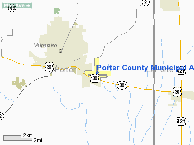
Porter County Municipal Airport (IATA: VPZ, ICAO: KVPZ, FAA LID: VPZ) is a public use airport located one nautical mile (1.8 km) southeast of the central business district of Valparaiso, a city in Porter County, Indiana, United States. It is owned by the Porter County Municipal Airport Authority.
Facilities and aircraft
Porter County Municipal Airport covers an area of 718 acres (291 ha) at an elevation of 770 feet (235 m) above mean sea level. It has two asphalt paved runways: 9/27 is 7,001 by 150 feet (2,134 x 46 m) and 18/36 is 4,001 by 75 feet (1,220 x 23 m).
For the 12-month period ending December 31, 2005, the airport had 36,992 aircraft operations, an average of 101 per day: 97.3% general aviation, 2.4% air taxi and 0.3% military. At that time there were 164 aircraft based at this airport: 84% single-engine, 9% multi-engine, 4% jet, 3% helicopter and 1% ultralight.
The above content comes from Wikipedia and is published under free licenses – click here to read more.
|
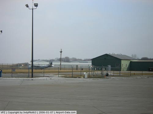 |
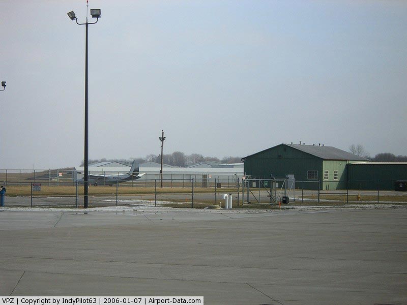
(Click on the photo to enlarge) |
|
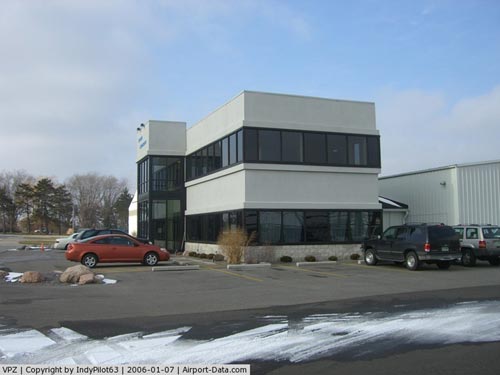 |
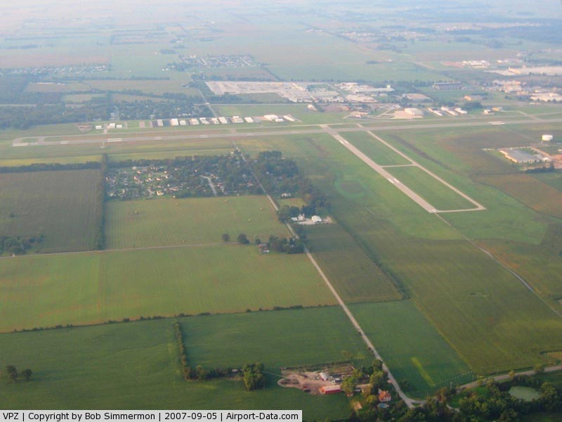
(Click on the photo to enlarge) |
|
 |
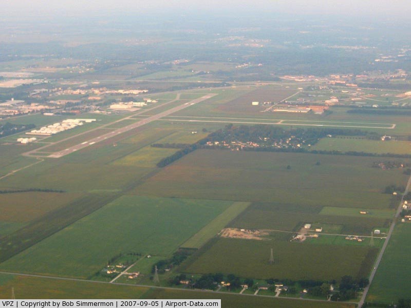
(Click on the photo to enlarge) |
|
 |
(Click on the photo to enlarge) |
Location
& QuickFacts
|
FAA
Information Effective: |
2008-06-05 |
|
Airport
Identifier: |
VPZ |
|
Airport
Status: |
Operational |
|
Longitude/Latitude: |
087-00-25.5000W/41-27-14.3000N
-87.007083/41.453972 (Estimated) |
|
Elevation: |
770 ft / 234.70 m (Surveyed) |
|
Land: |
718 acres |
|
From nearest
city: |
1 nautical miles SE of Valparaiso, IN |
|
Location: |
Porter County, IN |
|
Magnetic
Variation: |
02W (1985) |
Owner
& Manager
|
Ownership: |
Publicly
owned |
|
Owner: |
Porter County Muni Arpt Auth |
|
Address: |
4207 Murvihill Rd
Valparaiso,
IN 46383 |
|
Phone
number: |
219-462-6508 |
|
Manager: |
Kyle J. Kuebler |
|
Address: |
4207 Murvihill Rd
Valparaiso,
IN 46383 |
|
Phone
number: |
219-462-6508 |
Airport
Operations and Facilities
|
Airport
Use: |
Open
to public |
|
Wind indicator: |
Yes |
|
Segmented
Circle: |
Yes |
|
Control
Tower: |
No |
|
Lighting
Schedule: |
DUSK-DAWN
HIRL RY 09/27 & MIRL RY 18/36 PRESET ON LOW INTST DUSK-2300;
TO INCR INTST AFT 2300 & ACTVT MALSR RY 27; REIL RY
09; PAPI & REIL RYS 18 & 36 - CTAF; VASI RYS 09
& 27 OPERS 24 HRS. |
|
Beacon
Color: |
Clear-Green (lighted land airport) |
|
Landing
fee charge: |
No |
|
Sectional
chart: |
Chicago |
|
Region: |
AGL - Great Lakes |
|
Traffic
Pattern Alt: |
1000 ft |
|
Boundary
ARTCC: |
ZAU - Chicago |
|
Tie-in
FSS: |
HUF - Terre Haute |
|
FSS on
Airport: |
No |
|
FSS Toll
Free: |
1-800-WX-BRIEF |
|
NOTAMs
Facility: |
VPZ (NOTAM-d service avaliable) |
|
Certification
type/date: |
IV A U 10/198
CLSD TO SCHEDULED ACR OPNS WITH GREATER THAN 9 PSGR SEATS
& UNSCHEDULED ACR OPS GREATER THAN 30 SEATS. 90-DAY
PPR; CALL AMGR 219-462-6508. |
|
Federal
Agreements: |
NGY |
Airport Communications
|
CTAF: |
122.725 |
|
Unicom: |
122.725
|
Airport Services
|
Fuel
available: |
100LLA |
|
Airframe
Repair: |
MAJOR |
|
Power
Plant Repair: |
MAJOR |
|
Bottled
Oxygen: |
NONE |
|
Bulk Oxygen: |
NONE |
|
Runway Information
Runway 09/27
|
Dimension: |
7001 x 150 ft
/ 2133.9 x 45.7 m |
|
Surface: |
ASPH, Good Condition |
|
Surface Treatment: |
Saw-cut or plastic Grooved |
|
Weight Limit: |
Dual wheel: 250000 lbs.
Dual tandem wheel: 375000 lbs. |
|
Edge Lights: |
High |
|
|
Runway 09 |
Runway 27 |
|
Longitude: |
087-01-11.6134W |
086-59-39.6770W |
|
Latitude: |
41-27-08.6887N |
41-27-08.5446N |
|
Elevation: |
770.00 ft |
769.00 ft |
|
Alignment: |
90 |
127 |
|
ILS Type: |
|
ILS |
|
Traffic
Pattern: |
Left |
Left |
|
Markings: |
Non-precision instrument, Good Condition |
Precision instrument, Good Condition |
|
Crossing
Height: |
45.00 ft |
51.00 ft |
|
Displaced
threshold: |
500.00 ft |
0.00 ft |
|
VASI: |
4-box on left side |
4-box on left side |
|
Visual Glide
Angle: |
3.00° |
3.00° |
|
Approach
lights: |
|
MALSR |
|
Runway End
Identifier: |
Yes |
No |
|
Centerline
Lights: |
No |
No |
|
Touchdown
Lights: |
No |
No |
|
Obstruction: |
65 ft trees, 2224.0 ft from runway, 402 ft
right of centerline, 31:1 slope to clear |
, 50:1 slope to clear |
|
Decleard
distances: |
Take off run available 7000.00 ft
Take off distance available 7000.00 ft
Actual stop distance available 7000.00 ft
Landing distance available 6500.00 ft |
Take off run available 6500.00 ft
Take off distance available 6500.00 ft
Actual stop distance available 6500.00 ft
Landing distance available 6500.00 ft |
|
Runway 18/36
|
Dimension: |
4001 x 75 ft
/ 1219.5 x 22.9 m |
|
Surface: |
ASPH, Good Condition |
|
Surface Treatment: |
Saw-cut or plastic Grooved |
|
Weight Limit: |
Single wheel: 30000 lbs.
Dual wheel: 45000 lbs. |
|
Edge Lights: |
Medium |
|
|
Runway 18 |
Runway 36 |
|
Longitude: |
087-00-25.2900W |
087-00-24.9416W |
|
Latitude: |
41-27-43.9358N |
41-27-04.4130N |
|
Elevation: |
770.00 ft |
760.00 ft |
|
Alignment: |
127 |
127 |
|
Traffic
Pattern: |
Left |
Left |
|
Markings: |
Basic, Good Condition |
Basic, Fair Condition |
|
Crossing
Height: |
24.00 ft |
35.00 ft |
|
VASI: |
2-light PAPI on left side |
2-light PAPI on left side |
|
Visual Glide
Angle: |
3.00° |
3.00° |
|
Runway End
Identifier: |
Yes |
Yes |
|
Obstruction: |
80 ft trees, 2850.0 ft from runway, 33:1 slope
to clear |
36 ft trees, 920.0 ft from runway, 180 ft left
of centerline, 20:1 slope to clear |
|
Radio Navigation
Aids
|
ID |
Type |
Name |
Ch |
Freq |
Var |
Dist |
|
VP |
NDB |
Sedly |
|
212.00 |
02W |
5.8 nm |
|
IUL |
NDB |
La Porte |
|
356.00 |
03W |
10.9 nm |
|
MGC |
NDB |
Michigan City |
|
203.00 |
01W |
17.5 nm |
|
RWN |
NDB |
Winamac/dcmsnd |
|
335.00 |
00W |
28.3 nm |
|
CPB |
NDB |
Culver |
|
391.00 |
01W |
31.5 nm |
|
RZL |
NDB |
Rensselaer |
|
362.00 |
02W |
31.5 nm |
|
MX |
NDB |
Kedzi |
|
248.00 |
01W |
35.2 nm |
|
HK |
NDB |
Ermin |
|
332.00 |
01W |
40.5 nm |
|
RCR |
NDB |
Rochester |
|
216.00 |
03W |
43.7 nm |
|
MCX |
NDB |
White County |
|
377.00 |
03W |
46.1 nm |
|
OXI |
VOR/DME |
Knox |
103X |
115.60 |
00E |
18.0 nm |
|
IKK |
VOR/DME |
Kankakee |
053X |
111.60 |
00E |
44.4 nm |
|
CGT |
VORTAC |
Chicago Heights |
089X |
114.20 |
02E |
25.6 nm |
|
GIJ |
VORTAC |
Gipper |
101X |
115.40 |
00E |
36.3 nm |
|
EON |
VORTAC |
Peotone |
079X |
113.20 |
02E |
37.1 nm |
|
GSH |
VORTAC |
Goshen |
084X |
113.70 |
00E |
44.3 nm |
|
MDW |
VOT |
Chicago Midway |
|
111.00 |
|
39.0 nm |
Remarks
- `
RYS 09/27 & 18/36 PARALLEL TWY HAVE GREEN CNTRLN REFLECTORS.
- BIRDS
& DEER ON & INVOF ARPT.
Based Aircraft
|
Aircraft
based on field: |
170 |
|
Single Engine
Airplanes: |
144 |
|
Multi Engine Airplanes: |
9 |
|
Jet Engine Airplanes: |
11 |
|
Helicopters: |
5 |
|
Ultralights: |
1 |
Operational Statistics
Time
Period: 2005-01-01 - 2005-12-31
|
Aircraft
Operations: |
102/Day |
|
Air Taxi: |
2.4% |
|
General Aviation
Local: |
55.4% |
|
General Aviation
Itinerant: |
41.9% |
|
Military: |
0.2% |
Porter County Municipal Airport
Address:
Porter County, IN
Tel:
219-462-6508
Images
and information placed above are from
http://www.airport-data.com/airport/VPZ/
We
thank them for the data!
| General
Info |
| Country |
United
States |
| State |
INDIANA
|
| FAA ID |
VPZ |
| Latitude |
41-27-14.280N
|
| Longitude |
087-00-25.457W
|
| Elevation |
771 feet
|
| Near City |
VALPARAISO
|
We don't guarantee the information is fresh and accurate. The data may
be wrong or outdated.
For more up-to-date information please refer to other sources.
|
|