 |
|
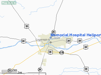
Memorial Hospital Heliport |
Location
& QuickFacts
|
FAA
Information Effective: |
2008-06-05 |
|
Airport
Identifier: |
IN96 |
|
Airport
Status: |
Operational |
|
Longitude/Latitude: |
086-21-40.0000W/40-45-49.0000N
-86.361111/40.763611 (Estimated) |
|
Elevation: |
676 ft / 206.04 m (Estimated) |
|
Land: |
0 acres |
|
From nearest
city: |
1 nautical miles N of Logansport, IN |
|
Location: |
Cass County, IN |
|
Magnetic
Variation: |
02W (1985) |
Owner & Manager
|
Ownership: |
Privately
owned |
|
Owner: |
Memorial Hospital |
|
Address: |
1101 Michigan Avenue
Logansport,
IN 46947 |
|
Phone
number: |
574-753-7541 |
|
Manager: |
James Schrader |
|
Address: |
1101 Michigan Avenue
Logansport,
IN 46947 |
|
Phone
number: |
574-753-1412 |
Airport
Operations and Facilities
|
Airport
Use: |
Private
MEDICAL USE. |
|
Wind indicator: |
Yes |
|
Segmented
Circle: |
No |
|
Control
Tower: |
No |
|
Lighting
Schedule: |
PHONE REQ
FOR PERIMETER LGTS CALL 574-753-1520. |
|
Sectional
chart: |
Chicago |
|
Region: |
AGL - Great Lakes |
|
Boundary
ARTCC: |
ZAU - Chicago |
|
Tie-in
FSS: |
HUF - Terre Haute |
|
FSS Toll
Free: |
1-800-WX-BRIEF |
|
Runway Information
Helipad H1
|
Dimension: |
52 x 52 ft /
15.8 x 15.8 m |
|
Surface: |
CONC, |
|
|
Runway H1 |
Runway |
|
Traffic
Pattern: |
Left |
Left |
|
Radio Navigation
Aids
|
ID |
Type |
Name |
Ch |
Freq |
Var |
Dist |
|
GGP |
NDB |
Logansport |
|
263.00 |
01W |
3.3 nm |
|
MCX |
NDB |
White County |
|
377.00 |
03W |
18.5 nm |
|
RCR |
NDB |
Rochester |
|
216.00 |
03W |
19.7 nm |
|
RWN |
NDB |
Winamac/dcmsnd |
|
335.00 |
00W |
22.7 nm |
|
IWH |
NDB |
Wabash |
|
329.00 |
03W |
25.6 nm |
|
CPB |
NDB |
Culver |
|
391.00 |
01W |
27.3 nm |
|
FKR |
NDB |
Frankfort |
|
278.00 |
02W |
31.0 nm |
|
RZL |
NDB |
Rensselaer |
|
362.00 |
02W |
39.0 nm |
|
HHG |
NDB |
Huntington |
|
417.00 |
03W |
41.2 nm |
|
VP |
NDB |
Sedly |
|
212.00 |
02W |
47.5 nm |
|
IUL |
NDB |
La Porte |
|
356.00 |
03W |
47.9 nm |
|
HZP |
NDB |
Zionsville |
|
248.00 |
03W |
49.8 nm |
|
OLK |
VOR |
Wolf Lake |
|
110.40 |
03W |
48.8 nm |
|
MZZ |
VOR/DME |
Marion |
023X |
108.60 |
03W |
35.1 nm |
|
OXI |
VOR/DME |
Knox |
103X |
115.60 |
00E |
36.0 nm |
|
GUS |
VORTAC |
Grissom |
21Y |
108.45 |
02W |
11.9 nm |
|
OKK |
VORTAC |
Kokomo |
082X |
113.50 |
00E |
19.8 nm |
|
BVT |
VORTAC |
Boiler |
098X |
115.10 |
01E |
34.6 nm |
|
GSH |
VORTAC |
Goshen |
084X |
113.70 |
00E |
48.2 nm |
Remarks
- ALL
APCH/DEP ROUTE HELICOPTER OPS ARE CONDUCTED IN AN AREA FROM 180 CLOCKWISE
TO 210 AND FROM 230 CLOCKWISE TO 260 USING THE TOUCHDOWN PAD AS THE
CENTER OF A COMPASS ROSE; AREA IS MARKED; WIND INDICATOR IS MAINTAINED.
Memorial Hospital Heliport
Address:
Cass County, IN
Tel:
574-753-7541,
574-753-1412
Images
and information placed above are from
http://www.airport-data.com/airport/IN96/
We
thank them for the data!
| General
Info |
| Country |
United
States |
| State |
INDIANA
|
| FAA ID |
IN96 |
| Latitude |
40-45-49.643N
|
| Longitude |
086-21-40.998W
|
| Elevation |
680 feet
|
| Near City |
LOGANSPORT
|
We don't guarantee the information is fresh and accurate. The data may
be wrong or outdated.
For more up-to-date information please refer to other sources.
|
|


