 |
|
| Lowell Airport |
| IATA: none – ICAO: none – FAA LID: C97 |
| Summary |
| Airport type |
Public |
| Owner |
Donald E. Bailey |
| Location |
Lowell, Indiana |
| Elevation AMSL |
675 ft / 206 m |
| Coordinates |
41°13′48″N 087°30′28″W / 41.23°N 87.50778°W / 41.23; -87.50778 |
| Runways |
| Direction |
Length |
Surface |
| ft |
m |
| 18/36 |
3,041 |
927 |
Turf |
| Source: Federal Aviation Administration |
Lowell Airport (FAA LID: C97) is a public-use airport located 5 nautical miles (9 km; 6 mi) southwest of the central business district of Lowell, a town in Lake County, Indiana, United States.
Facilities
Lowell Airport covers an area of 19 acres (8 ha) and has one runway designated 18/36 with a 3,041 x 100 ft (927 x 30 m) turf surface.
The above content comes from Wikipedia and is published under free licenses – click here to read more.
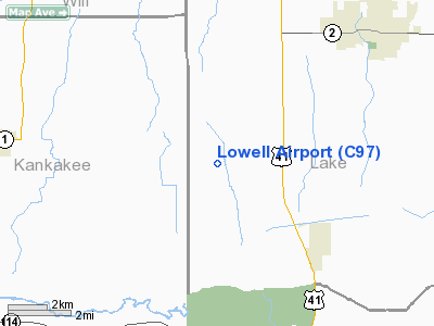
Location
& QuickFacts
|
FAA
Information Effective: |
2008-06-05 |
|
Airport
Identifier: |
C97 |
|
Airport
Status: |
Operational |
|
Longitude/Latitude: |
087-30-27.7000W/41-13-48.5000N
-87.507694/41.230139 (Estimated) |
|
Elevation: |
675 ft / 205.74 m (Estimated) |
|
Land: |
19 acres |
|
From nearest
city: |
5 nautical miles SW of Lowell, IN |
|
Location: |
Lake County, IN |
|
Magnetic
Variation: |
01W (1985) |
Owner & Manager
|
Ownership: |
Privately
owned |
|
Owner: |
Donald E. Bailey |
|
Address: |
14705 Belshaw Rd.
Lowell,
IN 46356 |
|
Phone
number: |
219-696-9603 |
|
Manager: |
Donald E. Bailey |
|
Address: |
14705 Belshaw Rd
Lowell,
IN 46356 |
|
Phone
number: |
219-696-9603 |
Airport
Operations and Facilities
|
Airport
Use: |
Open
to public |
|
Wind indicator: |
Yes |
|
Segmented
Circle: |
Yes |
|
Control
Tower: |
No |
|
Lighting
Schedule: |
PHONE REQ
FOR RWY LGTS AND ROTG BCN PHONE 219-696-9603. |
|
Beacon
Color: |
Clear-Green (lighted land airport) |
|
Landing
fee charge: |
Yes |
|
Sectional
chart: |
Chicago |
|
Region: |
AGL - Great Lakes |
|
Boundary
ARTCC: |
ZAU - Chicago |
|
Tie-in
FSS: |
HUF - Terre Haute |
|
FSS on
Airport: |
No |
|
FSS Toll
Free: |
1-800-WX-BRIEF |
|
NOTAMs
Facility: |
HUF (NOTAM-d service avaliable) |
Airport Communications
Airport Services
|
Runway Information
Runway 18/36
|
Dimension: |
3041 x 100 ft
/ 926.9 x 30.5 m |
|
Surface: |
TURF, Good Condition |
|
Edge Lights: |
Low |
|
|
Runway 18 |
Runway 36 |
|
Longitude: |
087-30-27.6863W |
087-30-27.6386W |
|
Latitude: |
41-14-03.5430N |
41-13-33.5001N |
|
Elevation: |
672.00 ft |
650.00 ft |
|
Alignment: |
127 |
127 |
|
Traffic
Pattern: |
Right |
Left |
|
Displaced
threshold: |
555.00 ft |
0.00 ft |
|
Obstruction: |
55 ft tree, 195.0 ft from runway, 125 ft right
of centerline, 3:1 slope to clear
RWY 18 APCH RATIO 13:1 AT DSPLCD THLD. |
5 ft crops, 131.0 ft from runway, 26:1 slope
to clear |
|
Radio Navigation
Aids
|
ID |
Type |
Name |
Ch |
Freq |
Var |
Dist |
|
RZL |
NDB |
Rensselaer |
|
362.00 |
02W |
22.5 nm |
|
VP |
NDB |
Sedly |
|
212.00 |
02W |
31.4 nm |
|
MX |
NDB |
Kedzi |
|
248.00 |
01W |
31.8 nm |
|
HK |
NDB |
Ermin |
|
332.00 |
01W |
32.9 nm |
|
IUL |
NDB |
La Porte |
|
356.00 |
03W |
36.9 nm |
|
RWN |
NDB |
Winamac/dcmsnd |
|
335.00 |
00W |
41.7 nm |
|
MGC |
NDB |
Michigan City |
|
203.00 |
01W |
42.3 nm |
|
MCX |
NDB |
White County |
|
377.00 |
03W |
46.1 nm |
|
IKK |
VOR/DME |
Kankakee |
053X |
111.60 |
00E |
18.1 nm |
|
OXI |
VOR/DME |
Knox |
103X |
115.60 |
00E |
39.2 nm |
|
ORD |
VOR/DME |
Chicago O'hare |
086X |
113.90 |
02E |
48.9 nm |
|
RBS |
VOR/DME |
Roberts |
115X |
116.80 |
02E |
49.1 nm |
|
EON |
VORTAC |
Peotone |
079X |
113.20 |
02E |
13.0 nm |
|
CGT |
VORTAC |
Chicago Heights |
089X |
114.20 |
02E |
17.1 nm |
|
JOT |
VORTAC |
Joliet |
070X |
112.30 |
02E |
41.2 nm |
|
BVT |
VORTAC |
Boiler |
098X |
115.10 |
01E |
45.1 nm |
|
MDW |
VOT |
Chicago Midway |
|
111.00 |
|
35.2 nm |
|
ORD |
VOT |
Chicago O'hare Intl |
|
112.00 |
|
48.7 nm |
Remarks
- SNOW
REMOVAL & MOWING WITH LARGE TRACTOR .
- DEER
ON & INVOF ARPT.
- RWY
18/36 SEASONAL CROPS 75 FT E AND 87 FT W OF CNTRLINE.
- PRVDD
ALL TFC PAT OPNS ARE RSTRD TO WEST SIDE OF THE N/S RWY.
Based Aircraft
|
Aircraft
based on field: |
11 |
|
Single Engine
Airplanes: |
11 |
Operational Statistics
Time
Period: 2005-09-30 - 2006-09-29
|
Aircraft
Operations: |
81/Week |
|
General Aviation
Local: |
92.9% |
|
General Aviation
Itinerant: |
7.1% |
Lowell Airport
Address:
Lake County, IN
Tel:
219-696-9603
Images
and information placed above are from
http://www.airport-data.com/airport/C97/
We
thank them for the data!
| General
Info |
| Country |
United
States |
| State |
INDIANA
|
| FAA ID |
C97 |
| Latitude |
41-13-48.500N
|
| Longitude |
087-30-27.700W
|
| Elevation |
675 feet
|
| Near City |
LOWELL
|
We don't guarantee the information is fresh and accurate. The data may
be wrong or outdated.
For more up-to-date information please refer to other sources.
|
|


