 |
|
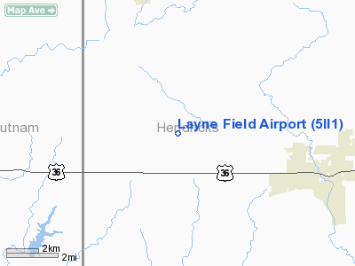
Location
& QuickFacts
|
FAA
Information Effective: |
2008-06-05 |
|
Airport
Identifier: |
5II1 |
|
Airport
Status: |
Operational |
|
Longitude/Latitude: |
086-37-03.0080W/39-46-58.1640N
-86.617502/39.782823 (Estimated) |
|
Elevation: |
905 ft / 275.84 m (Estimated) |
|
Land: |
0 acres |
|
From nearest
city: |
2 nautical
miles NE of New Winchester, IN |
|
Location: |
Hendricks
County, IN |
|
Magnetic
Variation: |
01W (1985) |
Owner & Manager
|
Ownership: |
Privately
owned |
|
Owner: |
John A. Layne |
|
Address: |
5010 W 100 N
Danville, IN 46122 |
|
Phone
number: |
317-539-5352 |
|
Manager: |
John A. Layne |
|
Address: |
5010 W 100 N
Danville, IN 46122 |
|
Phone
number: |
317-539-5352 |
Airport
Operations and Facilities
|
Airport
Use: |
Private |
|
Wind indicator: |
Yes |
|
Segmented
Circle: |
No |
|
Control
Tower: |
No |
|
Sectional
chart: |
St Louis |
|
Region: |
AGL - Great Lakes |
|
Boundary
ARTCC: |
ZID - Indianapolis |
|
Tie-in
FSS: |
HUF - Terre Haute |
|
FSS Toll
Free: |
1-800-WX-BRIEF |
|
Runway Information
Runway 18/36
|
Dimension: |
2800 x 100 ft
/ 853.4 x 30.5 m |
|
Surface: |
TURF, |
|
|
Runway 18 |
Runway 36 |
|
Traffic
Pattern: |
Left |
Right |
|
Radio Navigation
Aids
|
ID |
Type |
Name |
Ch |
Freq |
Var |
Dist |
|
TVX |
NDB |
Greencastle |
|
521.00 |
03W |
9.6 nm |
|
CFJ |
NDB |
Crawfordsville |
|
388.00 |
02W |
18.2 nm |
|
HZP |
NDB |
Zionsville |
|
248.00 |
03W |
19.4 nm |
|
HFY |
NDB |
Greenwood |
|
398.00 |
02W |
26.0 nm |
|
UMP |
NDB |
Metropolitan |
|
338.00 |
03W |
27.8 nm |
|
FKR |
NDB |
Frankfort |
|
278.00 |
02W |
29.4 nm |
|
HU |
NDB |
Yinno |
|
245.00 |
02W |
43.2 nm |
|
BM |
NDB |
Claye |
|
382.00 |
02W |
43.7 nm |
|
BA |
NDB |
Clifs |
|
410.00 |
03W |
46.2 nm |
|
PRG |
NDB |
Paris |
|
341.00 |
01E |
49.1 nm |
|
VHP |
VORTAC |
Brickyard |
110X |
116.30 |
01E |
11.7 nm |
|
TTH |
VORTAC |
Terre Haute |
100X |
115.30 |
02E |
34.2 nm |
|
SHB |
VORTAC |
Shelbyville |
057X |
112.00 |
01E |
37.8 nm |
|
OOM |
VORTAC |
Hoosier |
039X |
110.20 |
02W |
38.4 nm |
|
IND |
VOT |
Indianapolis Intl |
|
109.60 |
|
15.8 nm |
Remarks
- PRVDING
LTR OF AGREEMENT WITH OWNER OF DOUB ARPT - ALL TFC PATS AT LAYNE BE
EAST OF N/S RWY & ALL TFC PATS AT DOUBS BE WEST OF N/S RWY; OBST
IN RWY APCH SLOPE SFCS LOWERED/REMOVED & RWY THR DSPLCD & MKD
TO PRVD 20:1 APCH SFC CLNC OVER OBST; AREA 125 FT EITHER SIDE RWY CL
CLEAR OF ALL OBST.
Based Aircraft
|
Aircraft
based on field: |
1 |
|
Single Engine
Airplanes: |
1 |
Layne Field Airport
Address:
Hendricks County, IN
Tel:
317-539-5352
Images
and information placed above are from
http://www.airport-data.com/airport/5II1/
We
thank them for the data!
| General
Info |
| Country |
United
States |
| State |
INDIANA
|
| FAA ID |
5II1 |
| Latitude |
39-46-58.164N
|
| Longitude |
086-37-03.008W
|
| Elevation |
905 feet
|
| Near City |
NEW WINCHESTER
|
We don't guarantee the information is fresh and accurate. The data may
be wrong or outdated.
For more up-to-date information please refer to other sources.
|
|


