 |
|
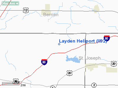
Location
& QuickFacts
|
FAA
Information Effective: |
2008-06-05 |
|
Airport
Identifier: |
II92 |
|
Airport
Status: |
Operational |
|
Longitude/Latitude: |
086-35-01.0740W/41-44-30.1590N
-86.583632/41.741711 (Estimated) |
|
Elevation: |
740 ft / 225.55 m (Estimated) |
|
Land: |
160 acres |
|
From nearest
city: |
4 nautical miles N of Rolling Prairie, IN |
|
Location: |
La Porte County, IN |
|
Magnetic
Variation: |
02W (1985) |
Owner
& Manager
|
Ownership: |
Privately
owned |
|
Owner: |
Oprah Winfrey |
|
Address: |
9252 North 600 East Rd
Rolling
Prairie, IN 46371 |
|
Manager: |
Calvin Eddings |
|
Address: |
9252 North 600 East Rd
Rolling
Prarie, IN 46371 |
Airport
Operations and Facilities
|
Airport
Use: |
Private |
|
Wind indicator: |
Yes |
|
Segmented
Circle: |
No |
|
Control
Tower: |
No |
|
Sectional
chart: |
Chicago |
|
Region: |
AGL - Great Lakes |
|
Boundary
ARTCC: |
ZAU - Chicago |
|
Tie-in
FSS: |
HUF - Terre Haute |
|
FSS Toll
Free: |
1-800-WX-BRIEF |
|
Runway Information
Helipad H1
|
Dimension: |
60 x 50 ft /
18.3 x 15.2 m |
|
Surface: |
CONC, |
|
|
Runway H1 |
Runway |
|
Traffic
Pattern: |
Left |
Left |
|
Radio Navigation
Aids
|
ID |
Type |
Name |
Ch |
Freq |
Var |
Dist |
|
MGC |
NDB |
Michigan City |
|
203.00 |
01W |
10.7 nm |
|
IUL |
NDB |
La Porte |
|
356.00 |
03W |
16.9 nm |
|
VP |
NDB |
Sedly |
|
212.00 |
02W |
21.9 nm |
|
CPB |
NDB |
Culver |
|
391.00 |
01W |
32.8 nm |
|
RWN |
NDB |
Winamac/dcmsnd |
|
335.00 |
00W |
38.9 nm |
|
RCR |
NDB |
Rochester |
|
216.00 |
03W |
44.4 nm |
|
HAI |
NDB |
Three Rivers |
|
407.00 |
02W |
46.3 nm |
|
MX |
NDB |
Kedzi |
|
248.00 |
01W |
49.6 nm |
|
OXI |
VOR/DME |
Knox |
103X |
115.60 |
00E |
25.4 nm |
|
ELX |
VOR/DME |
Keeler |
113X |
116.60 |
00E |
31.8 nm |
|
PMM |
VOR/DME |
Pullman |
058X |
112.10 |
00E |
48.5 nm |
|
GIJ |
VORTAC |
Gipper |
101X |
115.40 |
00E |
12.0 nm |
|
GSH |
VORTAC |
Goshen |
084X |
113.70 |
00E |
28.2 nm |
|
CGT |
VORTAC |
Chicago Heights |
089X |
114.20 |
02E |
46.5 nm |
Remarks
- OWNER
DESIRES ARPT NOT BE CHARTED.
- PRVDD
AREA IS APPRO MARKED; WIND INDICATOR IS MAINTAINED.
Based Aircraft
|
Aircraft
based on field: |
1 |
|
Helicopters: |
1 |
Layden Heliport
Address:
La Porte County, IN
Tel:
Images
and information placed above are from
http://www.airport-data.com/airport/II92/
We
thank them for the data!
| General
Info |
| Country |
United
States |
| State |
INDIANA
|
| FAA ID |
II92 |
| Latitude |
41-44-30.159N
|
| Longitude |
086-35-01.074W
|
| Elevation |
740 feet
|
| Near City |
ROLLING
PRAIRIE |
We don't guarantee the information is fresh and accurate. The data may
be wrong or outdated.
For more up-to-date information please refer to other sources.
|
|


